Map of the Vicinity of the Golden Gate San Francisco Bay California
$75.00
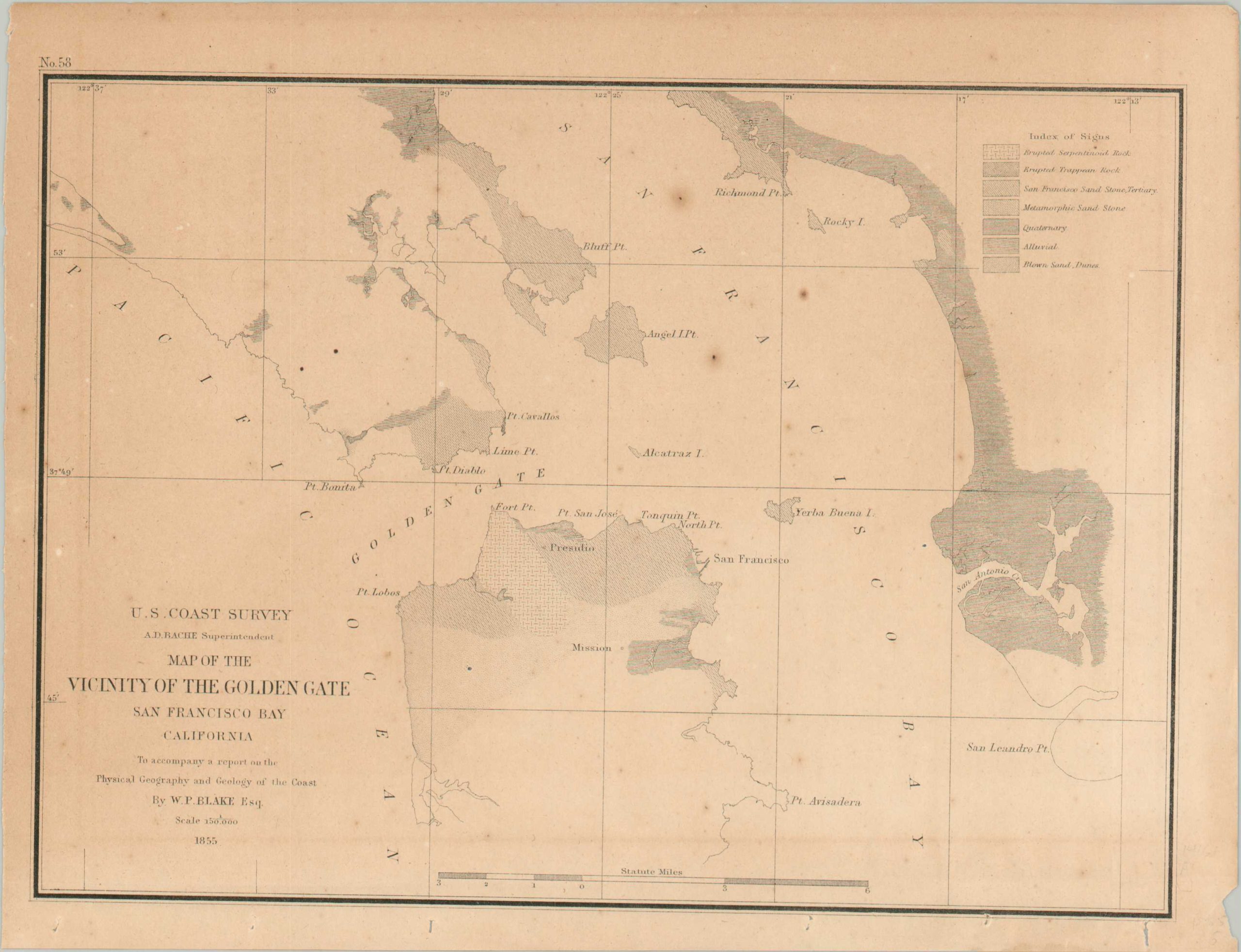
An early map of the San Francisco Bay.
1 in stock
Description
This quaint geological map of San Francisco Bay was published by the United States Coast Survey in 1856 as part of a report by W.P. Blake on the physical geography of the West Coast. The city of San Francisco had been officially chartered just six years earlier, shortly after California’s admission as a state. Shading identifies different types of geologic formations while a variety of features are labeled throughout the image. Of particular interest are the Presidio, Mission, and Alcatraz Island. The last would be first used as a military prison in 1859.
Map Details
Publication Date: 1856
Author: United States Coast Survey
Sheet Width (in): 10.8
Sheet Height (in): 8.2
Condition: B+
Condition Description: A moderately toned sheet shows scattered spotting and some light offsetting from the printed ink. About good condition overall.
$75.00
1 in stock