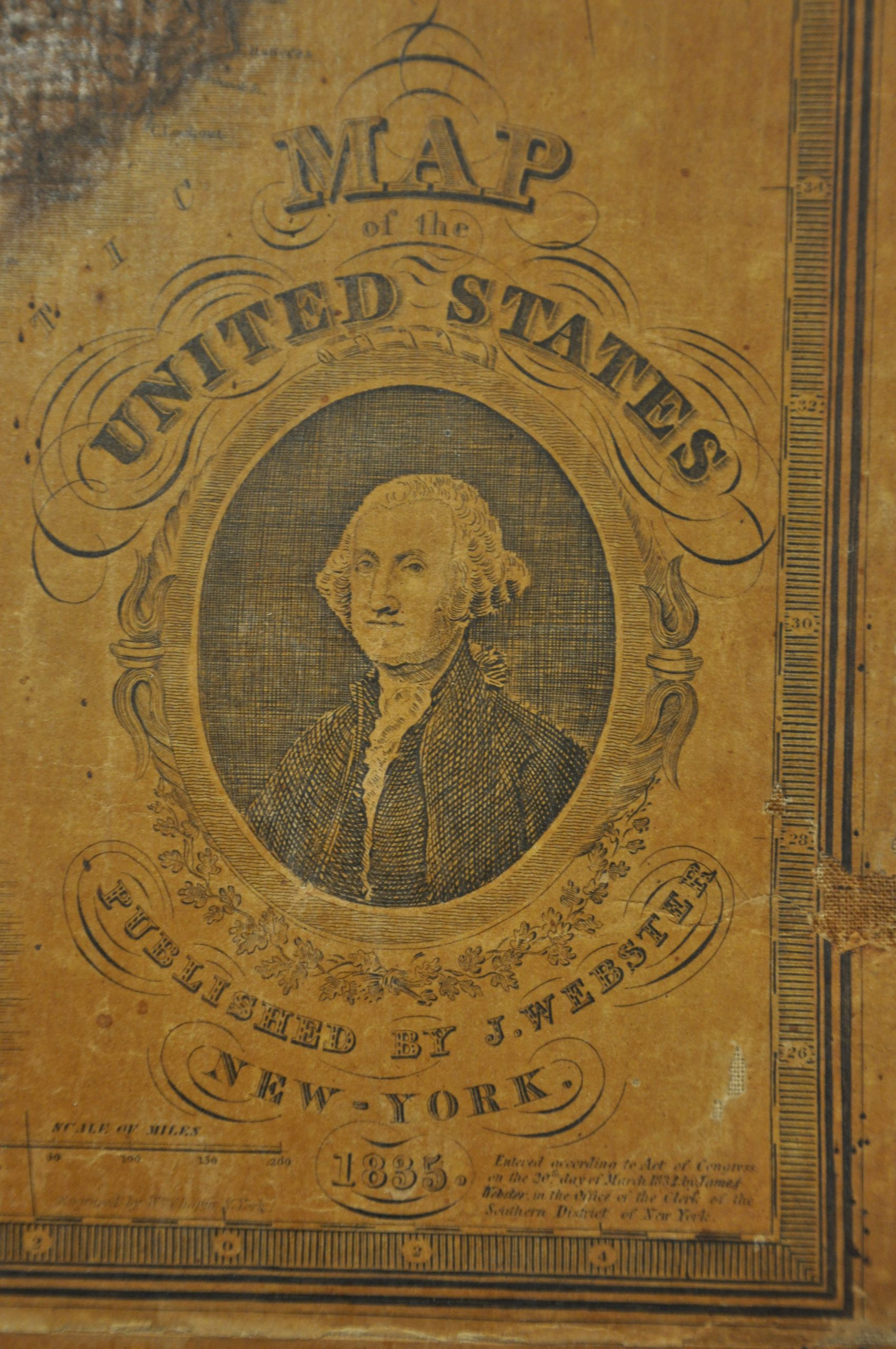
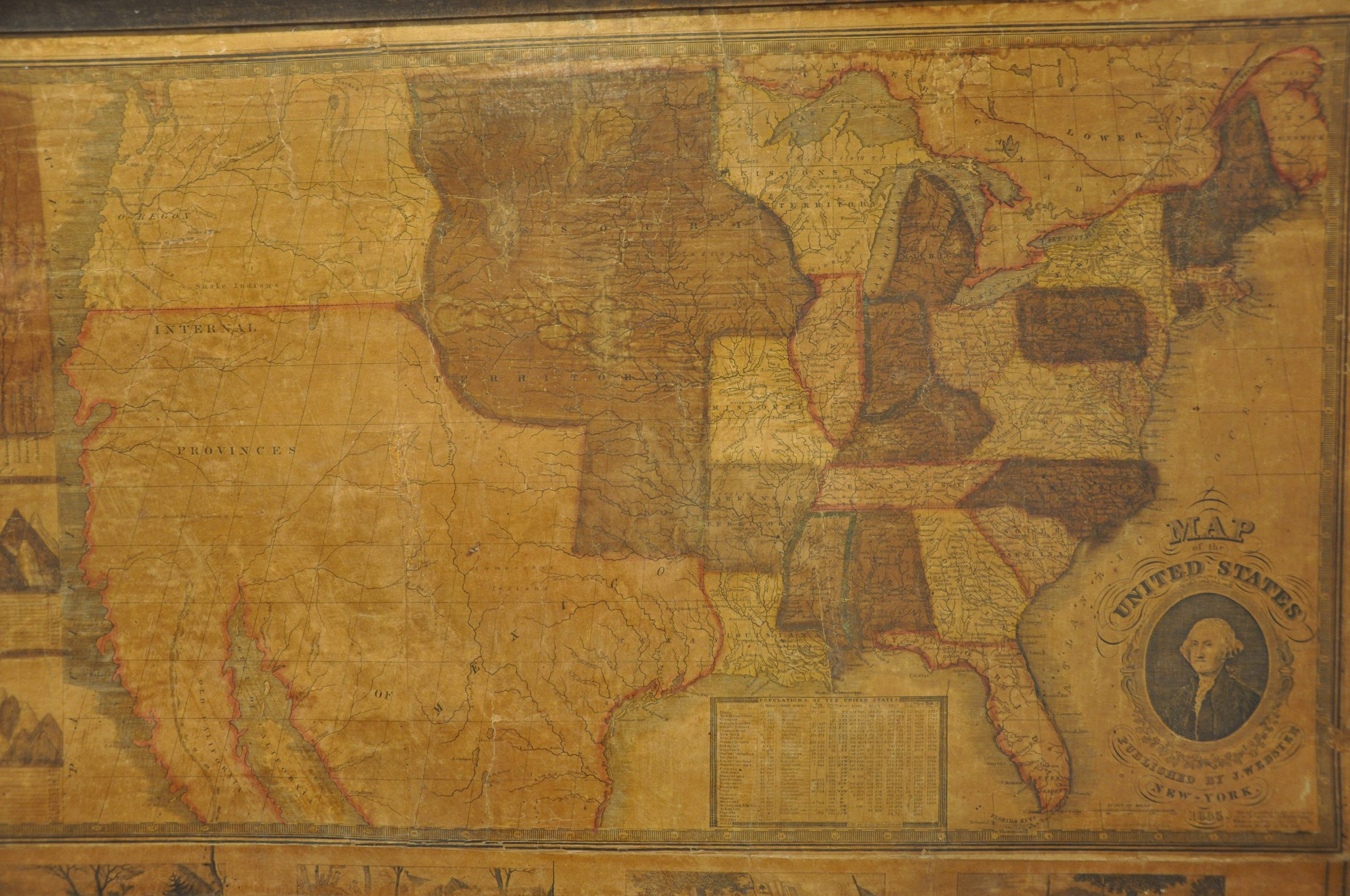
Map of the United States Published by J. Webster
$1,600.00
Impressive early wall map of America.
1 in stock
Description
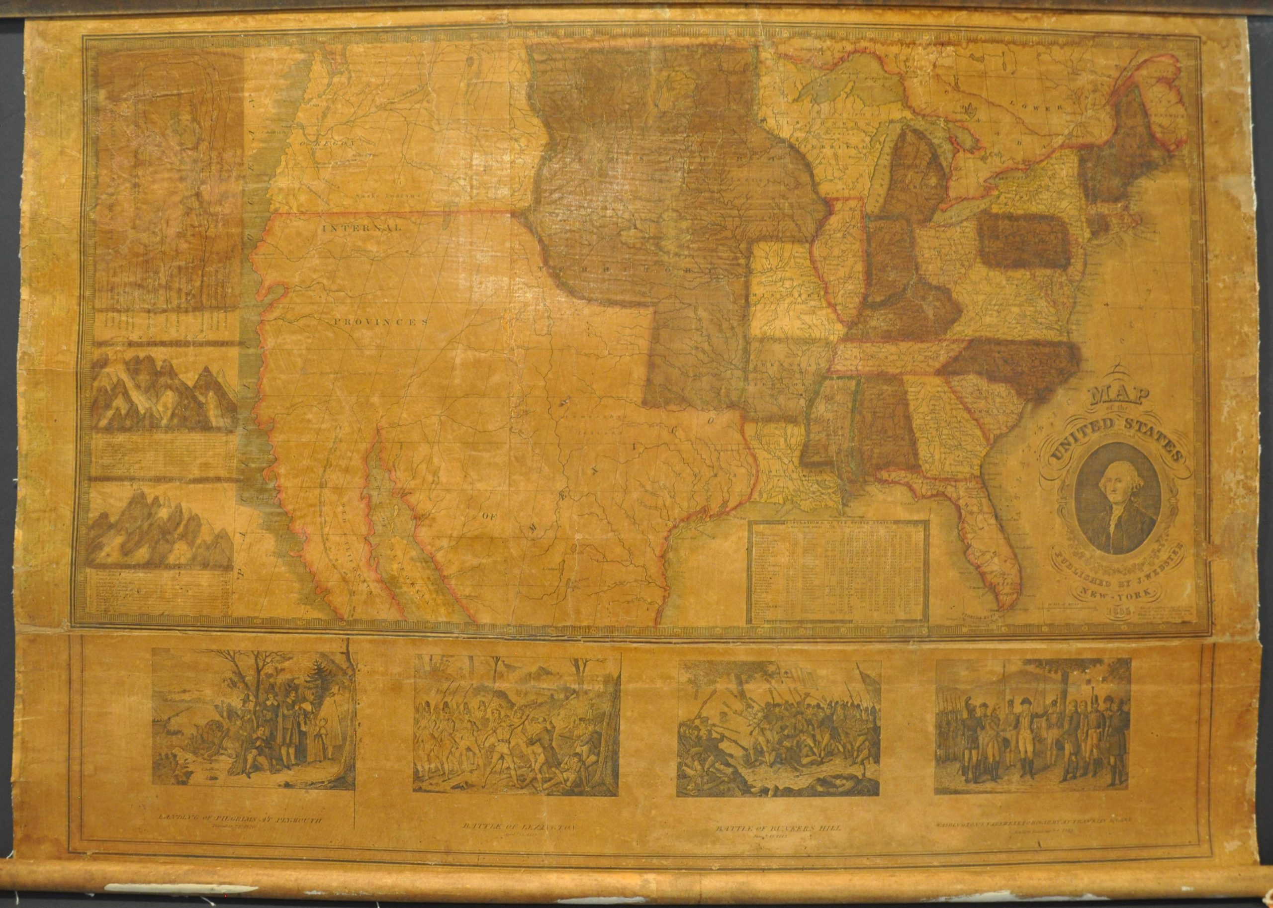
This important map showing America from coast to coast was engraved by William Chapin and published in New York by James Webster in 1835. Webster also issued a folding pocket map of the United States that year, extremely rare, but its image is restricted to Texas and the Missouri Territory. With the addition of a newly engraved sheet on the left side, this example extends all the way to the Pacific Coast, presenting a transcontinental United States a full decade before the term ‘Manifest Destiny’ was first coined.
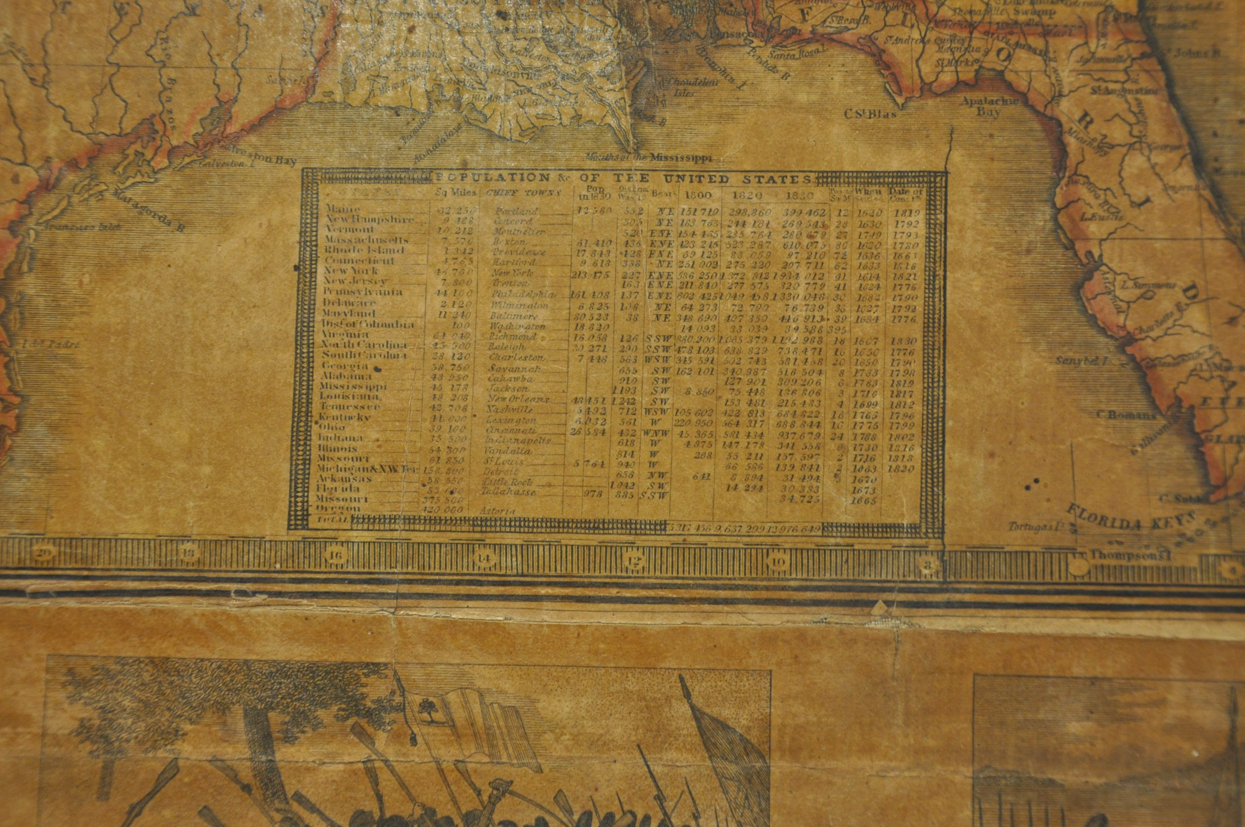
While Webster’s depiction of America is fascinating, it is not geographically groundbreaking. Many of the details have been ‘inspired’ (i.e. directly copied) from various editions of the ‘Washington’ map. Named for the iconic portrait of George Washington in the lower right, the first edition was printed in 1826 and variously re-issued several times. One such example was published by Humphrey Phelps in 1832, the primary source for most of the data in the East seen here. Many of the toponyms in the West have been stripped out, leaving a largely vacant region with a handful of named rivers, geographic features, and Native American tribes. Where a table of distances previously occupied Upper California, a new (and apparently custom) annotation reads ‘Extensive Buffalo Plains Unexplored by Man.”
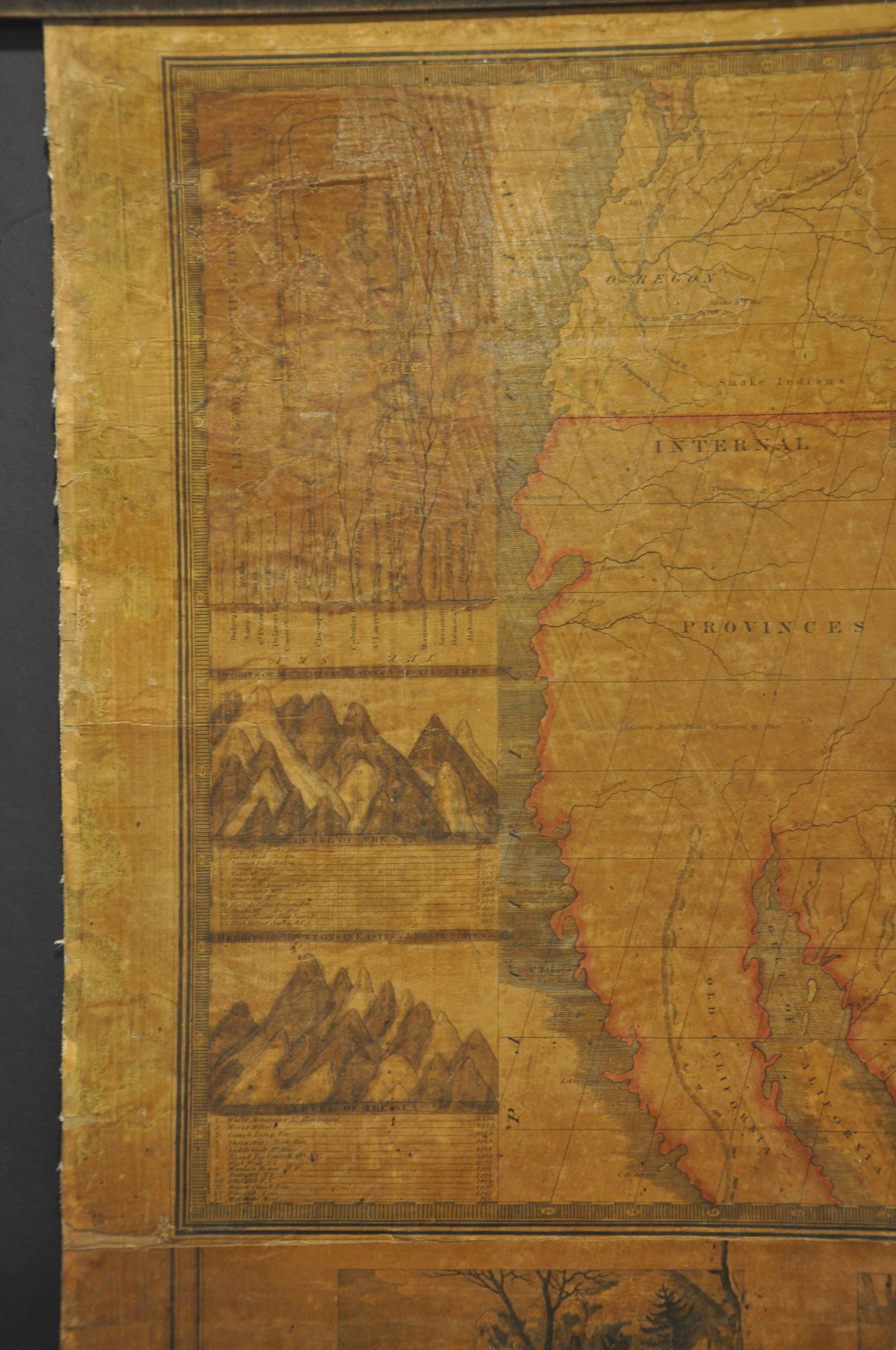
Another novel addition to the map can be seen on the far left side. Here are three comparative diagrams showing the relative lengths of the rivers and heights of mountains across America. While these illustrated references can be found in many forms during the 19th century, this is one of the few that limits the geographic scope only to the United States. It can be interpreted as a direct call for westward expansion, as entries like the Columbia River and Long’s Peak remained well outside America’s internationally recognized territory at the time of publication.
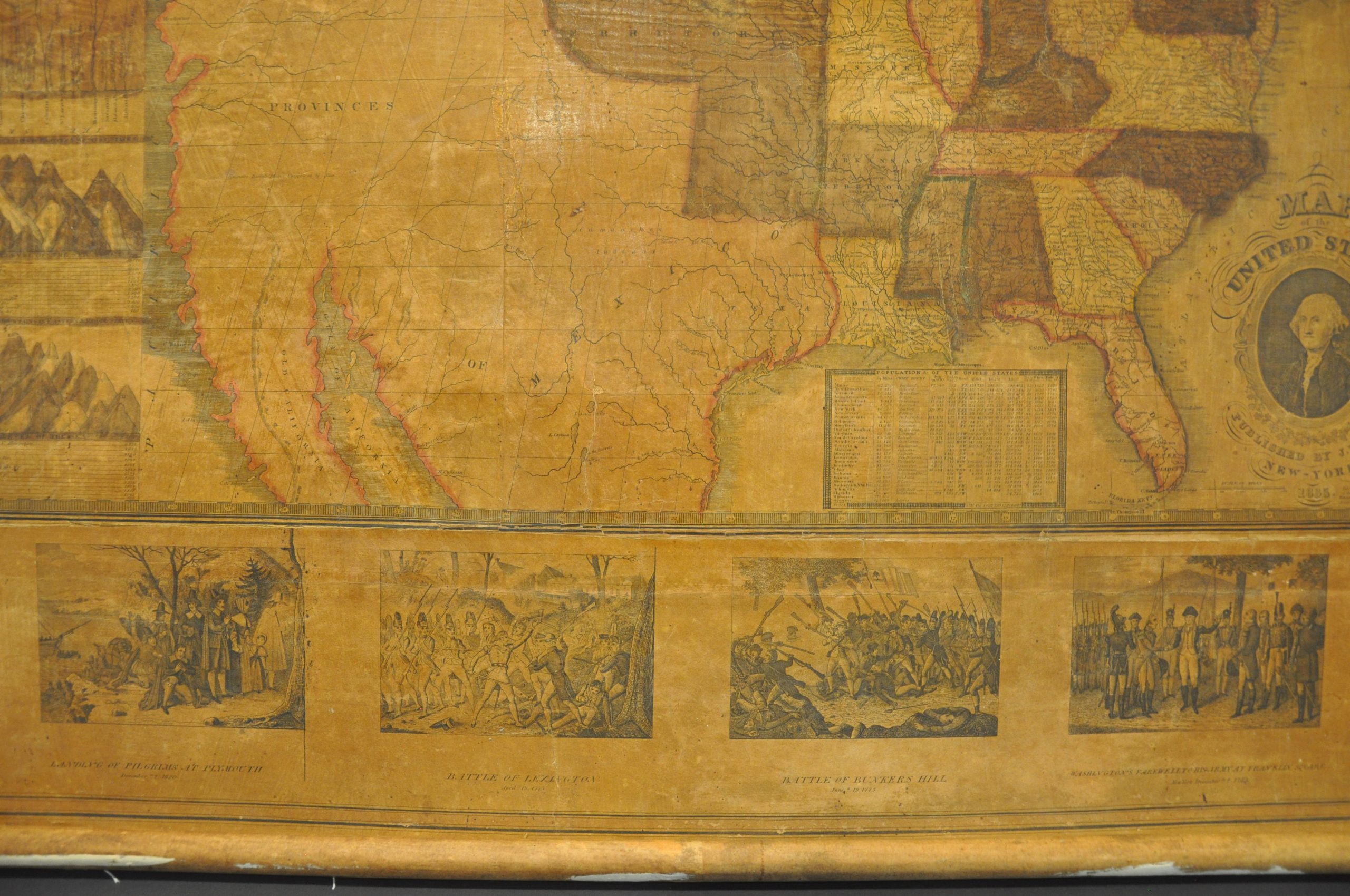
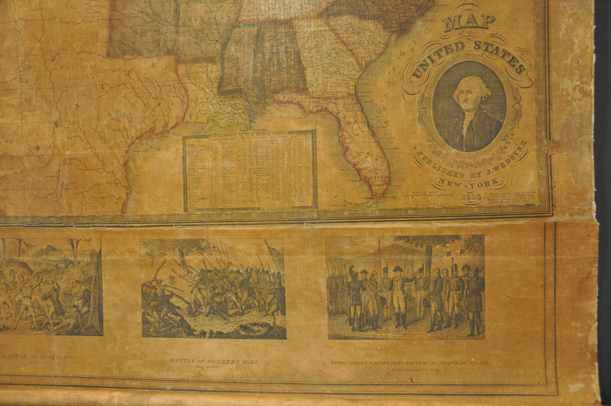
The four illustrated panels at the bottom of the sheet also appear to have been added by Webster as part of this custom wall map configuration. They commemorate important moments in American history and include scenes titled Landing of Pilgrims at Plymouth, Battle of Lexington, Battle of Bunker Hill, and Washington’s Farewell to his Army at Franklin Square.
Source; David Rumsey Map Collection;
Map Details
Publication Date: 1835
Author: James Webster
Sheet Width (in): 33
Sheet Height (in): 22.5
Condition: B
Condition Description: Three sheets (2x map + the lower illustrations) mounted on linen and affixed to (presumably original) old wooden rollers. Heavy discoloration as a result of the original body color and the total image has become toned with age. Legibility is fine except for those places originally shaded green, which have become heavily darkened. Visible wear along the left and right edges and some damp staining visible at the top of the page. Very minimal paper loss in a few spots, most evident along the seam between the upper and lower sheets. The map has been professionally cleaned, de-acidified, and touched up, with a few spots of color added to even out the image, most evident in the charts on the left side. About good condition overall.
$1,600.00
1 in stock