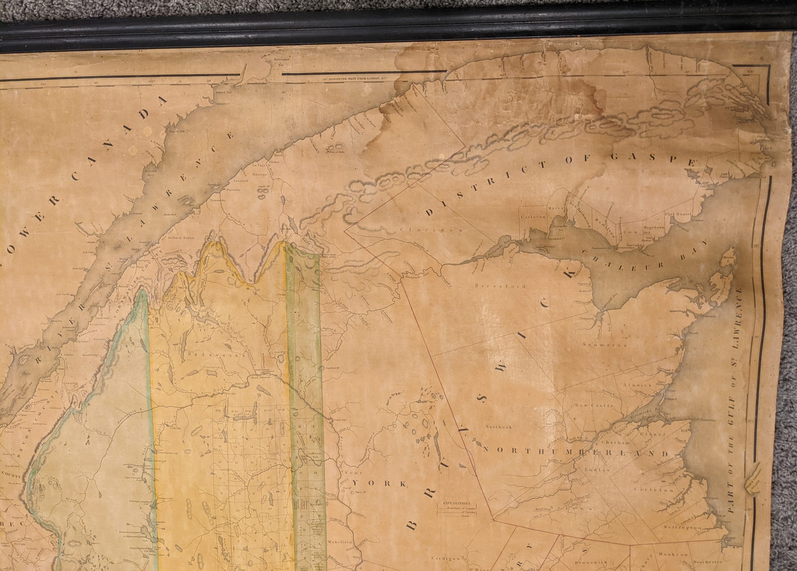
Map of the State of Maine with the Province of New Brunswick
Rare wall map of Maine issued just over a decade after statehood by ‘the father of Maine’s cartography.’
Out of stock
Description
This fabulously detailed wall map of Maine is a bold representation of American claims to the northeastern portion of the continent in the decades immediately following the Revolutionary War. According to the Treaty of Paris in 1783, the northeastern boundary of the new United States could be identified by following a line due north from the source of the St. Croix River to the continental divide that separates the Atlantic and St. Lawrence watersheds. These lands were ill-defined, and subsequent disputes between Britain and the U.S. over the exact definition of the border wouldn’t be conclusively settled until the Webster- Ashburton Treaty of 1842.
The map distinctly separates claims of Maine from those of British Canada in New Brunswick (the latter was most concerned with overland access to Quebec City and Montreal) using original hand color. Land claims and counties are outlined across both nations, though numbered and surveyed townships are shown only in American territory. Settlements and major geographic features are labeled throughout, while topography is depicted in hachure. The White Mountains of New Hampshire and highlands separating British Canada from the U.S. are particularly notable. An inset in the lower right shows the remainder of Nova Scotia and further areas around the Gulf of St. Lawrence.
The map was created by Moses Greenleaf, engraved by J.H. Young and F. Dankworth, and published in Portland, Maine in 1832 by Shirley and Hyde. According to the Osher Map Library;
“Moses Greenleaf (1777-1834) was Maine’s pioneer mapmaker. An outspoken advocate of Maine statehood and economic development, he prepared his first map in 1815 to accompany his demonstration that Maine deserved independence. Greenleaf actively promoted the settlement and economic development of Maine’s interior…
[He] embraced the task of educating others about Maine’s self-sufficiency and economic potential. He not only mapped Maine, he wrote detailed and comprehensive analyses of its population and economy. His 1815 map was accompanied in 1816 by his Statistical View of Maine , and his 1829 map by the 1829 Survey of the State of Maine.”
Map Details
Publication Date: 1832
Author: Moses Greenleaf
Sheet Width (in): 41.75
Sheet Height (in): 52.50
Condition: B+
Condition Description: Four sheet wall map mounted on linen and affixed to old wooden rollers. Professionally restored and cleaned of all old varnish, though areas of discoloration remain within the image. Most evident in the upper right corner, near the District of Gaspe. Other areas have lightened across the sheet and there's a 2" circular damp stain to the right of the title block. A large diagonal tear in the lower right cuts through the lower portion of the inset map and has also been professionally closed and repaired. Minor spotting and edge wear consistent with age. Good to very good overall - a wall map ready for display.
Out of stock


