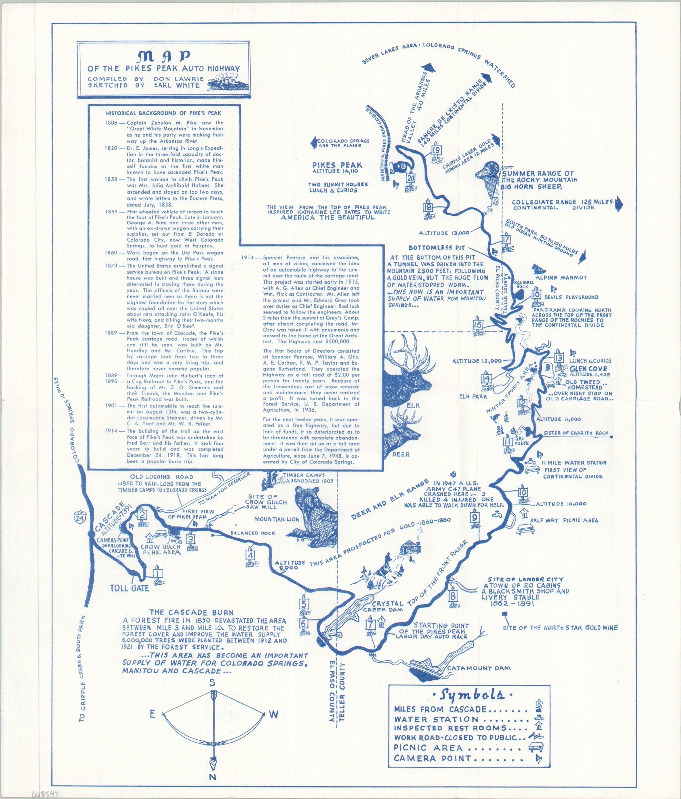
Map of the Pikes Peak Auto Highway
$145.00
Acclimating the public to a new toll on the Pikes Peak Highway.
1 in stock

Description
“With the exception of the streets of Heaven, which are reportedly paved with gold, the Pikes Peak Highway, from the standpoint of maintenance, is perhaps the most expensive 20-mile thoroughfare over which you will ever travel…Every one of the 50 cents which you pay for the privilege of making the never-to-be-forgotten trip to the summit of America’s most famous mountain is used for the upkeep of the road over which you travel.” – Text, verso.
This charming mid-century brochure offers an inviting overview of the historic Pikes Peak Highway, a 20-mile paved road that connects Cascade, Colorado, to the summit of Pikes Peak. The map, oriented with south at the top, offers a relatively simple overview of the winding route, noting water stations, restrooms, picnic areas, historic sites, and various points of interest. Accompanying text in the corner and on the verso provides a descriptive summary of the scenic highway and its famous Auto Race.
The map was compiled by Don Lawrie and sketched by Earl White. Probably printed in late 1948 or 1949 by the Out West Company of Colorado Springs. That same year, the city of Colorado Springs took over the highway’s operation from the Forest Service and implemented a toll to fund the maintenance costs. Lawrie was a key figure in developing the Pikes Peak Snow Area around Glen Cove, keenly interested in influencing public reception to the despised charge.
Map Details
Publication Date: 1948
Author: Don Lawrie and Earl White
Sheet Width (in): 10.60
Sheet Height (in): 12.40
Condition: A
Condition Description: Double-sided map brochure with light wear along folds and in the margins. Very good condition overall.
$145.00
1 in stock