Map of the Northern Parts of the United States of America
$325.00
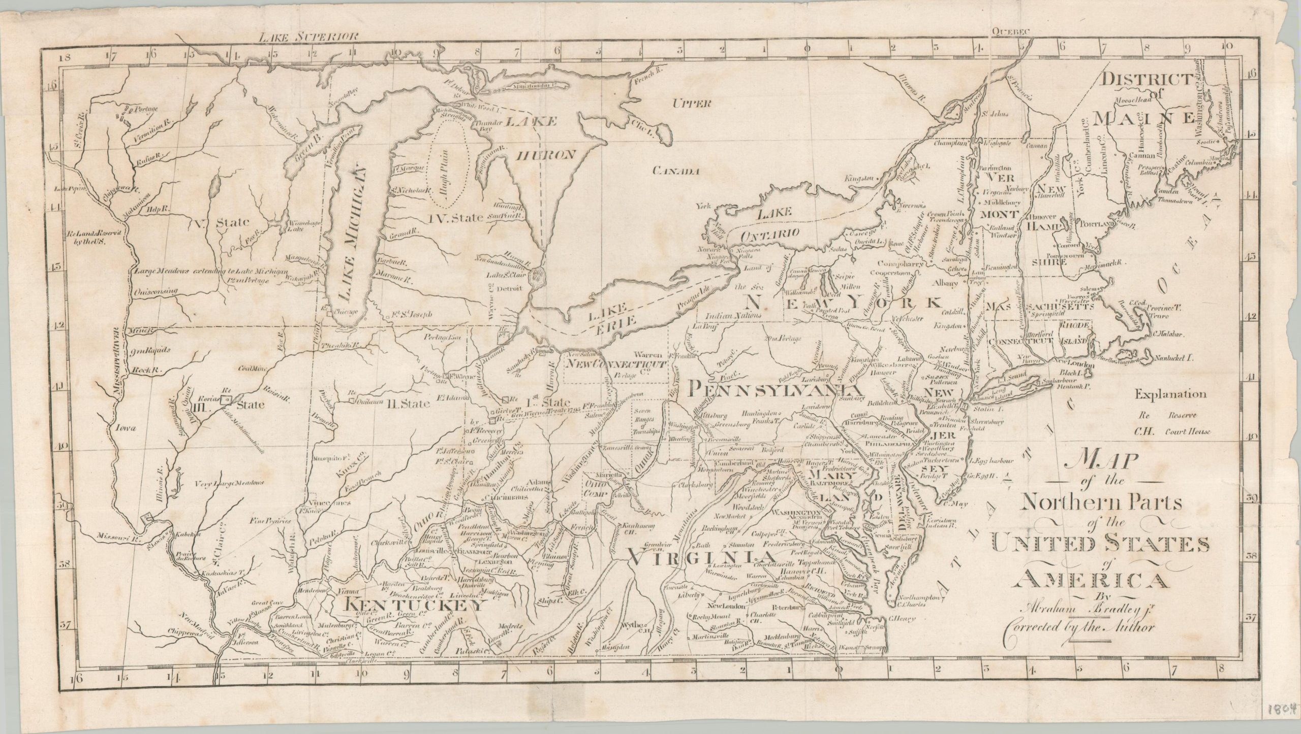
An outline of America’s early 19th century growth plan.
1 in stock
Description
The content of this important early map of the United States was originally created in 1797 (this is a later example) by Assistant Postmaster General Abraham Bradley to outline relevant infrastructure and political organization across the fledgling nation. Military reservations and courthouses – extensions of governmental power – are emphasized.
New territories across the Midwest reflect developments from the 1789 Northwest Ordinance, though the proposed states still represent the rugged and largely unpopulated frontier. Across the Mississippi, the text ‘Lands Reserv’d by the U.S.’ reflects the recent acquisitions through the Louisiana Purchase.
The image presents the northern part of Bradley’s highly influential map from 1797. It was updated by Jedidiah Morse and published in 1804 as part of the 2nd edition of his American Gazetteer.
Source: Leventhal Map Collection
Map Details
Publication Date: 1804
Author: Jedidiah Morse
Sheet Width (in): 16.25
Sheet Height (in): 9.25
Condition: B+
Condition Description: Scattered soiling across a sheet of paper that's softly wrinkled and moderately worn. A somewhat light impression, but remains legible and in good condition overall.
$325.00
1 in stock