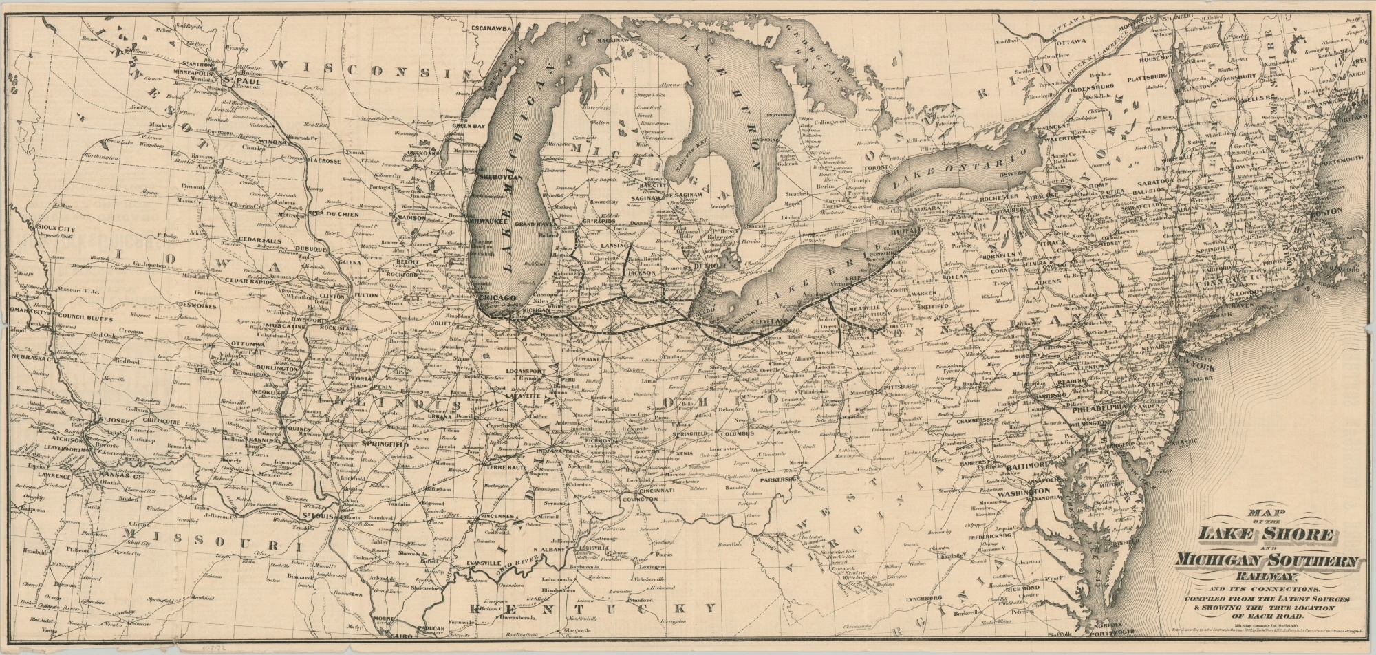
Map of the Lake Shore and Michigan Southern Railway
Marvelous map and timetable of the Lake Shore and Michigan Southern Railway.
Out of stock
Description
While it has origins in earlier lines dating back to the 1830s (some of the first to ever access Chicago), the Lake Shore Railway wasn’t officially known as such until 1868. Subsequent mergers the following year led to a further reorganization and the final branding as the Lake Shore and Michigan Southern Railway.
This map, dated 1873 in the lower right, shows the system linking Chicago and Buffalo; with lines to Detroit, Lansing and Grand Rapids, as well as several spurs in the oil fields of Ohio. Competing lines are also labeled, and the subtitle assures the reader the information was “compiled from the latest sources & showing the true location of each road.”
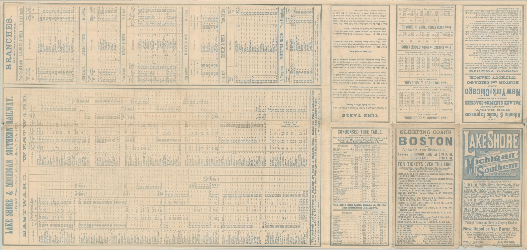
The verso presents timetables revised as of March 1877. That same year, a majority stock in railroad ownership was acquired by Cornelius Vanderbilt to add to his New York Central’s iron empire.
Map Details
Publication Date: 1877
Author: Clay, Cosack & Co.
Sheet Width (in): 27
Sheet Height (in): 13
Condition: A-
Condition Description: Issued originally folded into sixteen panels, with moderate wear along former fold lines. Small holes at fold intersection, creasing , and several small tears are visible along the outer edges. Light soiling on the verso does not affect the image. Marginal wear is also present in the lower left, but overall the map remains in very good condition.
Out of stock