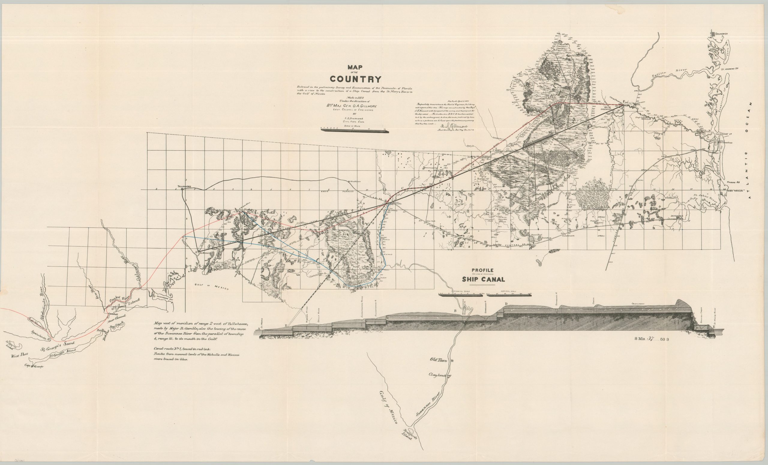
Map of the Country Embraced in the preliminary Survey and Examination of the Peninsula of Florida with a view to the construction of a Ship Canal from the St. Mary’s River to the Gulf of Mexico
Original price was: $300.00.$225.00Current price is: $225.00.
Efforts to traverse Florida by ship in the late 19th century.
1 in stock
Description
This fascinating and detailed map of northern Florida reflects ongoing efforts to create a ship canal across the state. This particular proposal, initiated by Robert Gamble using earlier surveys by Quincy Gillmore, presents a plan to connect the St. Mary’s River at Camp Pickney in the east with Crooked River and St. George’s sound in the east. The ambitious and somewhat irregular route (one of at least three different paths) is highlighted in red. A wealth of information about the landscape is presented, including physical features, elevation data, and existing infrastructure. A profile of the proposed ship canal can be seen in the lower right.
The surveys by Gillmore and his assistant, S.L. Fremont, were originally performed in 1879 and printed in 1880. According to research by Kevin Brown at Geographicus, this is a later example, published by the Government Printing Office as part of a Congressional report in 1895.
Map Details
Publication Date: 1895
Author: Major Robert Gamble
Sheet Width (in): 36.9
Sheet Height (in): 22.2
Condition: A
Condition Description: Softly creased along originally issued fold lines and a bit of wear along the outer edges of the sheet. Irregular left margin from being previously bound. Very good to near fine condition overall.
Original price was: $300.00.$225.00Current price is: $225.00.
1 in stock