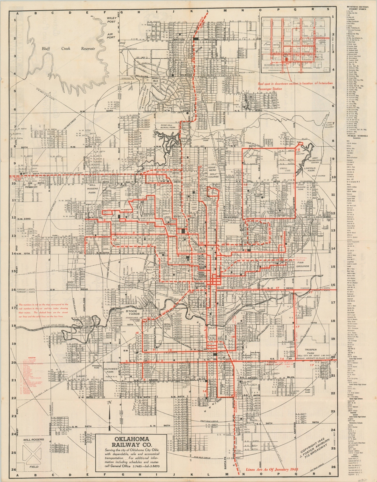
Map of Oklahoma City
$95.00
WWII-era street plan of Oklahoma City.
1 in stock
Description
Despite being issued by the Oklahoma Railway Company, this map of Oklahoma City presents a transit system dominated by bus routes (solid red). Only a few dashed streetcar lines can be seen serving the state capital, identified in the legend (lower left).
An index of important buildings, schools, and golf courses can be seen on the right side of the sheet. The verso shows a diagram of the downtown business district and a map of the Oklahoma Railway Company interurban lines, along with company advertisements and a panoramic photograph of the city skyline.
Copyright 1942 by J. Foster Ashburn, updated to January of 1943.
Map Details
Publication Date: 1943
Author: J. Foster Ashburn
Sheet Width (in): 18.4
Sheet Height (in): 23.3
Condition: A-
Condition Description: Light wear along the edges of the sheet and a few specks of discoloration confined to the margins. Light creasing along fold lines, as issued, and scattered soiling on the verso that does not affect the image. Very good overall.
$95.00
1 in stock

