
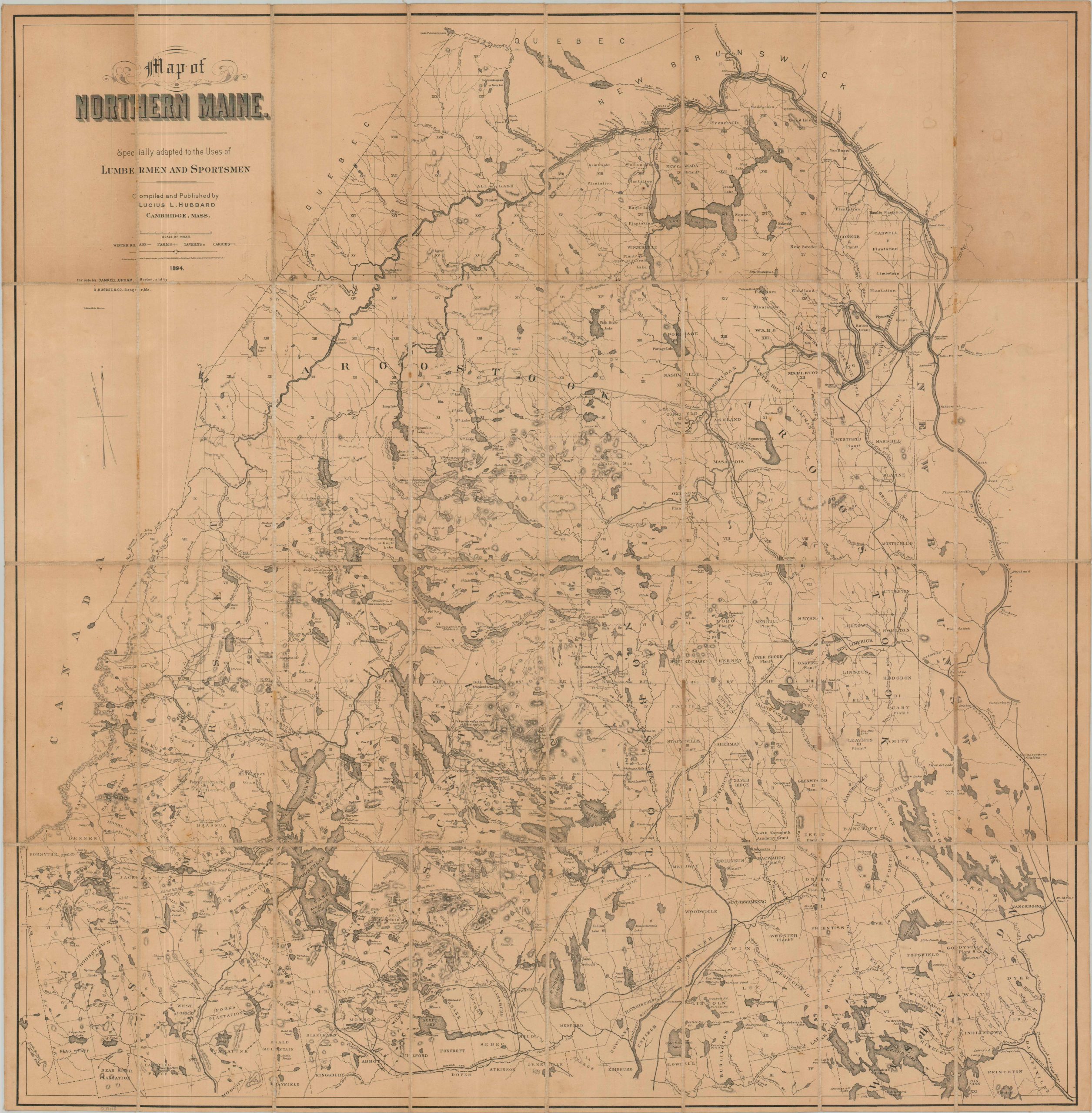
Map of Northern Maine. Specifically adapted to the Uses of Lumbermen and Sportsmen
$425.00
First edition of a large format map covering Maine’s northernmost counties.
1 in stock
Description
This scarce 1894 folding map presents an exceptionally detailed, large-scale survey of the vast North Woods of Maine, compiled and published in Cambridge, Massachusetts, by noted geologist, author, and woodsman Lucius L. Hubbard. Designed as a field guide for timber prospectors, guides, anglers, and wilderness tourists, this first edition vastly expanded upon Hubbard’s earlier, localized cartography of the Moosehead Lake region to cover the northern half of the state, encompassing the great wilderness around Moosehead Lake, the headwaters of the Penobscot, Kennebec, and St. John Rivers, and the newly developing settlements of Aroostook County.
The finely detailed image offers an intimate look at the region’s limited transportation infrastructure and handful of scattered settlements. Dozens of land grants are labeled across the surveyed sections, contrasting with numerous toponyms that preserve the linguistic heritage of Maine’s Indigenous inhabitants. Geographic features, topography, and hydrography are also prominent elements of the composition, particularly useful to the anglers, guides, and lumbermen for whom the map was intended.
The publication of the map, revised in 1896 and 1899, coincided with a major transformation of northern Maine. Railroads were rapidly pushing into the wilderness, opening previously remote forests to commercial logging while simultaneously making the region accessible to sportsmen and tourists. The newly constructed Bangor and Aroostook Railroad was particularly important, providing access to portions of the state that had previously required arduous travel by river, trail, and logging road. Contemporary advertisements for Hubbard’s map specifically promoted its coverage of these newly accessible regions.
Sources: Digital Maine; Osher Map Library; OCLC# 54995644
Map Details
Publication Date: 1894
Author: Lucius L. Hubbard
Sheet Width (in): 32.80
Sheet Height (in): 33.40
Condition: B
Condition Description: Lithographed map dissected into 24 segments and affixed to old linen, likely as issued (includes original envelope). Staining on the verso does not demonstrably affectToning in the upper corners, where the paper was exposed, and some scattered spotting throughout. About good condition overall.
$425.00
1 in stock