[Map of Nicaragua]
Early survey of a possible railroad of canal route through Nicaragua.
Out of stock
Description
The dream of connecting the Atlantic and Pacific Oceans has been in the minds of explorers, industrialists and politicians in the Western Hemisphere since it was first discovered by Columbus. Early on, it was determined that a spot somewhere in Central America would be best suited for such a “bridge” between the oceans, and expeditions and surveys were proposed by the French, English, Spanish, Dutch and even the Scots in the 16th – 20th centuries.
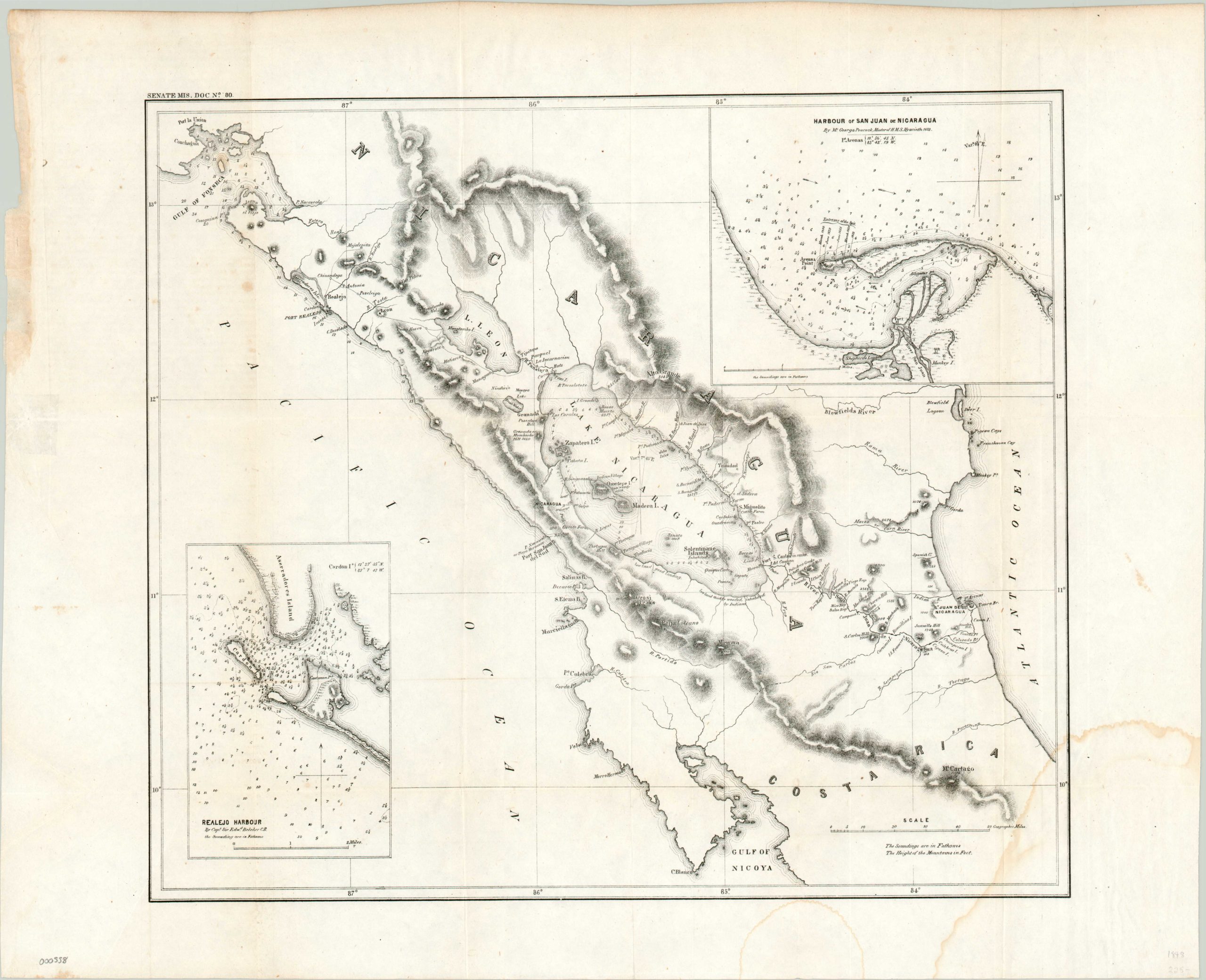
This map of Nicaragua shows the culmination of such an effort by an American named John Rockwell, who created a report on a joint Congressional resolution to authorize a survey of a possible route through the country in 1849. At this stage, it was assumed the easiest method of transportation would be a railroad (rather than a canal), but the map was created to evaluate both options. Topographical details, settlement locations, rivers and lakes, and inset maps of navigable harbors all provide information that would have been critical to planning such a survey, had it ever occurred. Ultimately, Nicaragua would be bypassed as the host of a trans-oceanic canal in favor of Panama, and even then it would take over 65 years from the time of this map’s publication to open for traffic!
Map Details
Publication Date: 1849
Author: Government Publishing Office
Sheet Width (in): 23.6
Sheet Height (in): 19.00
Condition: B+
Condition Description: Fold lines as issued and minor soiling along the edges and in margins. Two damp stains visible in the lower right, one of which enters the image. Remains very presentable.
Out of stock