Map of Missouri
$35.00
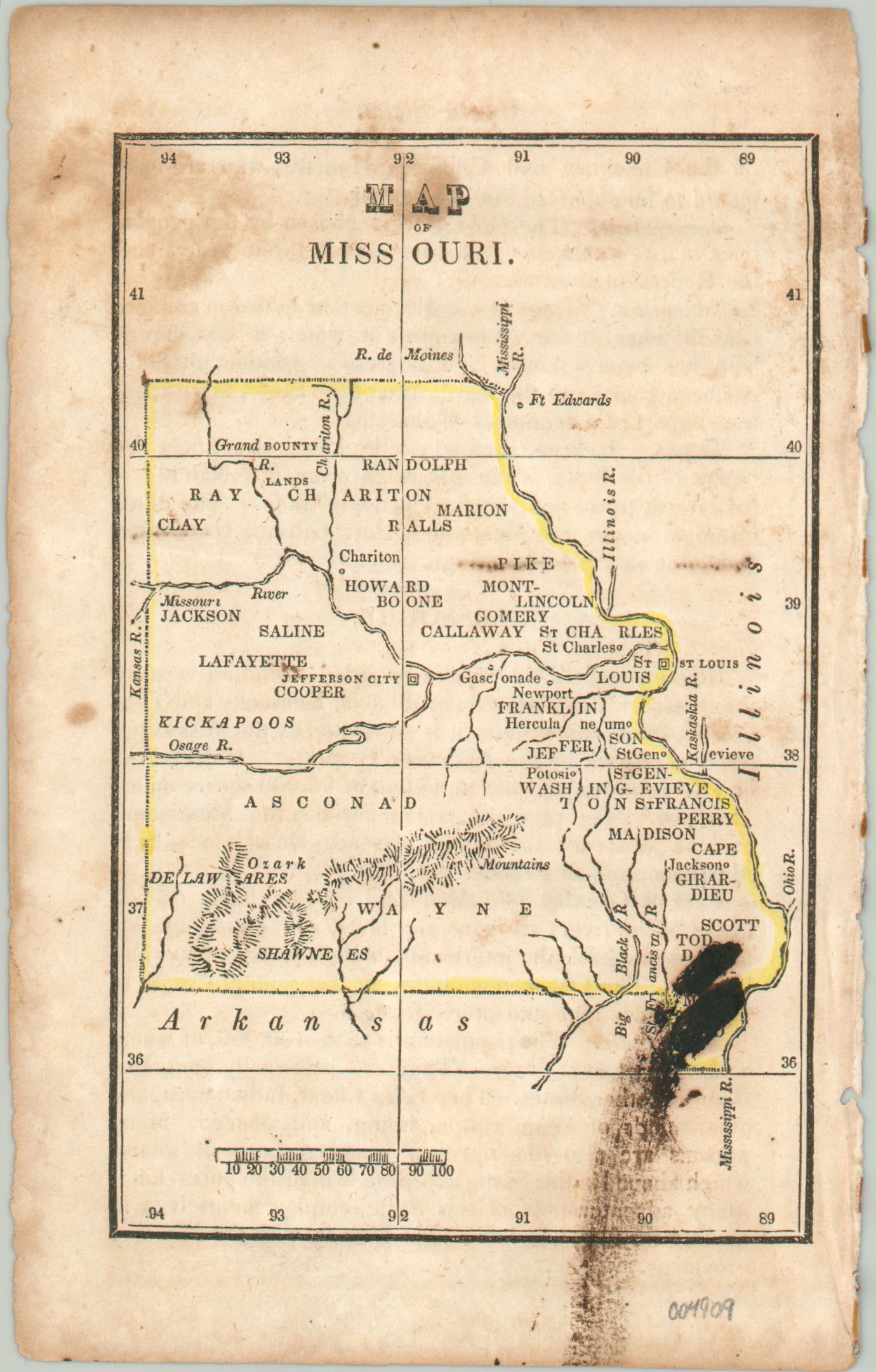
Woodcut map from 1830 showing the state of Missouri.
1 in stock
Description
This neat little map was originally published in Boston in 1830 as part of Nathan Hale’s An Epitome of Universal Geography. It presents a simple overview of the Show-Me-State about a decade after its admission to the Union. Counties, a handful of scattered settlements, and geographic features are rudimentarily labeled throughout the image. Of interest is Jefferson City, the capital since 1826.
Bounty Lands granted to veterans from the War of 1812 are noted in the north, whereas the southern part of the state contains the Ozarks. Numerous Native American tribes are named. Descriptive text on the verso provides additional information, such as “the population is about 100,000, of whom a sixth part are slaves.”
Map Details
Publication Date: 1830
Author: Nathan Hale
Sheet Width (in): 4.4
Sheet Height (in): 6.9
Condition: B
Condition Description: Heavy soiling and staining visible in the upper left and lower right corners. Old outline color. Fair to good condition.
$35.00
1 in stock