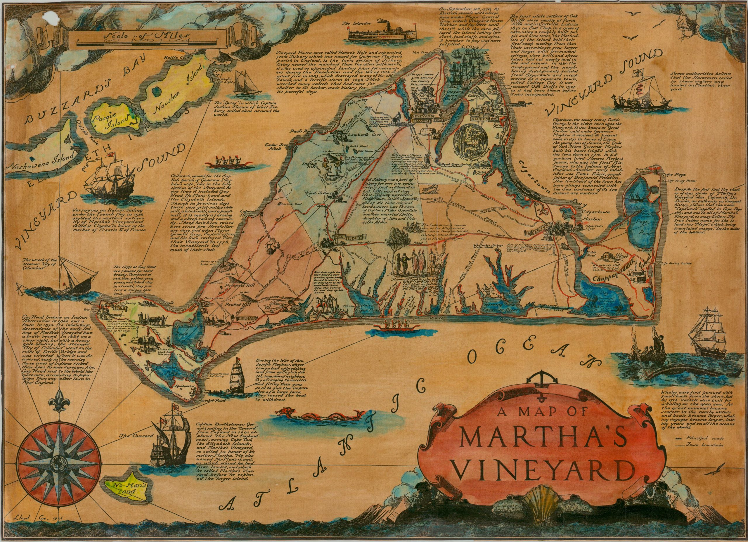
Map of Martha’s Vineyard
$225.00
A gorgeous depiction of one of America’s most iconic nautical destinations.
1 in stock
Description
This striking hand-colored map of Martha’s Vineyard was illustrated by the talented Lloyd Coe and published in the mid-1920s, while the resort island was a popular destination for East Coast socialites. Scattered vignettes across the island and in the surrounding waters describe the rich history of Martha’s Vineyard, with a special emphasis on prominent sailing ships and maritime events. The Revolutionary War, original indigenous inhabitants, and patterns of settlement are also explored visually. The decorative elements, combined with the attractive coloration, give the impression of a treasure map!
Lloyd Coe (1899–1977) was a Massachusetts-born painter, illustrator, and cartoonist who studied at the National Academy of Design and the Vesper George School of Art. He is best known for his landscapes and beach scenes, his work for publications like The New Yorker and the Saturday Review of Literature, and for designing the 1938 and 1946 Christmas Seals. Coe also authored children’s books and served for several years as the president of the Rockport Art Association.
Sources: AskArt; David Rumsey Map Collection
Map Details
Publication Date: 1926
Author: Lloyd Coe
Sheet Width (in): 25.00
Sheet Height (in): 18.00
Condition: B
Condition Description: Printed black and whitemap with old hand color on a thinly laminated or glossy sheet of paper. A small dime sized hole in the upper left as a result of oxidization and some scatered discoloration from age and light exposure. About good condition overall.
$225.00
1 in stock