Map of Greater Kansas City “The Heart of America”
$95.00
Enjoy yourself in Kansas City!
1 in stock
Description
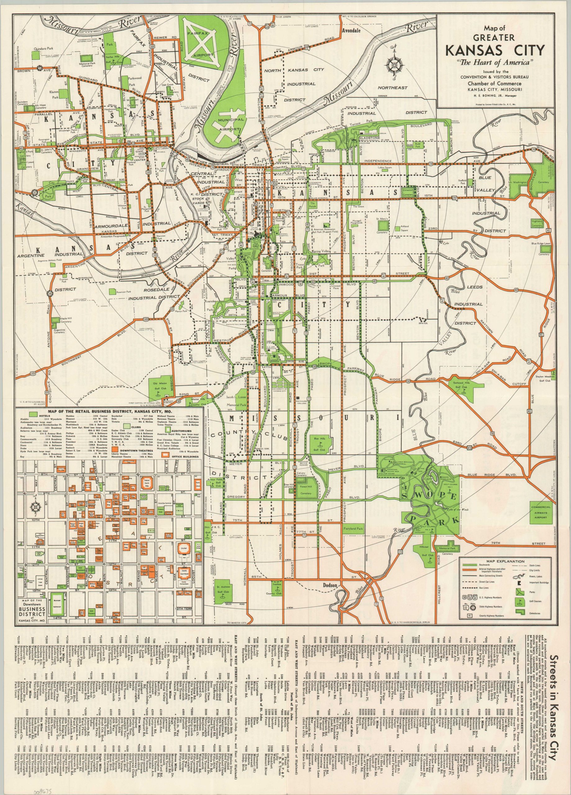
This charming midcentury map of Kansas City, Missouri, was issued in 1940 by the Convention & Tourist Bureau of the Chamber of Commerce. The image successfully blends the transportation infrastructure, leisure opportunities, and industrial expansion that defined the success of urban environments across America.
Bus and streetcar lines present the options for mass transit, while a robust highway network extends even further into the suburbs. Tree-lined boulevards, highlighted in green, connect various parks, cemeteries, and other outdoor spaces. A large-scale inset, lower left, shows the Retail Business District, outlining and labeling hotels, theaters, clubs, and more. Additional information for the visitor is provided on the verso, including descriptions of local attractions, a list of hotels, and tips for driving into the city.
Map Details
Publication Date: 1940
Author: Kansas City Chamber of Commerce Convention & Visitors Bureau
Sheet Width (in): 16.80
Sheet Height (in): 23.40
Condition: A
Condition Description: Double-sided map brochure with light wear along original folds. Near fine condition.
$95.00
1 in stock