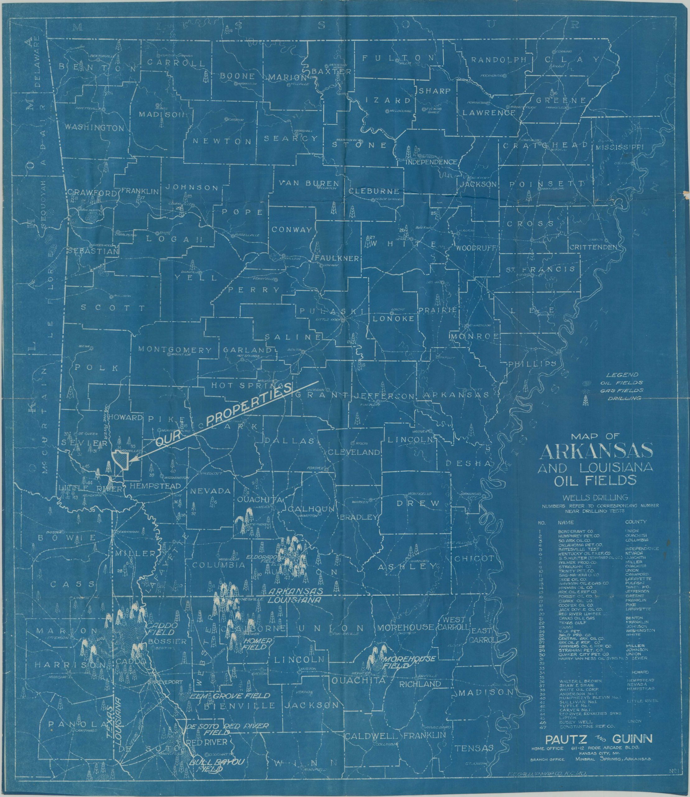
Map of Arkansas and Louisiana Oil Fields
Ramping up oil and natural gas production in Arkansas.
Out of stock
Description
This blueprint map shows the location of valuable oil and natural gas deposits across Arkansas and northern Louisiana. A concentration of the precious fossil fuels is immediately evident in the center of the sheet, near the state border.
Oil derricks (many of which are gushing) note the sites of particular drilling operations, usually concentrated around named fields. Nearly fifty different wells and test sites are numbered and identified in a list in the lower right.
The map was published in Kansas City by the F.E. Gallup Map Company, probably between 1920 and 1923, Distributed by the firm of Pautz and Guinn, whose properties (potentially laden with liquid gold) are outlined in Howard County, Arkansas. Dated by the absence of the Smackover Field, which by 1924 was producing about 150,000 barrels a day.
Map Details
Publication Date: c. 1922
Author: F.E. Gallup Map Co.
Sheet Width (in): 25
Sheet Height (in): 28.5
Condition: B+
Condition Description: Printed on blueprint paper with uneven margins and moderate wear along old fold lines. Numerous closed tears on the right side, the largest about 4", have been repaired on the verso with archival tape with no image loss. One small closed tear has also been repaired on the left side. Several manuscript markings and some soiling on the verso does not affect the image. Good condition overall.
Out of stock