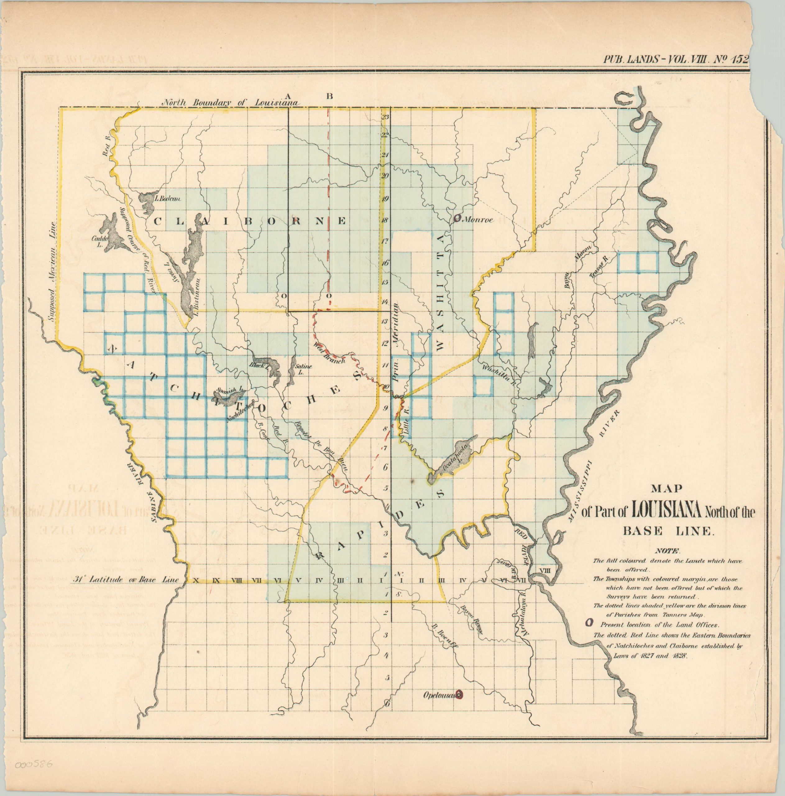
Map of a Part of Louisiana North of the Base Line
Early 19th century survey of northern Louisiana.
Out of stock
Description
This map represents the ongoing efforts of the United States government to officially incorporate and consolidate newly acquired territory. Although Louisiana was granted statehood in 1812, it still had large swathes of unsurveyed territory within its borders.
This map, issued in a federal report around 1828, shows the ongoing process of surveying, organizing, and selling land to prospective settlers and real estate speculators. Negotiated parish boundaries and townships are colored by hand, and while the border with Mississippi is set at the 33rd parallel, while the border with Mexico is labeled as the “Supposed Mexican Line,” despite being officially negotiated under the Adams-Onis Treaty nearly a decade before the map’s publication!
Map Details
Publication Date: c. 1828
Author: General Land Office
Sheet Width (in): 12.30
Sheet Height (in): 12.90
Condition: B-
Condition Description: Minor offsetting and a chip in the sheet in the upper right corner.
Out of stock