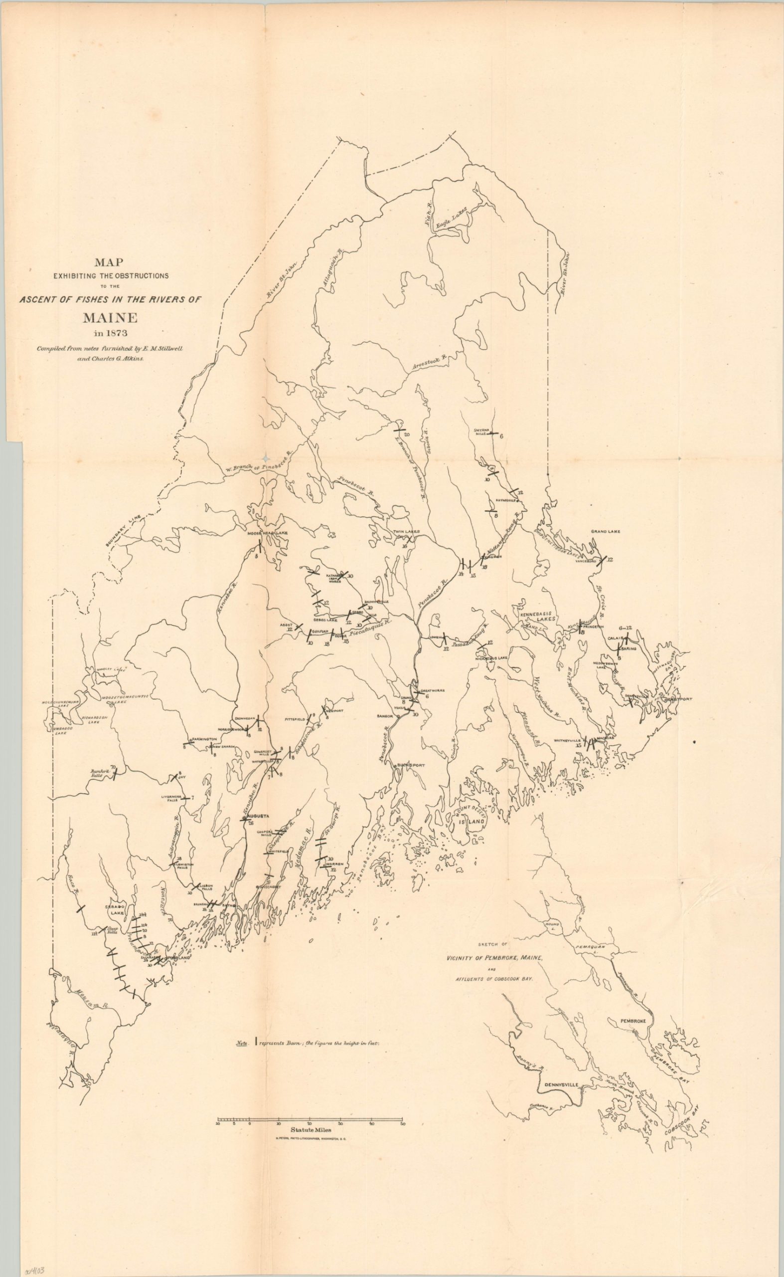
Map Exhibiting The Obstructions to the Ascent of Fishes in the Rivers of Maine in 1873
$75.00
Early efforts to help repopulate the salmon across the rivers of Maine.
1 in stock
Description
This simple black and white map of Maine was originally issued to accompany a report of the U.S. Commission on Fish and Fisheries published by the Government Printing Office in Washington, D.C. around 1874. It shows the numerous obstacles, both natural and manmade, along Maine’s rivers that obstruct Atlantic salmon as they swim upriver towards their annual spawning grounds. According to the Maine Encyclopedia,
“The salmon have been the focus of restoration efforts for over 150 years. Historic runs in the U.S. were about 500,000 fish; but, by the mid-1850s Atlantic salmon were gone from most of the rivers in southern New England and had declined noticeably throughout Maine. Hatcheries were established in Maine as early as the 1870s. The Craig Brook hatchery in Orland was established in 1890 for the purpose of stocking salmon. Since that time, millions of young and adult salmon have been stocked in Maine rivers and millions of dollars have been spent on restoration.”
Source: Maine Encyclopedia
Map Details
Publication Date: c. 1874
Author: U.S. Commission on Fish and Fisheries
Sheet Width (in): 14.1
Sheet Height (in): 23.5
Condition: B+
Condition Description: Moderate creasing along former fold lines and a bit of extraneous wrinkling in the lower right. Several small spots of separation along fold lines and at fold intersections, but overall in good to very good condition.
$75.00
1 in stock