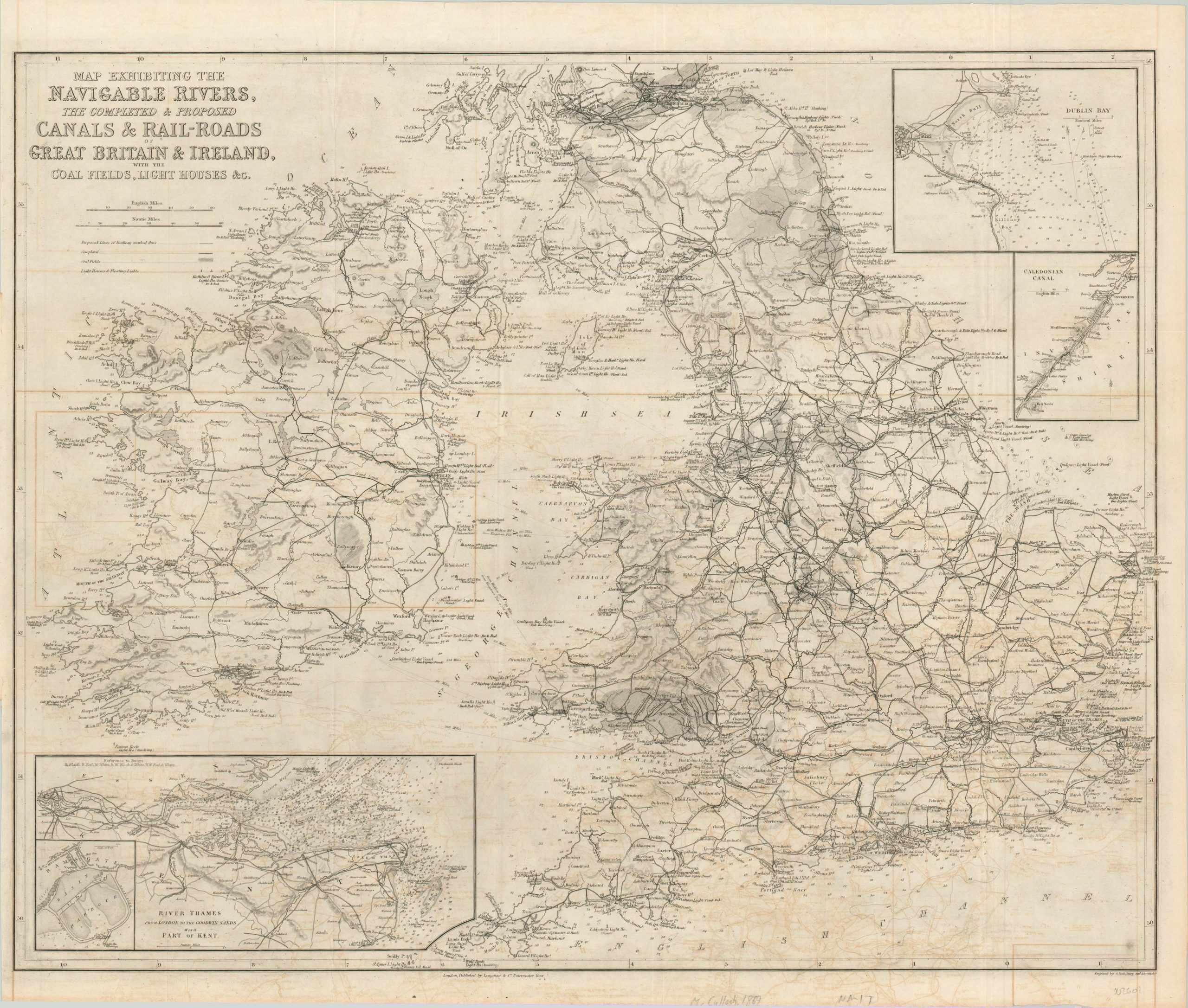
Map Exhibiting the Navigable Rivers, the Completed & Proposed Canals & Rail-Roads of Great Britain and Ireland
$125.00
A transportation map of Great Britain and Ireland after the smoke has cleared from the Industrial Revolution.
1 in stock
Description
This wonderfully detailed transportation map of England, Ireland, and Scotland reflects how the British Isles rapidly evolved during the Industrial Revolution of the preceding century. Railroads and canals connect nearly every corner of the country to the coastline, allowing for the cheap and reliable transportation of goods and people all across the globe. Both completed and proposed routes are shown – reflecting the contemporary enthusiasm for such development.
Inset maps show three primary ports and thoroughfares; including Dublin Bay, the Thames Estuary, and the Caledonian Canal. Light houses and coal fields are also shown within the image and were both important components of maintaining British naval supremacy throughout the English Channel and across the globe.
The map was engraved by S. Hall and published in London by Longman & Company in 1869.
Map Details
Publication Date: 1869
Author: S. Hall
Sheet Width (in): 26.00
Sheet Height (in): 22.00
Condition: B
Condition Description: Moderate offsetting visible across the sheet, which is printed on thin paper that shows light creasing from old fold lines. Uneven and small tears around the outer edges. Remains in good condition overall.
$125.00
1 in stock

