
Map and Workings – Panama Canal
The ‘Official Map’ of the Panama Canal!
Out of stock

Description
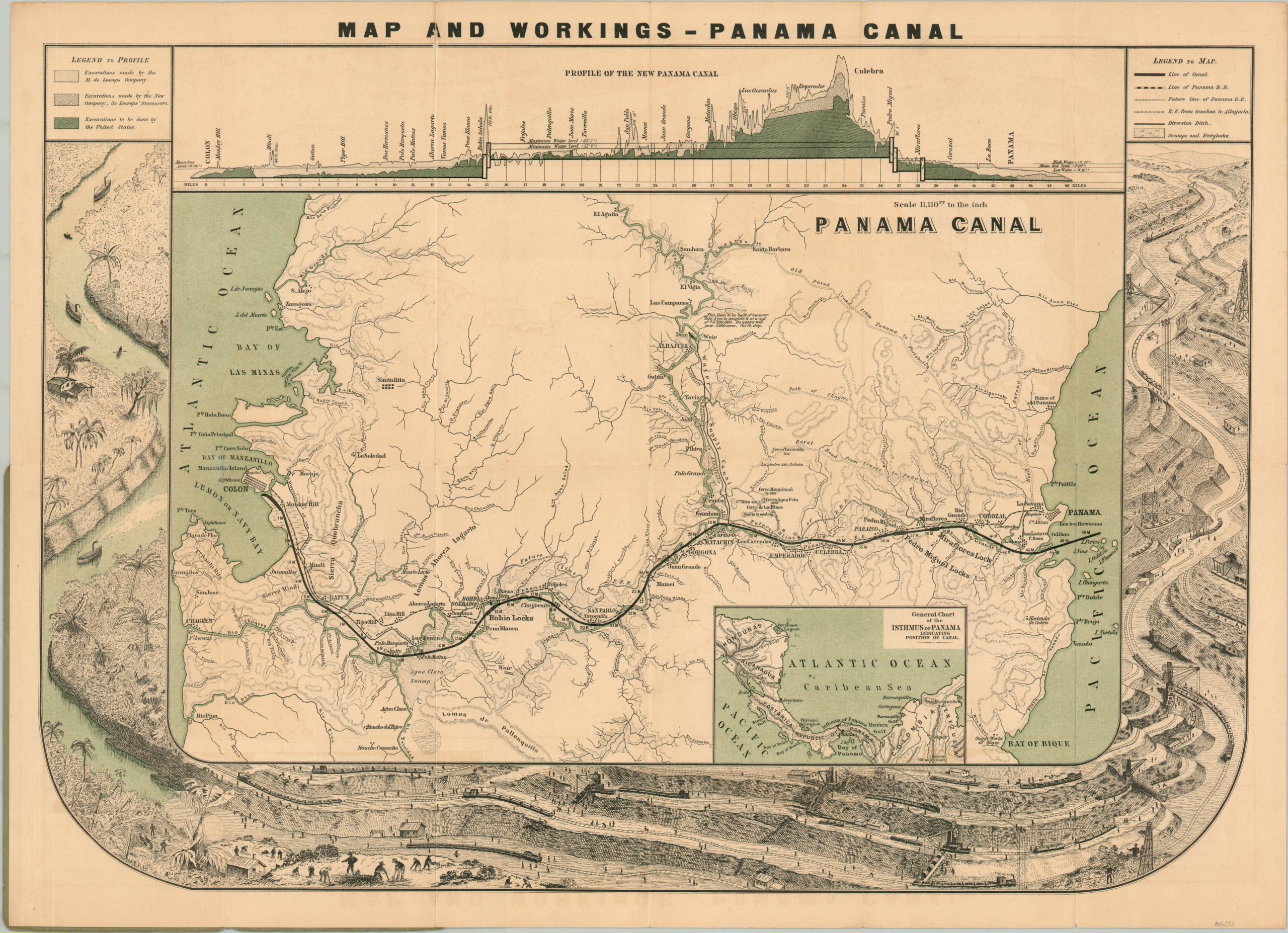
This attractive overview of the Panama Canal was published in Colon by I.L. Maduro, Jr. around 1904, shortly after the U.S. took over construction operations from the French. A central map shows the prospective route connecting Colon in the west with Panama in the East. The line of the Panama Canal Railway is noted, along with various settlements and geographic features. A profile of the canal is shown at the top of the page, with green color highlighting the extensive work left to be done by the Americans. The rest of the outer edges of the sheet are occupied by an illustrated representation of the multi-stage earthmoving efforts.
When it first opened for shipping in 1914, the Panama Canal was one of the most complex and expensive expensive engineering operations on the planet. At the time, it held the record for the largest locks, the largest earth dam, largest man-made lake, and the most amount of earth excavated during construction. Thousands of lives were lost during the excavation of the approximately 50-mile channel that allowed ships to bypass the continental landmass of the Western Hemisphere.
Map Details
Publication Date: c. 1904
Author: I.L. Maduro, Jr.
Sheet Width (in): 24.2
Sheet Height (in): 17.4
Condition: A-
Condition Description: Lithographed map folded into 12 segments and affixed to original stiff paper wraps. A 2" clean separation in the upper left (through the title) has been repaired on the verso with archival tape. Very good condition overall.
Out of stock