
Manchester.
$195.00
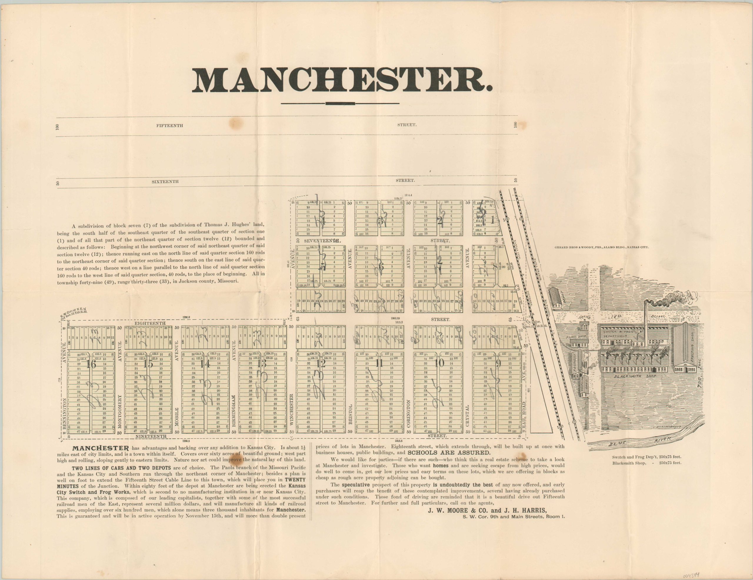
Real estate map of a neighborhood in eastern Kansas City.
1 in stock
Description
“Manchester has advantages and backing over any addition to Kansas City. It is about 1 1/2 miles east of city limits, and is a town within itself. Covers over sixty acres of beautiful ground; west part high and rolling, sloping gently to eastern limits. Nature nor art could improve the natural lay of this land…The speculative prospect of this property is undoubtedly the best of any now offered, and early purchasers will reap the benefits of these contemplated improvements, several having already purchased under such conditions.” [Text, bottom].
This interesting lithographed map shows several city blocks in the small subdivision of Manchester, east of downtown Kansas City, Missouri. Numbered lots can be seen amid labeled roads, along with the corresponding measurements for each. Two railroad lines – the Kansas City & Southern and Missouri Pacific – are noted on the extreme right of the parcel. Immediately opposite is a detailed visualization of the Kansas City Switch and Frog Works, then under construction and a major source of local employment.
The map was printed in Kansas City by the firm of Gerard Brothers & Woody around 1890 on behalf of J.W. Moore & Co. and J.H. Harris, local real estate agents.
Map Details
Publication Date: c. 1890
Author: J.W. Moore & Co. and J.H. Harris
Sheet Width (in): 20.25
Sheet Height (in):
Condition: B+
Condition Description: Creased along old fold lines and spotted in several places throughout the image, most evident in two spots, about the size of a dime, on the left side of the sheet. Numerical annotations in pencil in the lots and on the verso. Good to very good overall.
$195.00
1 in stock