
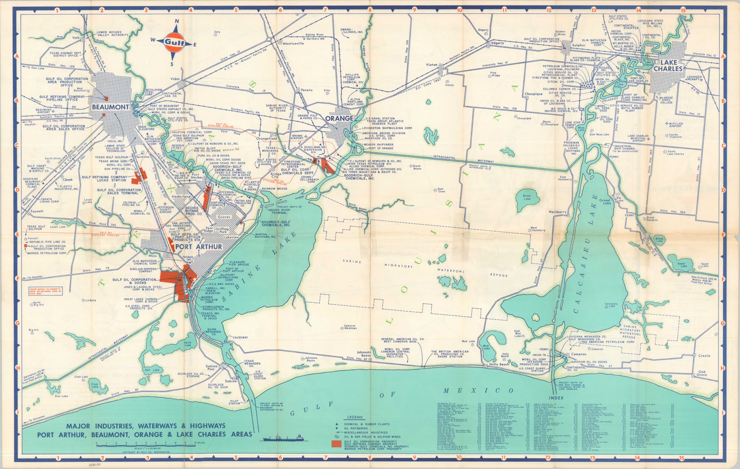
Major Industries Waterways & Highways Port Arthur, Beaumont, Orange & Lake Charles Areas
$195.00
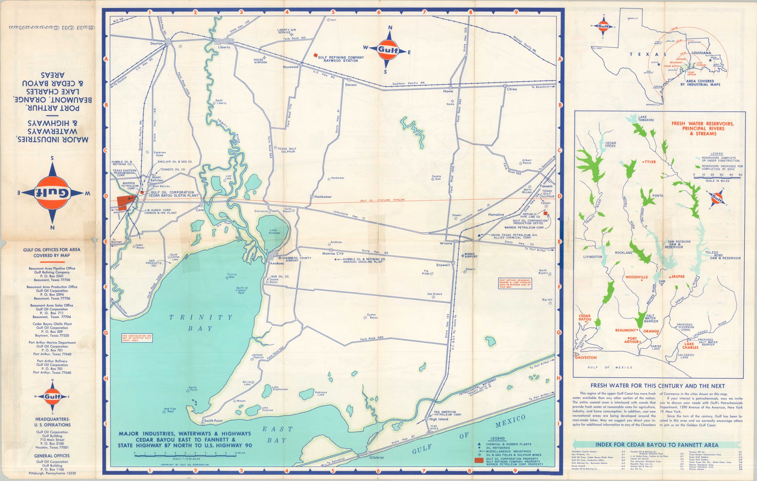
freshwater For This Century and The Next
1 in stock
Description
This inviting map of portions of the Louisiana and Texas Gulf Coast was published around 1960 by the Gulf Oil Corporation. One side of the sheet highlights the major infrastructure across Lake Charles and the ‘Golden Triangle’ of Beaumont, Orange, and Port Arthur. Dozens of industries related to petrochemicals are labeled throughout, while major Gulf Oil facilities and pipelines are highlighted in orange. Migratory waterfowl refuges are unironically outlined adjacent to oil & gas fields, sulphur mines, and processing plants.
The verso of the sheet shows a similar overview of the area around Trinity Bay and Cedar Bayou, along with a diagram showcasing the principal sources of freshwater in the region. Perhaps unsurprising for an industrial promotional piece, but no mention is made of the area’s devastating hurricanes!
Map Details
Publication Date: c. 1970
Author: Gulf Oil Corporation
Sheet Width (in): 32.75
Sheet Height (in): 21.00
Condition: B
Condition Description: Double-sided map with numerous old repairs with cellophane tape, small marginal chips, and some minor discoloration along folds. Fair to good condition overall.
$195.00
1 in stock