
Maine
$150.00
The District of Maine about fifteen years prior to statehood.
1 in stock
Description
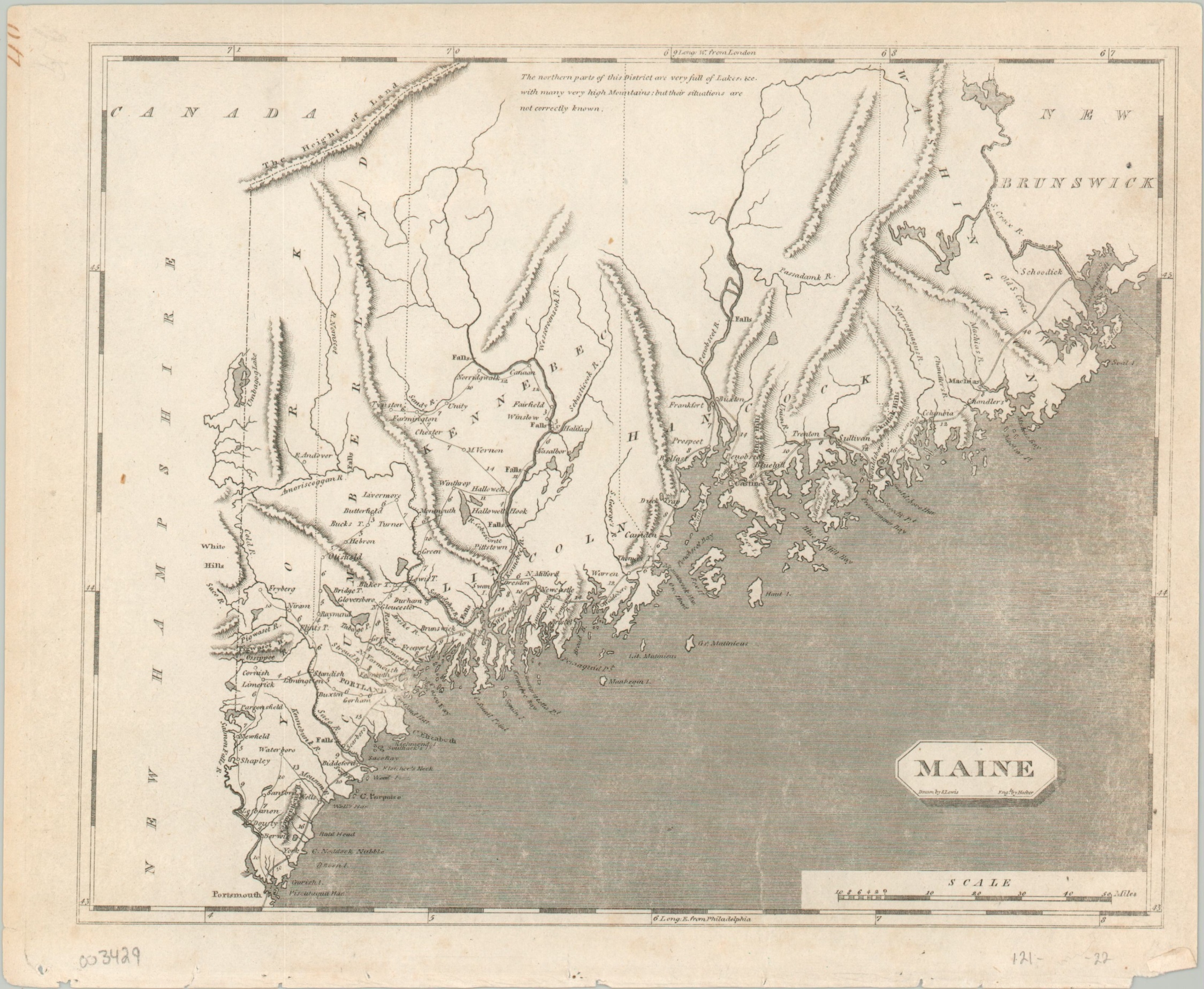
This early 19th-century map shows the lower portions of what would eventually become the state of Maine. At the time of publication, the region was officially designated the District of Maine and was part of the Commonwealth of Massachusetts. Borders with adjacent British Canada were ambiguous at best, as referenced by the annotation near the top of the page, “The northern parts of this District are very full of Lakes, &c. with many very high Mountains, but their situations are not correctly known.”
Such mountains are shown with topography in hachure, such as the labeled “Height of Land” nearby. Elsewhere, scattered towns and settlements are connected by a rudimentary road network. Distances are shown between points, indicating some level of familiarity with the local geography.
Designed by Aaron Arrowsmith and Samuel Lewis and engraved by William Hooker. Published in Philadelphia by Joseph Conrad in 1804, as part of A new and elegant general atlas...
Map Details
Publication Date: 1804
Author: Aaron Arrowsmith and Samuel Lewis
Sheet Width (in): 10.60
Sheet Height (in): 8.75
Condition: A-
Condition Description: Light wear visible around the outer edges, including faint discoloration and some tiny tears along the bottom of the sheet. Some lightening to the image on the right side from the plate strike, but overall in very good condition.
$150.00
1 in stock