Mackinac Island Michigan
$80.00
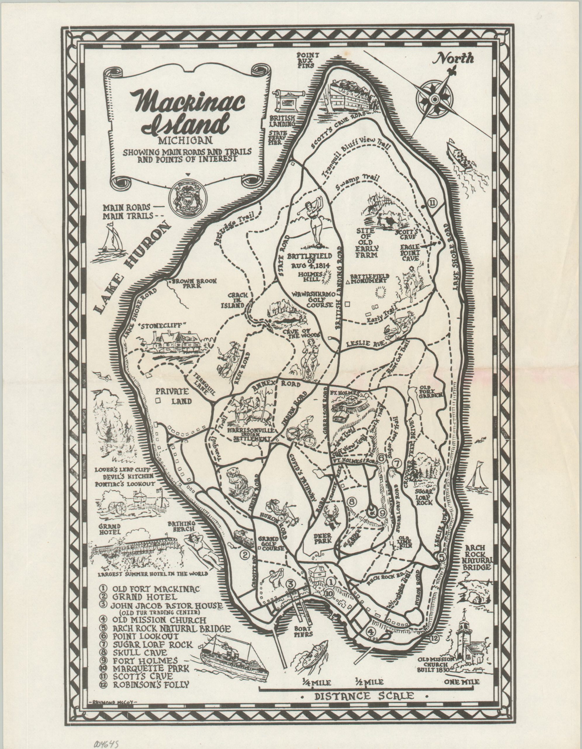
Minimal midcentury map of Michigan’s Mackinac Island.
1 in stock
Description
This charming map of Mackinac, issued at a generous scale of 1 inch to the quarter mile, shows the primary roads (no cars allowed!) and hiking trails across the island. Cute vignettes emphasize local recreation, historic sites, and transportation – notably the iconic horse-drawn carriages. Various locations of interest are labeled, with twelve numbered sites identified within the image.
The map was originally drawn by Raymond McCoy and issued with various titles. The earliest example I can find is a ‘Visitor’s Map to Mackinac Island’, published in 1946 by the Kappa Gamma Delta Fraternity. I suspect this variant is slightly later.
Map Details
Publication Date: c. 1950
Author: Raymond McCoy
Sheet Width (in): 8.5
Sheet Height (in): 11
Condition: A
Condition Description: Creased along a single horizontal fold line. Very good overall.
$80.00
1 in stock