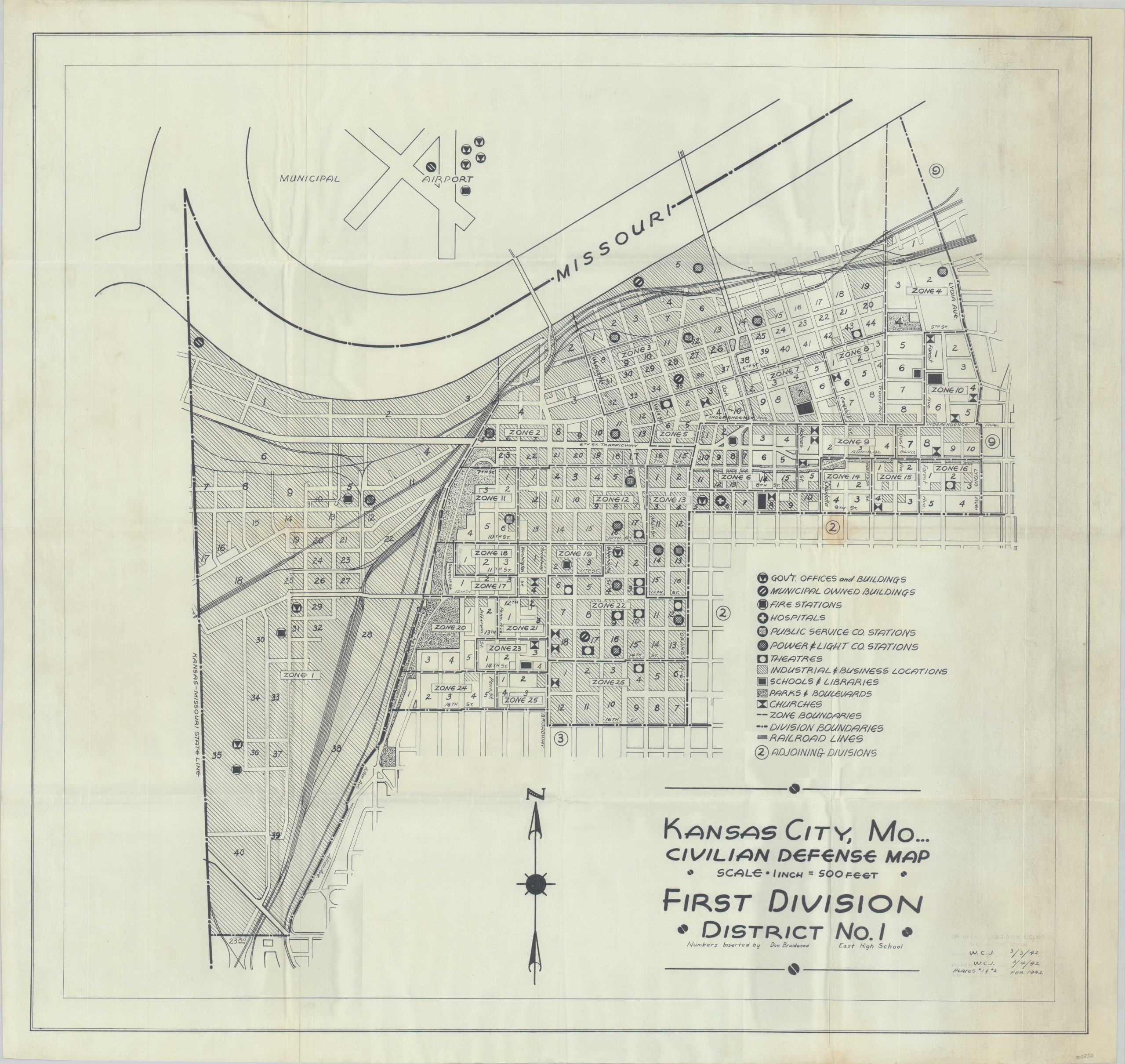
Kansas City, MO… Civilian Defense Map First Division District No. 1
$350.00
Planning for the worst in Kansas City during the Cold War.
1 in stock
Description
The Federal Civil Defense Administration (FCDA) was first established as a government agency by President Truman in late 1950, as a direct response to the Soviet Union’s successful test of a nuclear weapon. Civilian defense planning focused on the survivability of global nuclear war, including constructing and stocking fallout shelters, evacuation plans, and other preparatory and mobilization material. Such efforts were generally disseminated through local committees organized in conjunction with related groups like the American Red Cross, United Service Organization, Boy Scouts of America, etc. until the FDCA was merged with the Office of Defense Mobilization in 1958.
This is an excellent example of preparing for the civilian response to nuclear war in downtown Kansas City, Missouri, probably published around 1955, though using a base map dated 1942. Showing the ‘First Division, District No. 1’ in what was probably a larger set of plans, the plan is split into 26 different zones bounded by the Missouri River, the state line, and several other adjoining divisions. A variety of critical infrastructure, public buildings, and recreational areas are identified according to the legend in the center-right.
Map Details
Publication Date: c. 1955
Author: Federal Civil Defense Administration
Sheet Width (in): 35
Sheet Height (in): 33
Condition: B+
Condition Description: Noticeable discoloration and soiling visible on the right side of the sheet, Light creasing and wear along old fold lines, with a spot of discoloration in the center right. Good to very good condition overall.
$350.00
1 in stock

