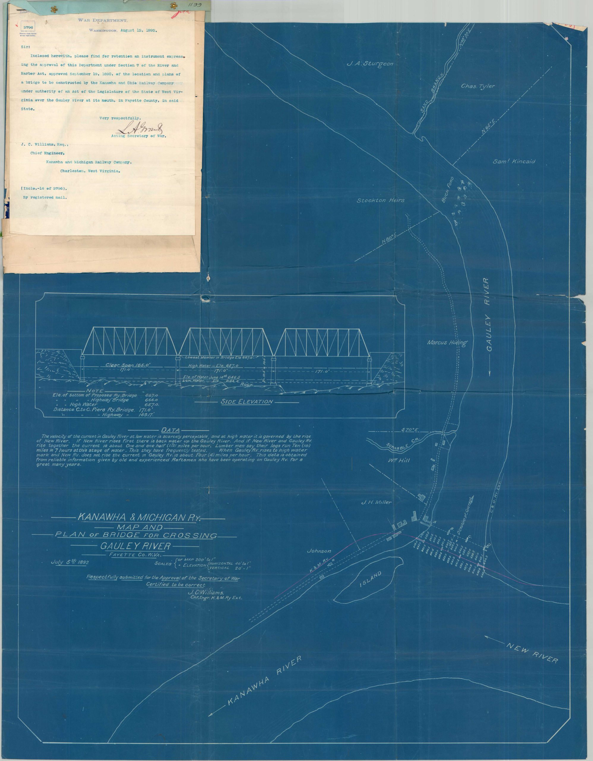
Kanawha & Michigan Ry. Map and Plan of Bridge for Crossing Gauley River
$475.00
Plans for crossing the Gauley River in the early 1890s.
1 in stock
Description
This rare blueprint plan presents a proposed railway bridge to cross the Gauley River near (appropriately named) Gauley Bridge, West Virginia. Though the first bridge in the area was constructed in the 1820s, it wasn’t until the 1890s that the Kanawha & Michigan Railway sought to construct a passage to connect its recently acquired lines to the Chesapeake & Ohio Railroad on the opposite bank.
Railways are clearly shown within the image (the K&M is highlighted pink); in addition to property owners, building outlines, and prominent geographic features. A profile view of the bridge can be seen in the center left, immediately above a summary of collected river data.
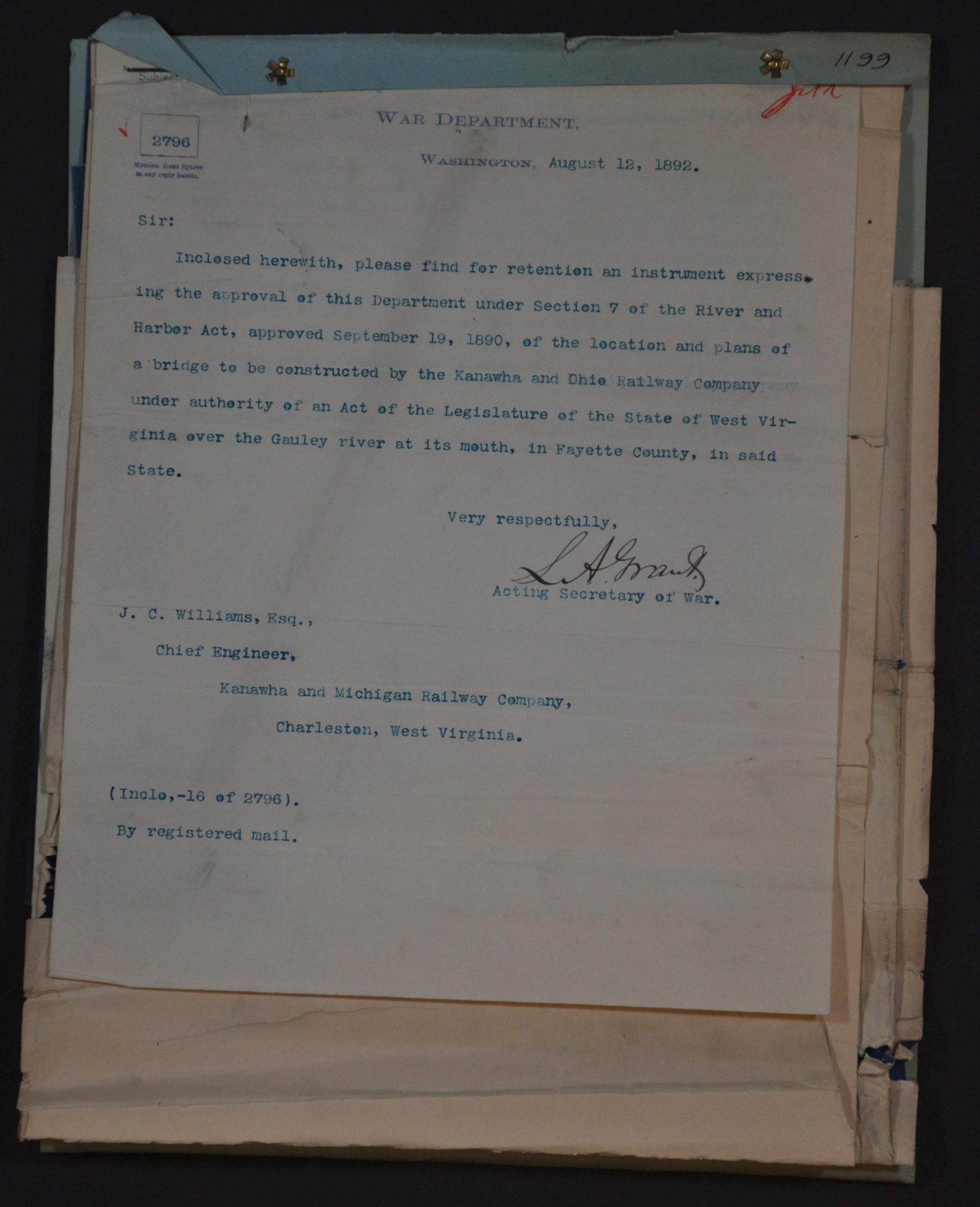
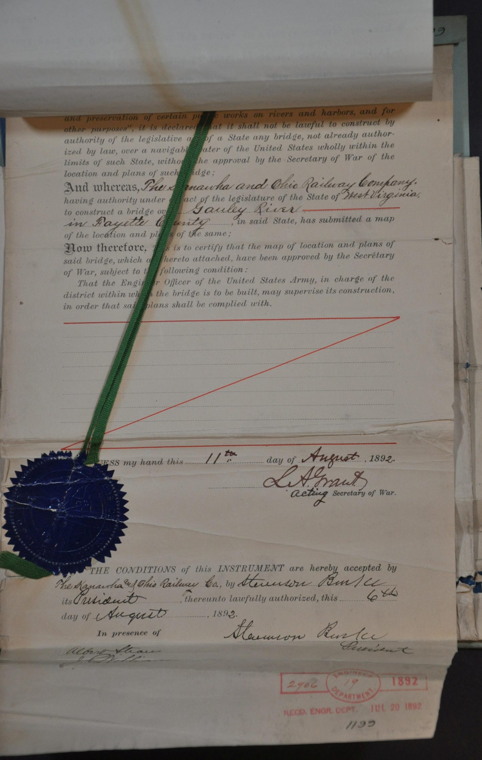
The diagram and information presented were certified by the K. & M. Chief Engineer J.C. Williams in 1892 for ultimate approval by the Secretary of War. Said approval, signed by Acting Secretary of War Lewis A. Grant, was forthcoming and is appended to the map in the upper left.
Map Details
Publication Date: 1892
Author: J.C. Williams
Sheet Width (in): 25
Sheet Height (in): 31.25
Condition: B+
Condition Description: Large single-sided blueprint map (size given), irregularly folded and heavily wrinkled. A few irregular tears and separation at fold intersections. Map affixed with rivets to a blue cover sheet, a typewritten sheet, and a sealed and annotated agreement. All show signs of wear, but remain sturdy and completely legible. Good condition overall.
$475.00
1 in stock