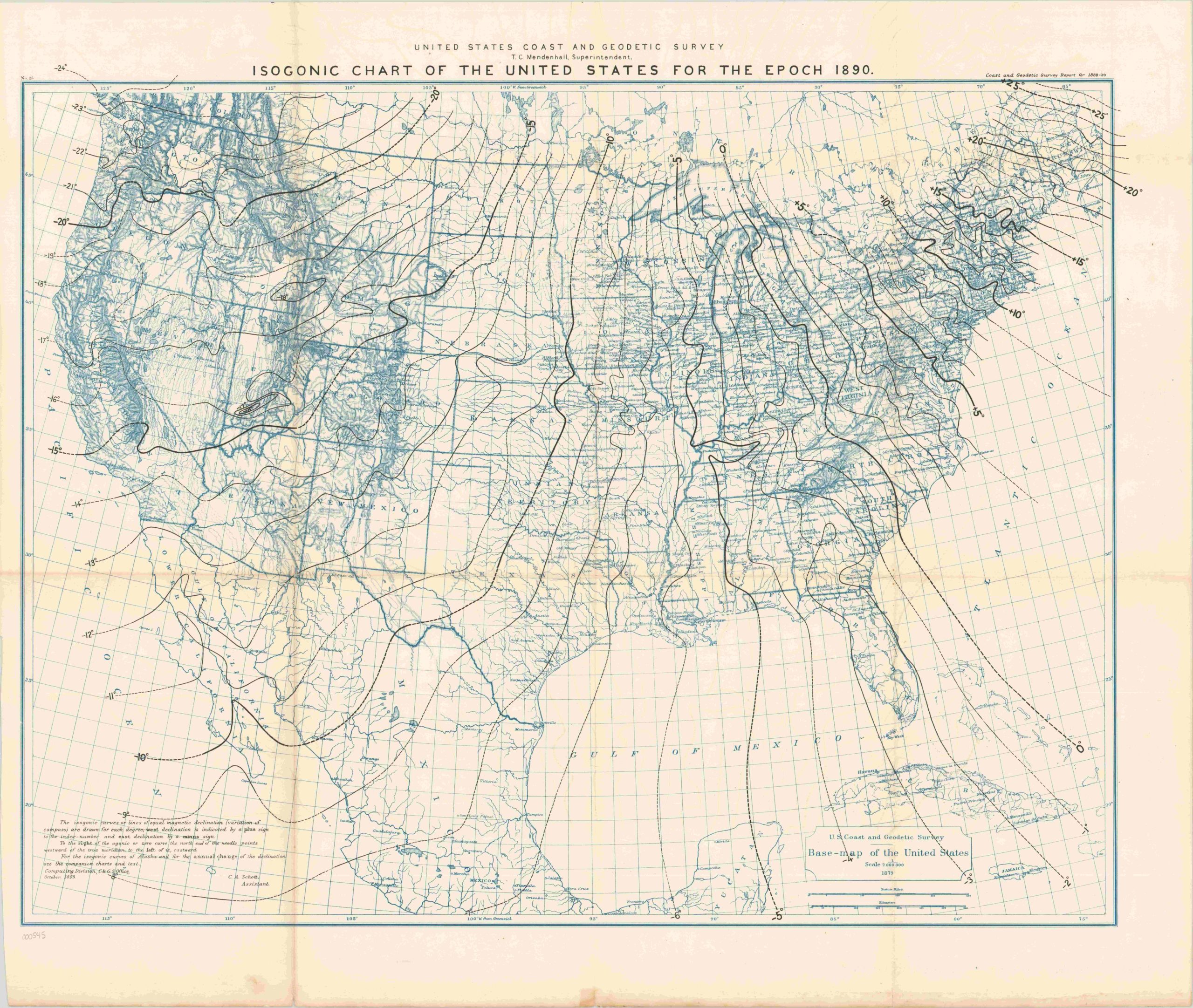
Isogonic Chart of the United States for the Epoch 1890
Federal map of the United States showing lines of magnetic declination.
Out of stock
Description
This chart of the United States and northern Mexico highlights an interesting feature of Earth’s magnetic fields – the tendency for magnetic north to drift while true north remains constant. As summarized in the explanatory text, each line (or isogonic curve) is drawn and labeled to account for necessary changes in degrees when accounting for true north as a result of the varying magnetic fields. Degrees are added or subtracted from a compass reading based on the location of the reader, with east and west represented by minus and plus signs, respectively. The portion of the title, “In the Epoch 1890” reflects that the map is useful only for a temporary period, as the magnetic fields change over time.
The chart was issued in 1888 by the U.S. Coast and Geodetic Survey, successor to the U.S. Coastal Survey which began in 1807. The government agency operates today as the U.S. National Geodetic Survey under the auspices of the Department of Commerce, and maintains responsibility for the mapping and charting of the United States.
Map Details
Publication Date: 1888
Author: United States Coast and Geodetic Survey
Sheet Width (in): 30.5
Sheet Height (in): 26
Condition: A-
Condition Description: Some discoloration and creasing along the originally issued fold lines. Wear and discoloration at the extreme bottom edge. Very good overall, with nice two-toned color.
Out of stock