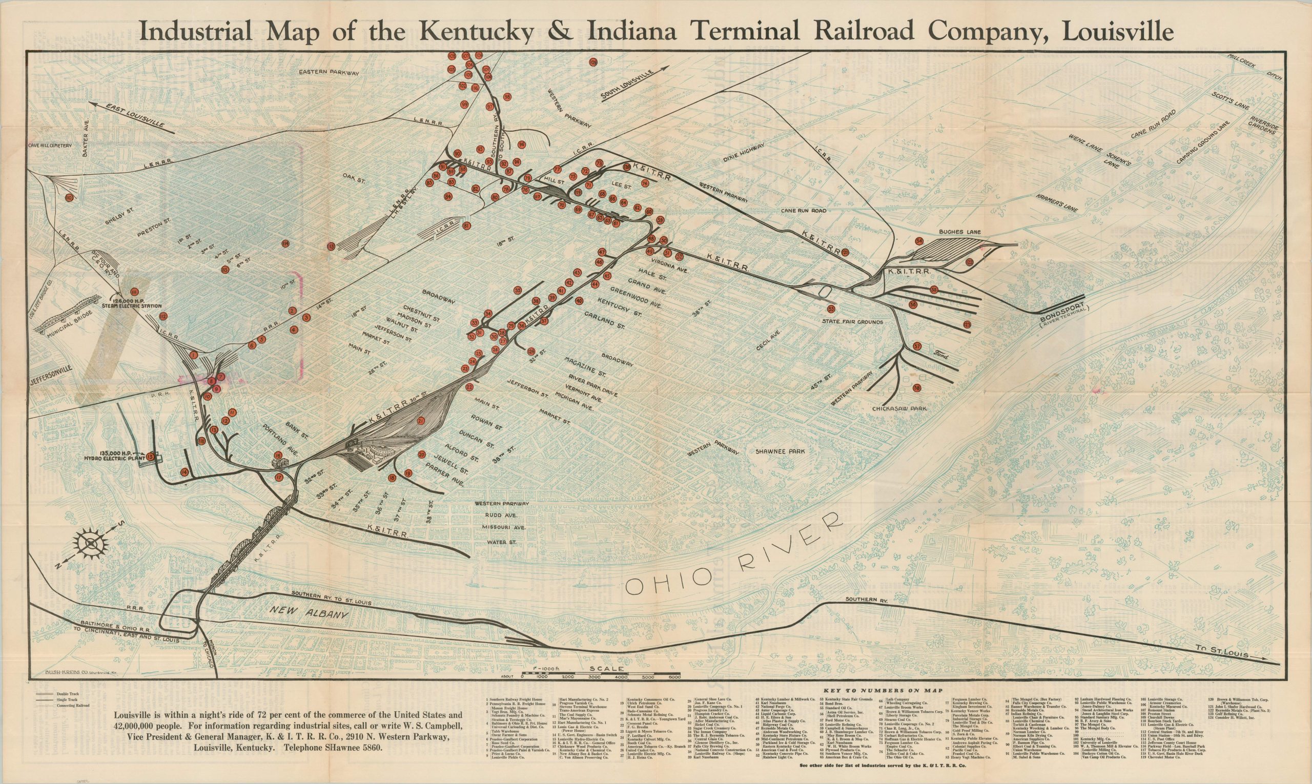
Industrial Map of the Kentucky & Indiana Terminal Railroad Company, Louisville
$375.00
A scarce Depression-era promotional brochure for Louisville’s industry and the railroad infrastructure that supports it.
1 in stock
Description
“Louisville, virtually the center of population of the United States, is rightfully considered the Market Center of America.” – text, verso.
This tremendous panorama of Louisville, Kentucky, offers an interesting overview of the (appropriately nicknamed) River City. The extensive railway network of the Kentucky & Indiana Terminal Railroad Company is boldly emphasized amid a rather muted pictorial representation of the city. Parks and amenities, while mentioned sparsely, are not the focus; the theme is Louisville’s industry, conveniently connected to Indiana across the Ohio River bridge.
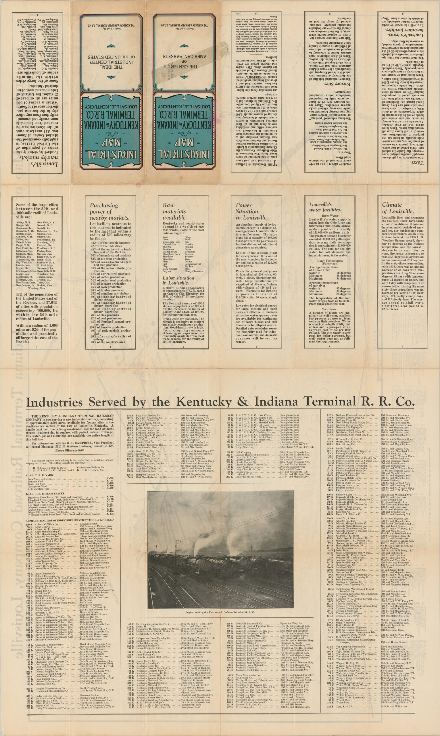
Nearly 125 important businesses served by the K & I are noted throughout the image (oriented with southeast at the top) and labeled along the bottom of the sheet. A comprehensive list of industries served by the railway company is provided on the verso (over 300 in total), as well as numerous panels of text highlighting the welcoming climate, abundant raw materials, favorable tax climate, and robust infrastructure of Louisville.
The map was designed by the Louisville-based Bush-Krebs Company and published in 1936 or 1937 (based on text on the verso) by the Kentucky & Indiana Terminal R.R. Co.
Map Details
Publication Date: 1936
Author: Bush-Krebs Co.
Sheet Width (in): 50.00
Sheet Height (in): 30.00
Condition: B
Condition Description: Double-sided folding brochure with moderate toning and wear along folds - including separation at fold intersections (repaired on verso) and a bit of wrinkling. A 5" strip of discoloration visible in the center left of the image - from old tape on the verso that has been professionally removed. Some see through nearby from the red ink on the front covers. About good condition overall.
$375.00
1 in stock