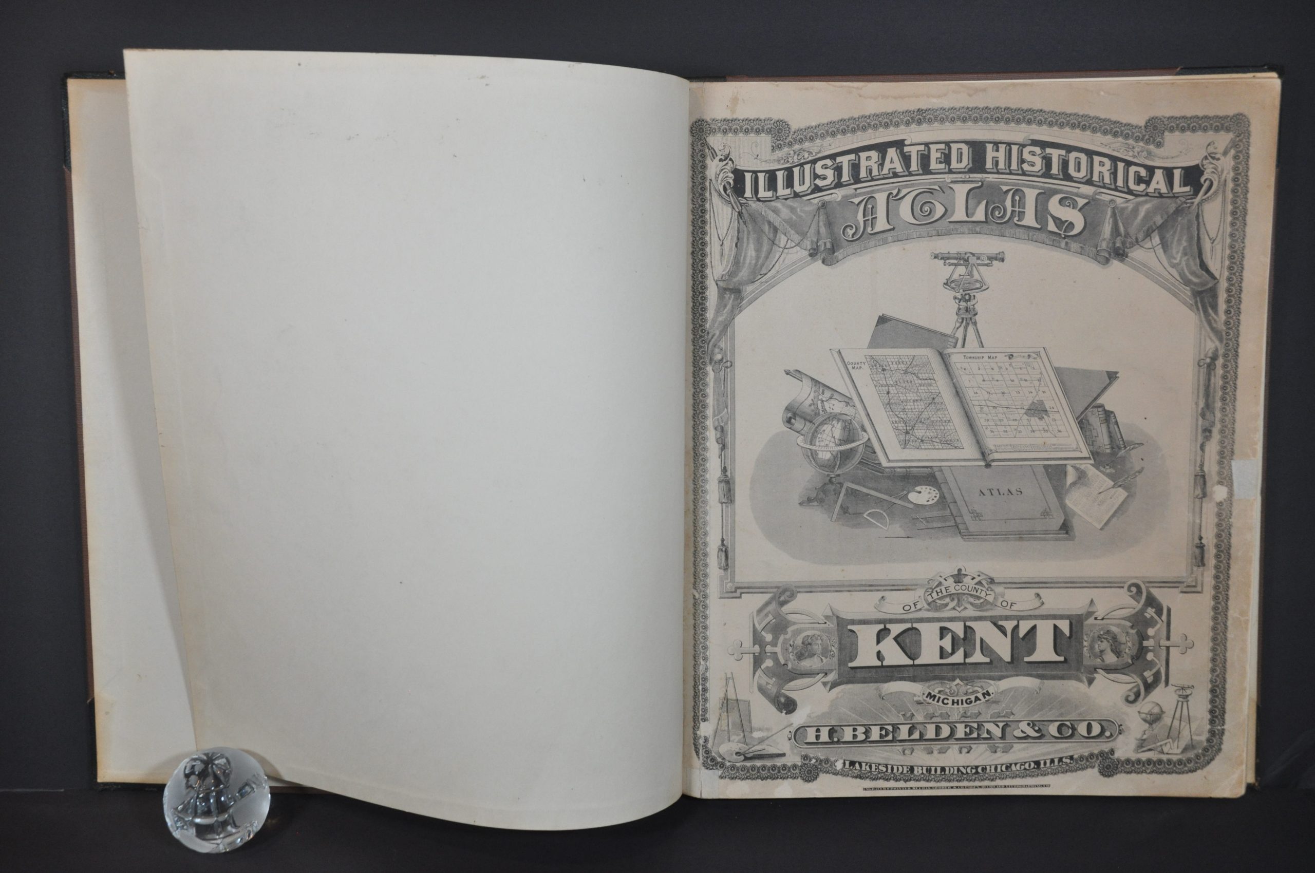
Illustrated Historical Atlas of the County of Kent, Michigan
$400.00
Detailed atlas of Kent County, Michigan from 1874.
1 in stock


Description
This informative atlas of Kent County, Michigan was published in Chicago by H. Belden & Co. in 1876. Engraving and printing were performed by Charles Shober & Co. and the entire volume was assembled in the city’s Lakeside Building.
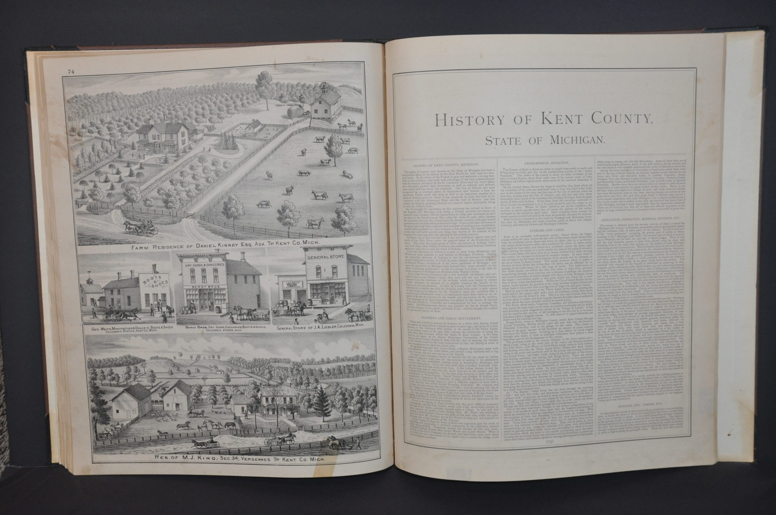
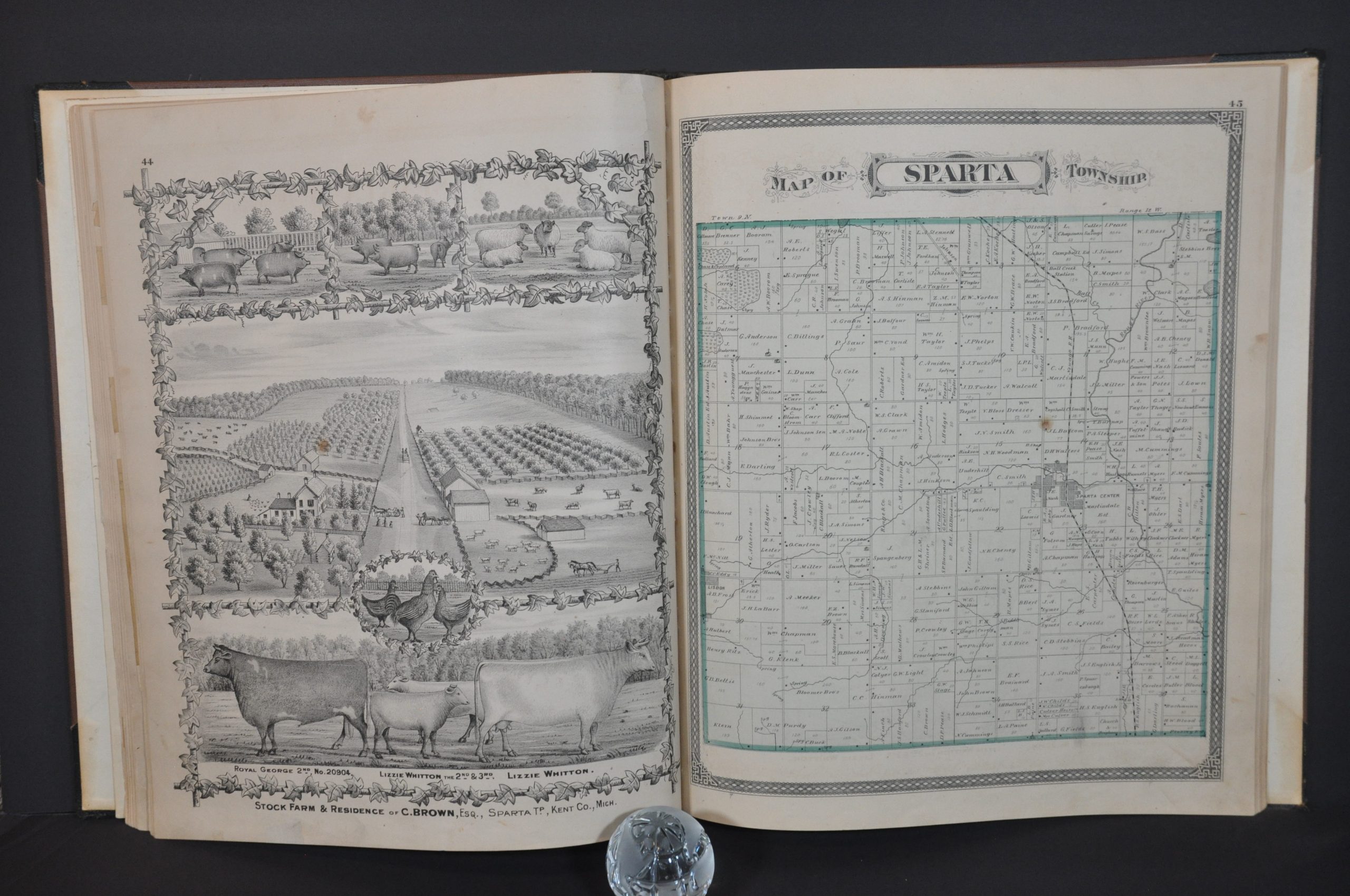
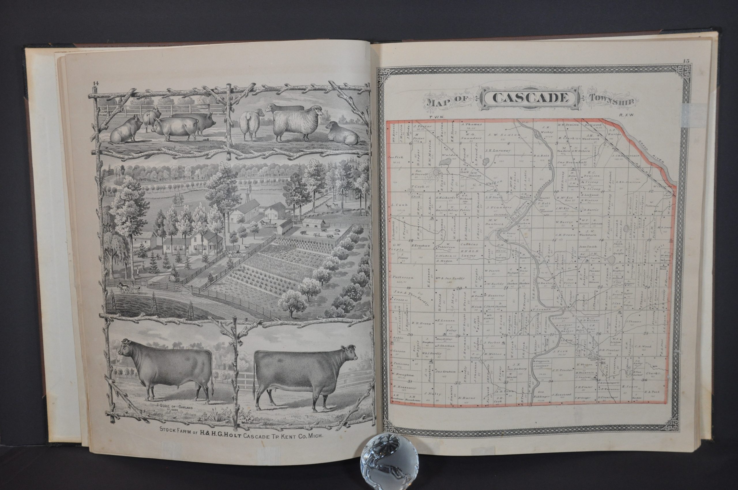
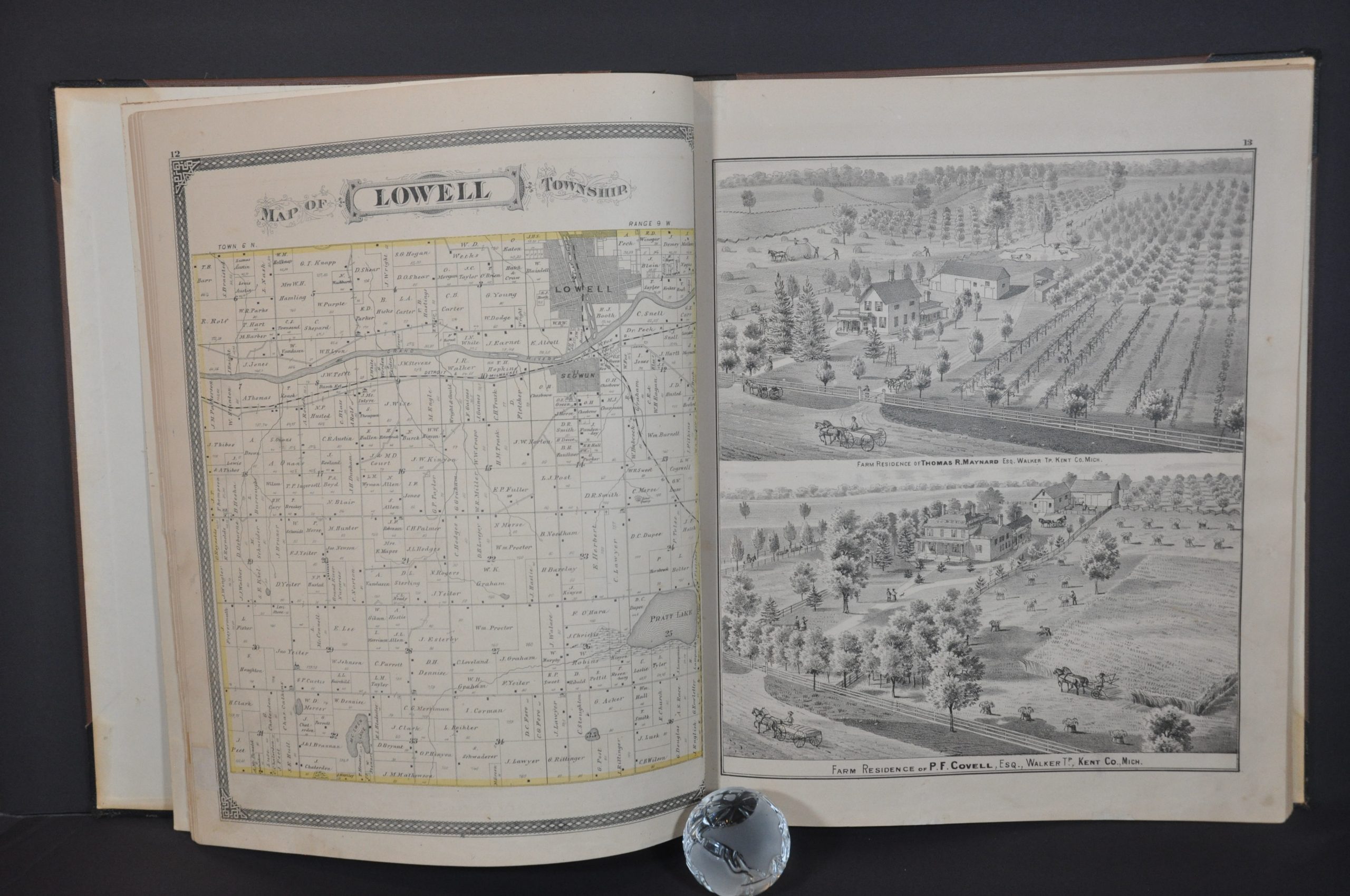
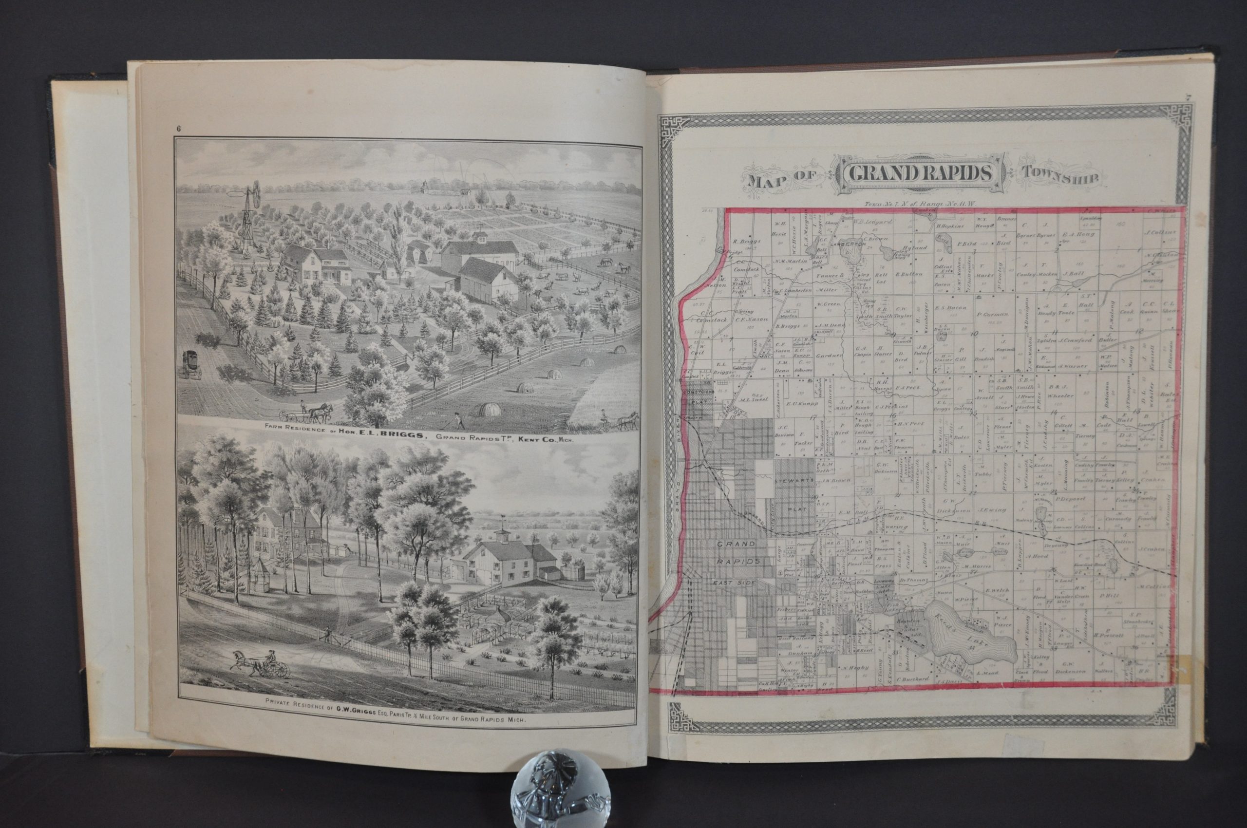
Like many 19th-century county atlases, the work was sold on a pre-order subscription basis in order to defray the significant upfront costs of production. Residents and companies could pay an extra fee to include portraits, advertisements, or views of homes and businesses. Dozens of examples are included throughout the atlas, even illustrations of prized farm animals! A patron’s directory near the end lists the subscribers, their address, place of employment, place of birth, and year settled – a fascinating window into the demographics of the county in the mid-1870s.
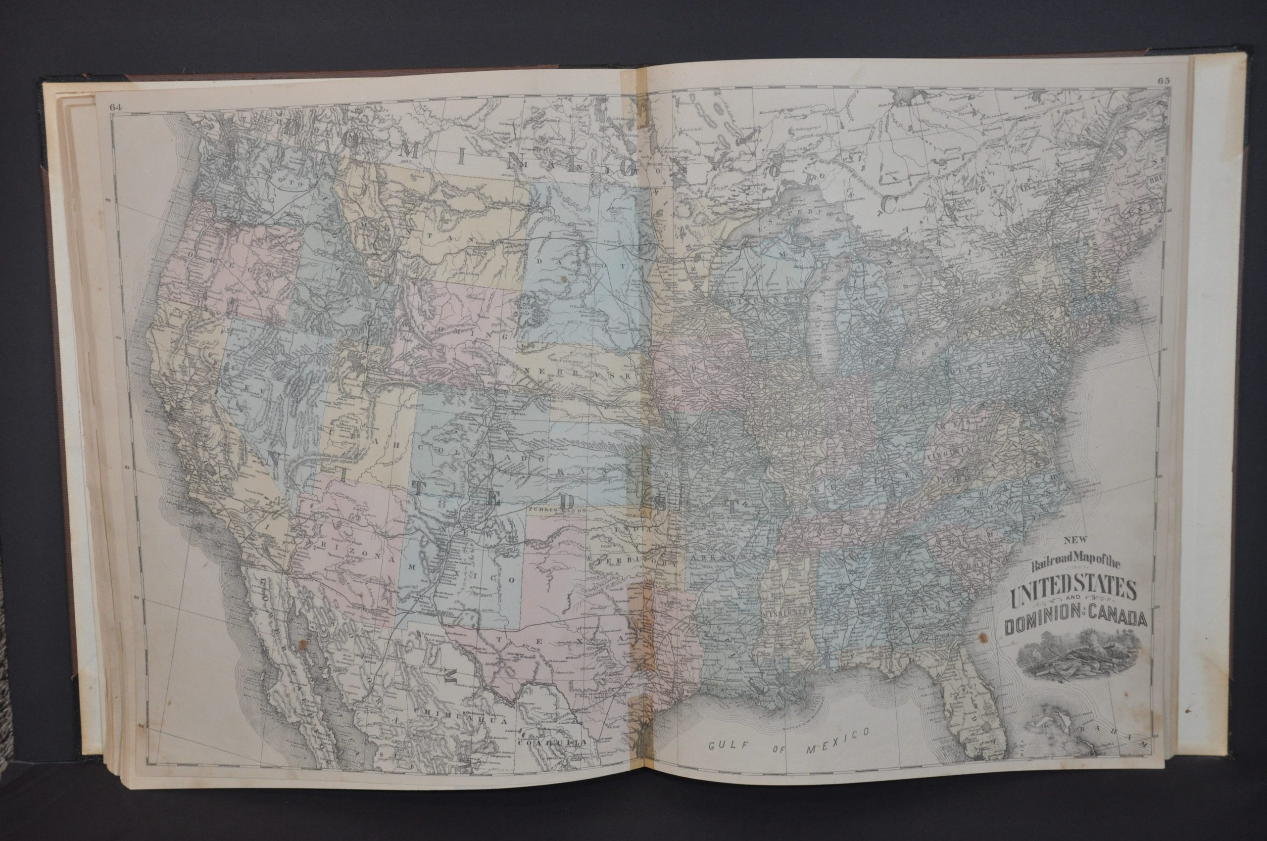
The atlas obviously also includes maps. It begins with a colorful index map of the county highlighting each township (24 in total). These are then covered individually by subsequent plat maps that show local landowners, important buildings, transportation routes, geographic features, and other contemporary items of interest. Oddly, a city plan of Grand Rapids was not included in the production. The atlas concludes with double-page maps of Michigan and the United States, single-page maps of the hemispheres, and ten pages of county history.
Map Details
Publication Date: 1876
Author: H. Belden & Co.
Sheet Width (in): 15
Sheet Height (in): 17.25
Condition: B+
Condition Description: Professionally restored and rebound in new quarter leather with original brown cloth. Repaired gutter with newer endpapers. Title page shows some toning and soiling, along with paper fill around the edges. The map of Plainfield Township is in rough shape, with much of the margin missing and serious image loss in the bottom third. Otherwise the contents are generally very good, with some repairs in the margins, scattered soiling, dirty fingerprints, etc. consistent with age and use. Complete,92 pp., with 26 single page and two double page maps, plus numerous views and historic text.
$400.00
1 in stock