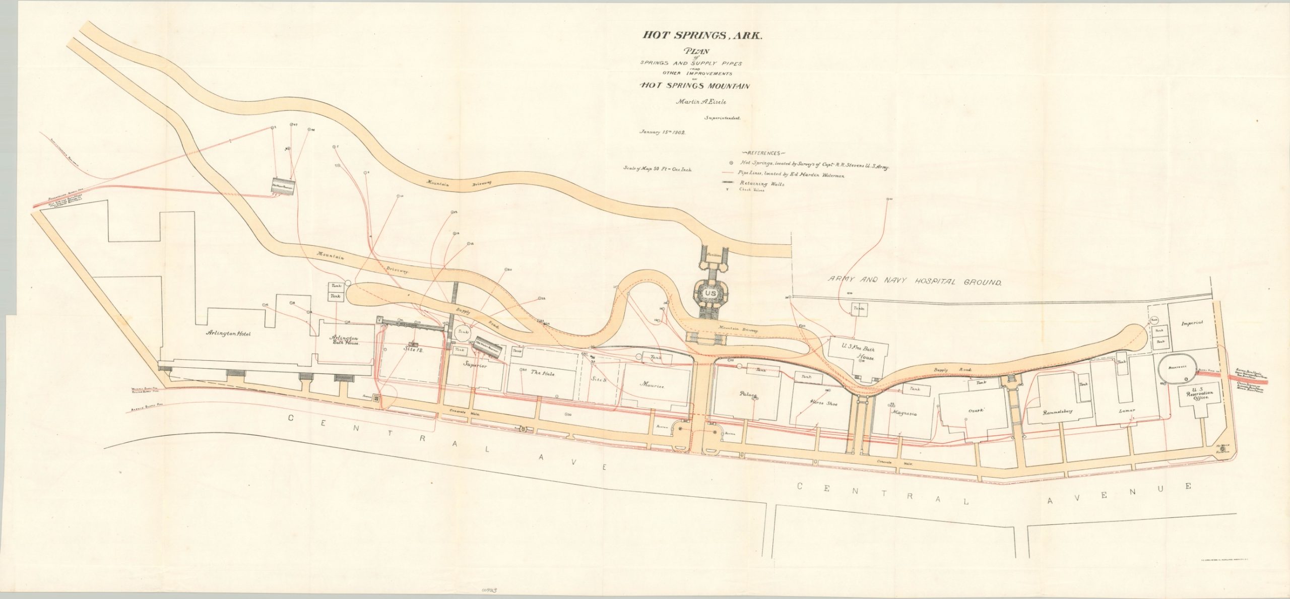
Hot Springs, Ark. Plan of Springs and Supply Pipes and Other Improvements on Hot Springs Mountain
$179.00
Hot Springs, Arkansas – some of the first federally protected land in the United States.
1 in stock
Description
This fascinating diagram shows the infrastructure used to distribute water from Hot Springs Mountain to the nearby bathing houses, resorts, and hotels around the appropriately named Hot Springs, Arkansas. Pipelines, spring sources, water tanks, valves, and retaining walls are noted throughout and prominent buildings are outlined and individually labeled. According to the Arkansas Digital Archives,
“The city of Hot Springs was named after the springs there, whose waters have an average temperature of 143 F and which yield almost a million gallons of water each day. It is said that Native Americans of the areas visited the healing waters of the “Valley of the Vapors” long before European explorers reached the area. President Andrew Jackson designated Hot Springs as the United States’ first federal reservation in 1832, and the town of Hot Springs was officially incorporated on January 10, 1851.”
The map was designed by Martin Eisele, Superintendent of the Hot Springs Reservation, and published by the Government Printing Office in Washington, D.C. in 1902.
Sources; National Park Service; Arkansas State Archives
Map Details
Publication Date: 1902
Author: Martin Eisele
Sheet Width (in): 38.4
Sheet Height (in): 17.75
Condition: A
Condition Description: Light creasing along originally issued fold lines. Near fine.
$179.00
1 in stock

