Highway Map and Guide of Kentucky and Tennessee
$60.00
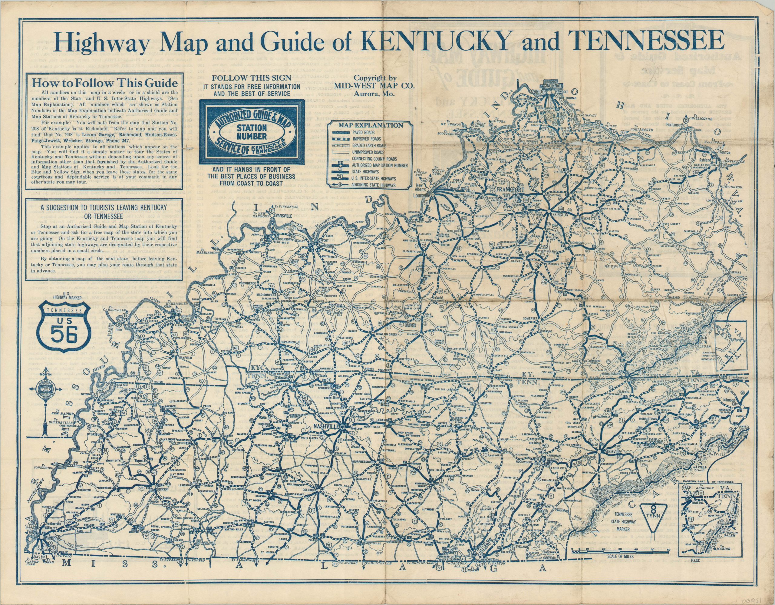
A complete system of travel through Depression-era Kentucky and Tennessee.
1 in stock
Description
This detailed transportation map shows the complex system of roads that preceeded the National Interstate Highway System in Kentucky and Tennessee. Several different types of road surfaces are shown according to the accompanying legend, which also indicates the location of various stations operating as part of the Authorized Guide and Map Service. An index of the 400 locations throughout both states is provided on the verso.
The map was published around 1932 by the Mid-West Map Company as part of this broader nationwide service. Instructions in the upper left corner were applicable to maps published of numerous U.S. states and distributed for free at participating businesses.
Map Details
Publication Date: c. 1932
Author: Mid-West Map Co.
Sheet Width (in): 21.9
Sheet Height (in): 17
Condition: B
Condition Description: Moderate creasing and wear along fold lines, including small holes at fold intersections that has resulted in minor image loss. Soiling around the outer edges.
$60.00
1 in stock