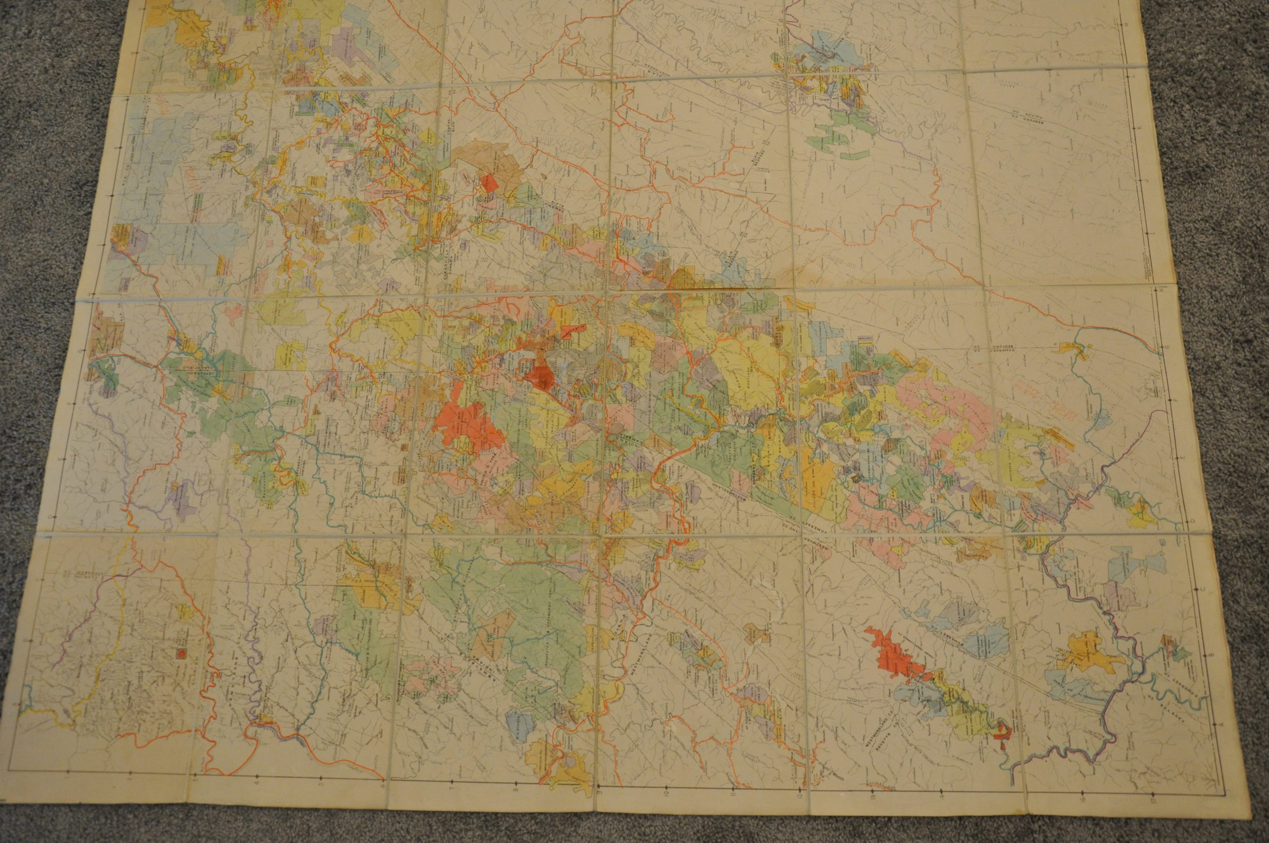
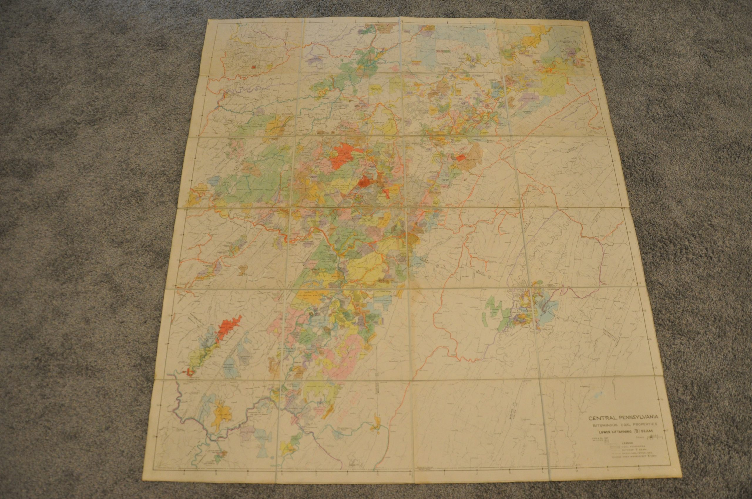
[Group of four large maps showing areas in the Pittsburgh Coal Seam]
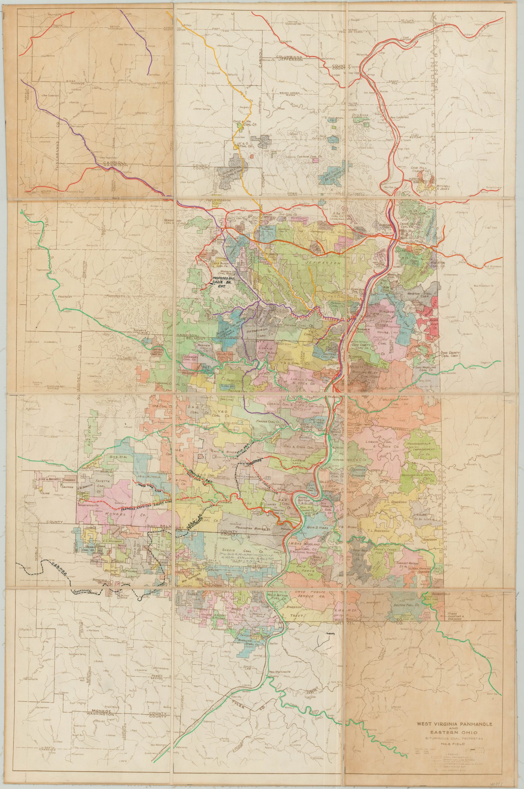
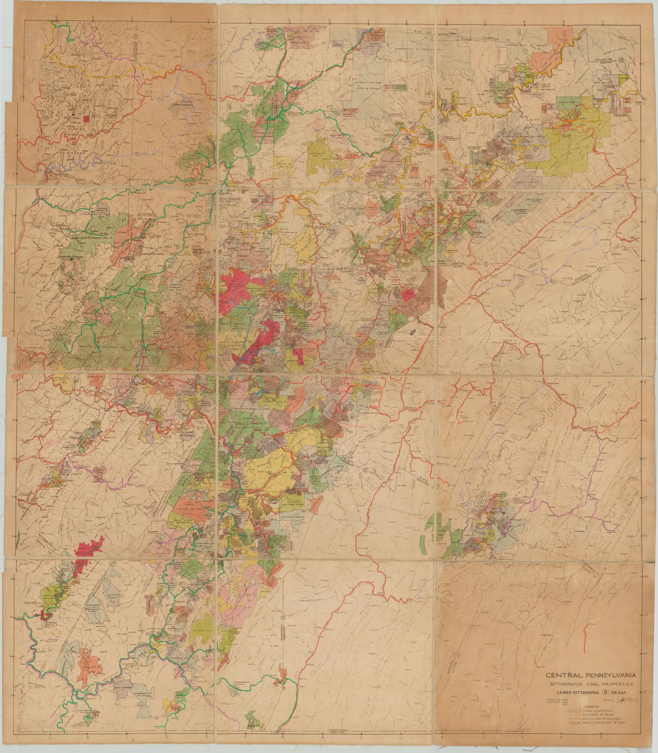
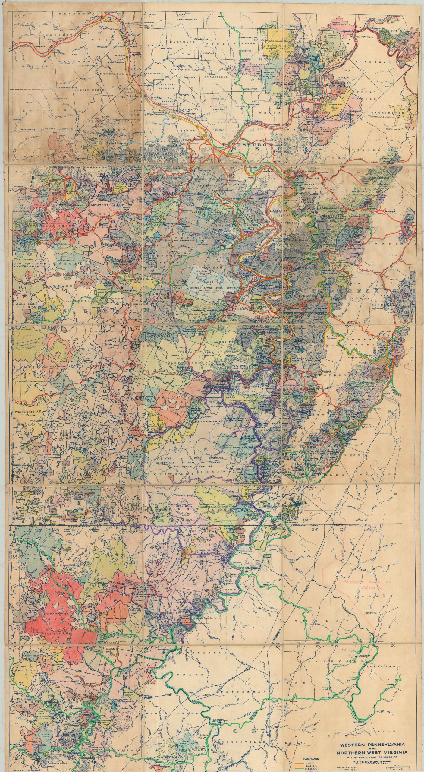
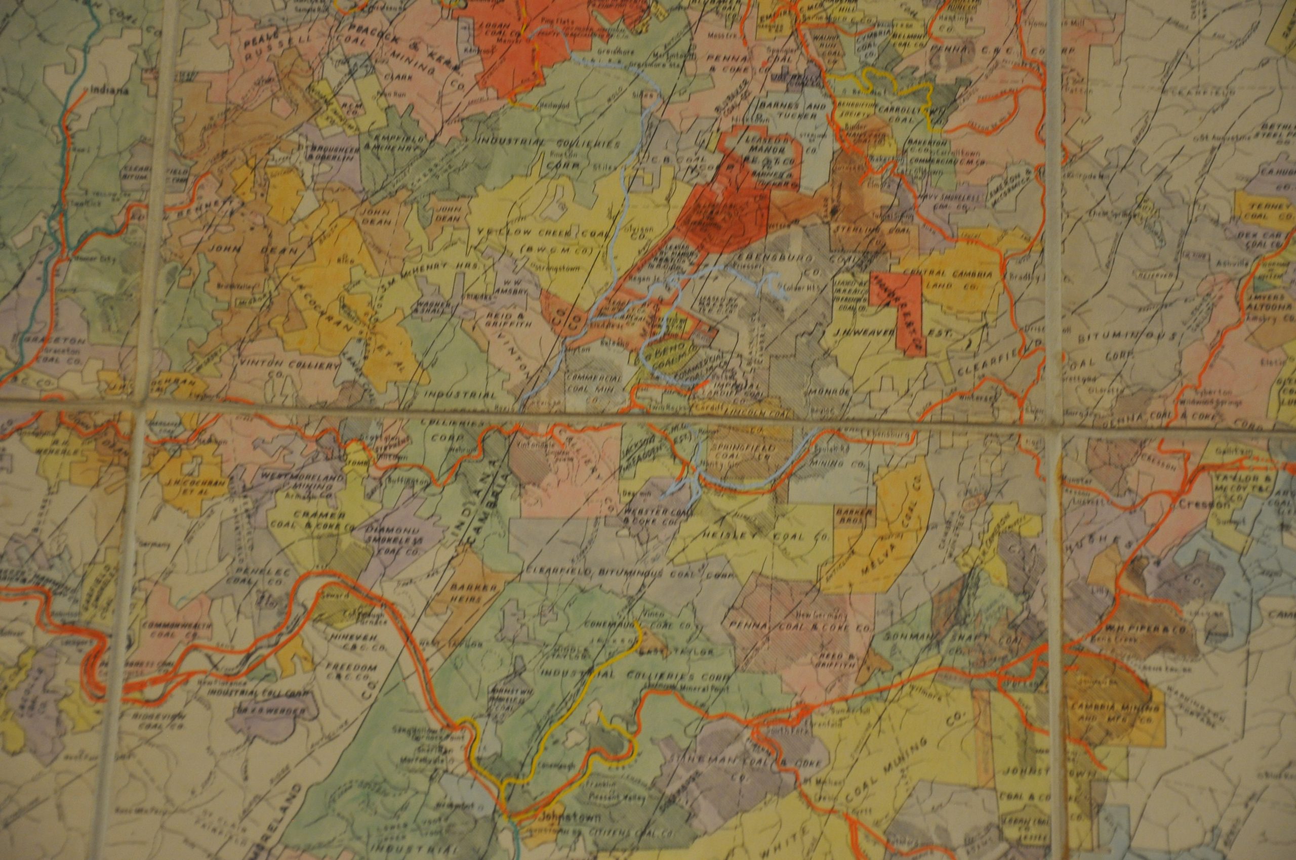
Fascinating group of four large maps showing regional coal production and transportation throughout the Pittsburgh Coal Seam.
Out of stock
Description
This group of four maps covers a large territory across the states of Ohio, Pennsylvania and West Virginia. While not the most glamorous or populous area in the United States, the region does sit atop a large portion of the Pittsburgh Coal Seam - the most economically important coal bed in the eastern U.S., and a source of much of the early coal the fueled America's Industrial Revolution.
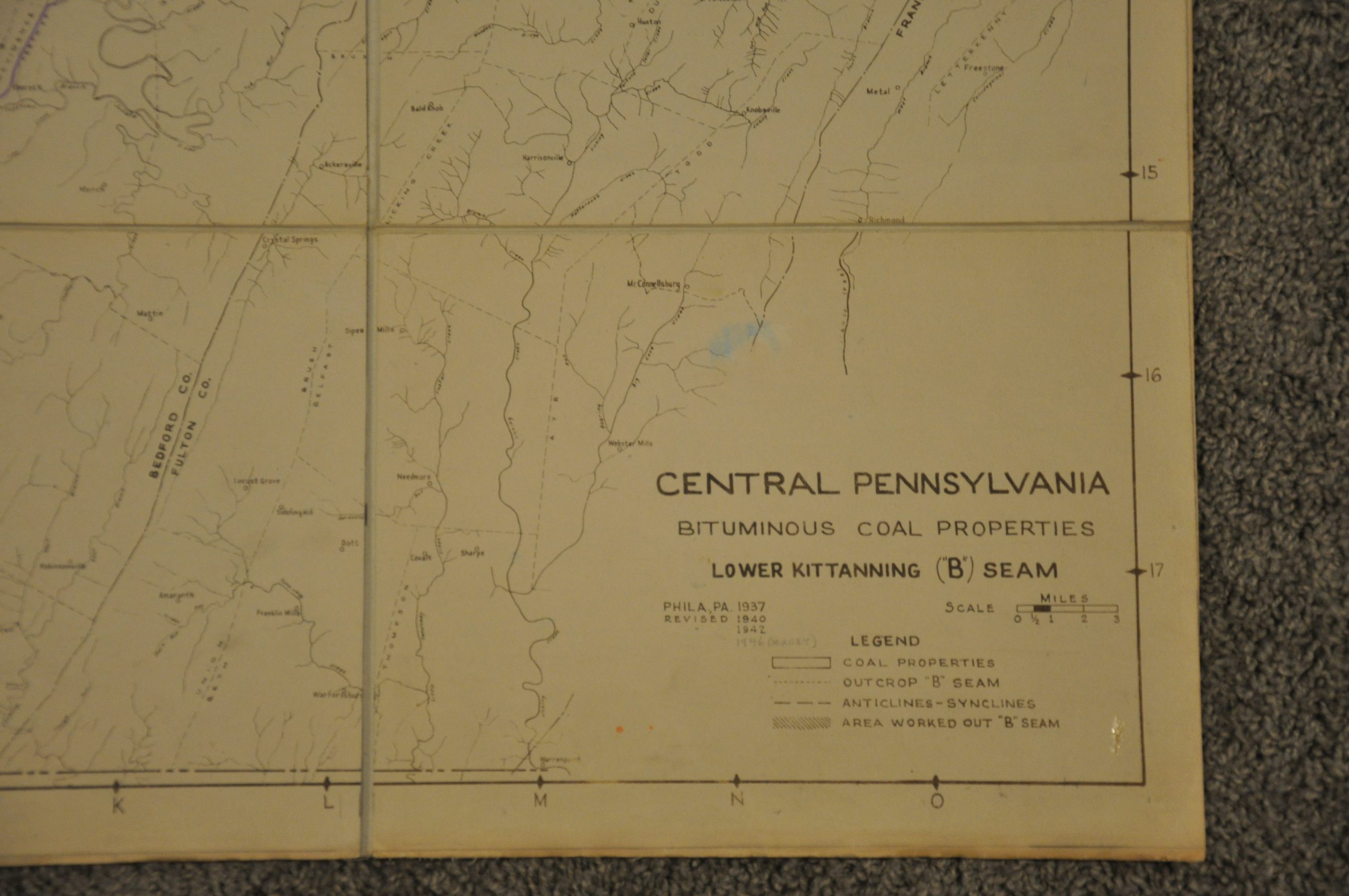
This vast, thick coal bed in the Appalachian Basin saw mining operations begin as early as 1760, and they still continue throughout the region today. This group of maps, attributed vaguely to a "Coal Research Study", was originally published in Philadelphia variously between 1937 and 1940, and the image has been revised to the mid 1940's.
Each shows a region related to a specific outcropping of the Pittsburgh Seam, and covers in detail the local coal mines in operation. Production facilities and mining towns are all named, as are the rail lines connecting them. Individual properties are outlined and labeled according to the owning company, and areas that have already been "worked out" are overlaid with hashed lines.
I've been unable to confirm if the maps were created originally by the Pennsylvania Railroad, but these particular examples were customized extensively for use within the company's Central Engineering Department. Bright color has been applied by hand to denote mine ownership and railroad tracks in operation throughout the region (Penn's tracks in red). Additional manuscript annotations show further interesting details; such as abandoned lines, proposed branches, notes on real estate transfers, and more.
West Virginia Panhandle and Eastern Ohio Bituminous Coal Properties No. 8 Field - Size: 27.5" x 42" Dissected into 12 panels, with two showing moderate discoloration. Otherwise very good overall. Originally issued in 1938 and revised to 1945. Shows several proposed and abandoned rail lines, and a note pertaining to a 1952 real estate sale to the American Coal Company.
Western Pennsylvania and Northern West Virginia - Size: 27.5" x 53" Dissected into 15 panels, with several showing moderate to severe discoloration. Remains in good condition, intact and on strong linen. Originally issued in 1940 and revised to 1948.
Central Pennsylvania Bituminous Coal Properties - Size: 33.5" x 37.5" Dissected into 12 panels, all of which show moderate to severe toning. Remains in strong condition, despite the obvious visual defects. Originally issued in 1937 and revised to 1942.
Central Pennsylvania Bituminous Coal Properties - Size: 50" x 56.5" Dissected into 24 panels, two of which show faint discoloration from adhesive residue on the verso. Otherwise the map is in very good condition, with faint wear and a few spots of ink offsetting. This copy is an enlarged version of the above map, updated to 1946.
Map Details
Publication Date: 1946
Author: Coal Research Study?
Sheet Width (in): See Description
Sheet Height (in): See Description
Condition: B
Condition Description: See Individual Descriptions Above
Out of stock

