Geological Survey of Michigan Atlas Accompanying Reports on Upper Peninsula, 1869 – 1873
Exploring the mineral resources of the Upper Peninsula during the Reconstruction Era.
Out of stock


Description
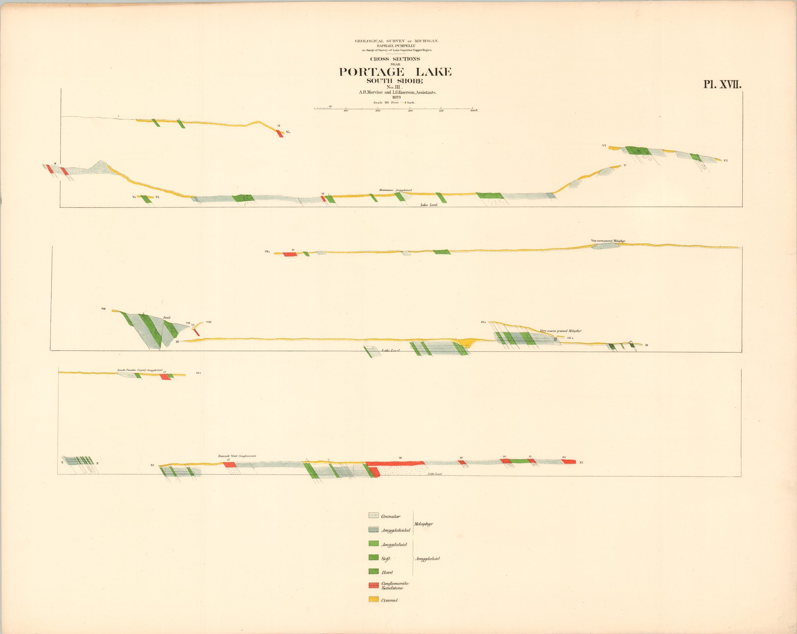
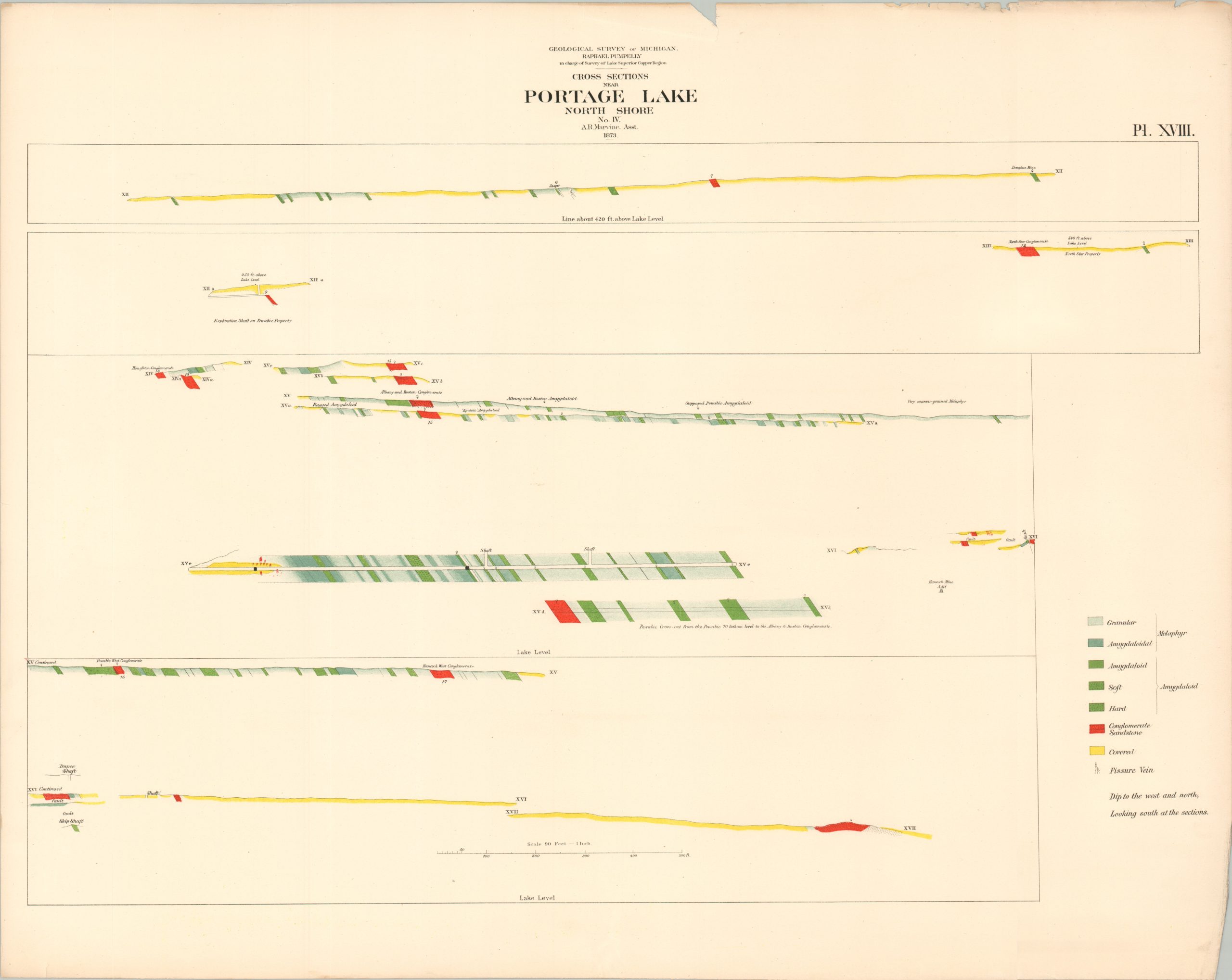
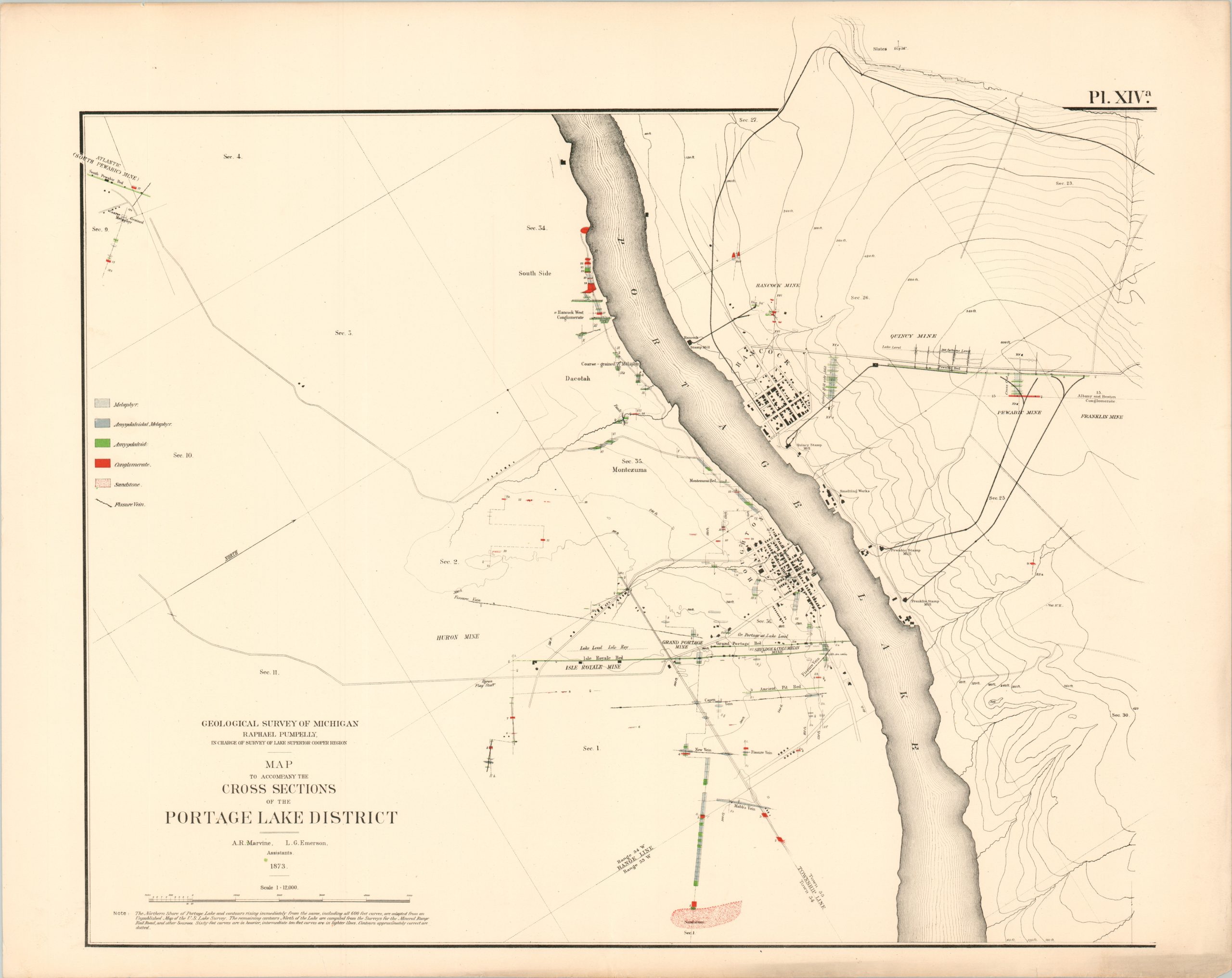
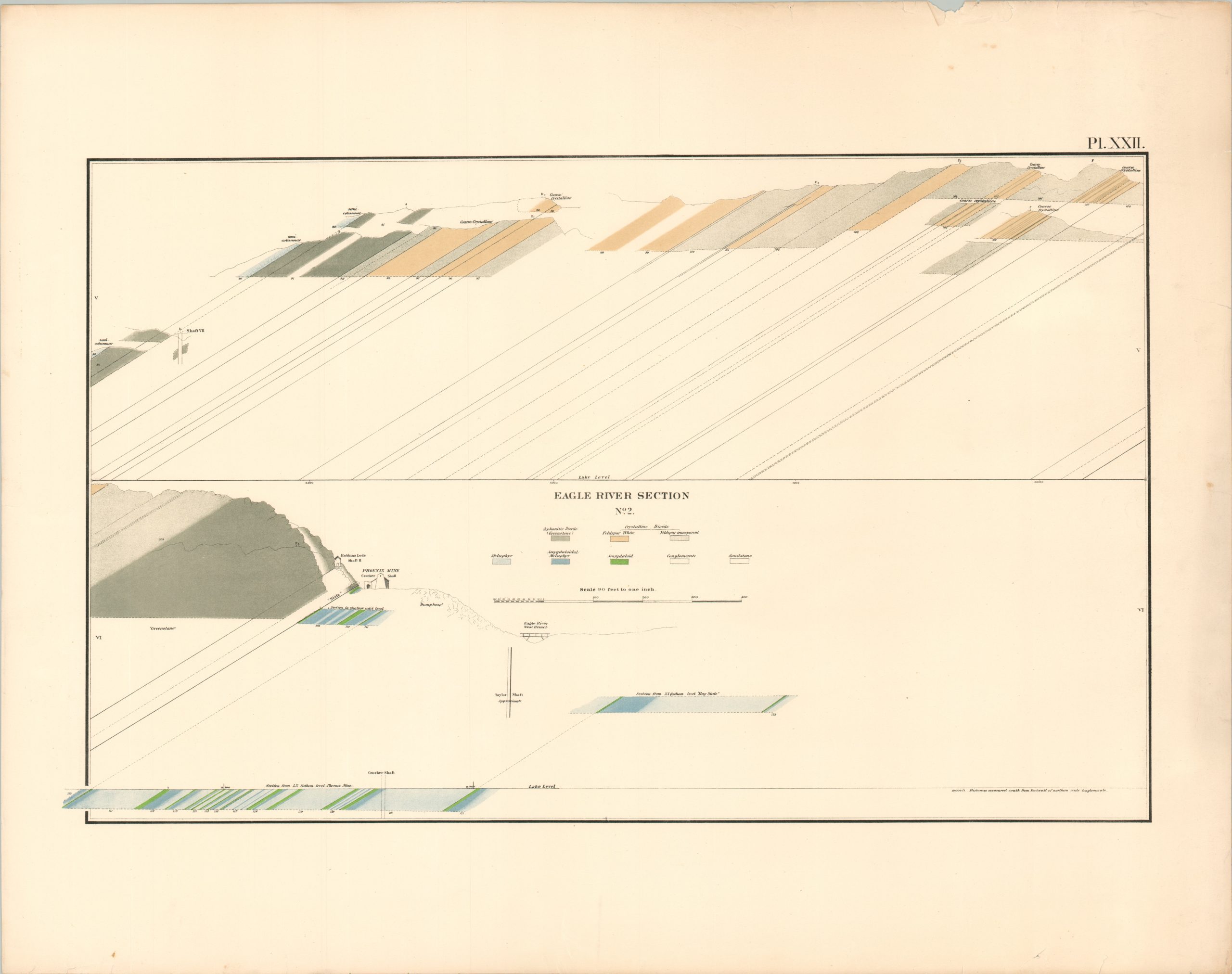
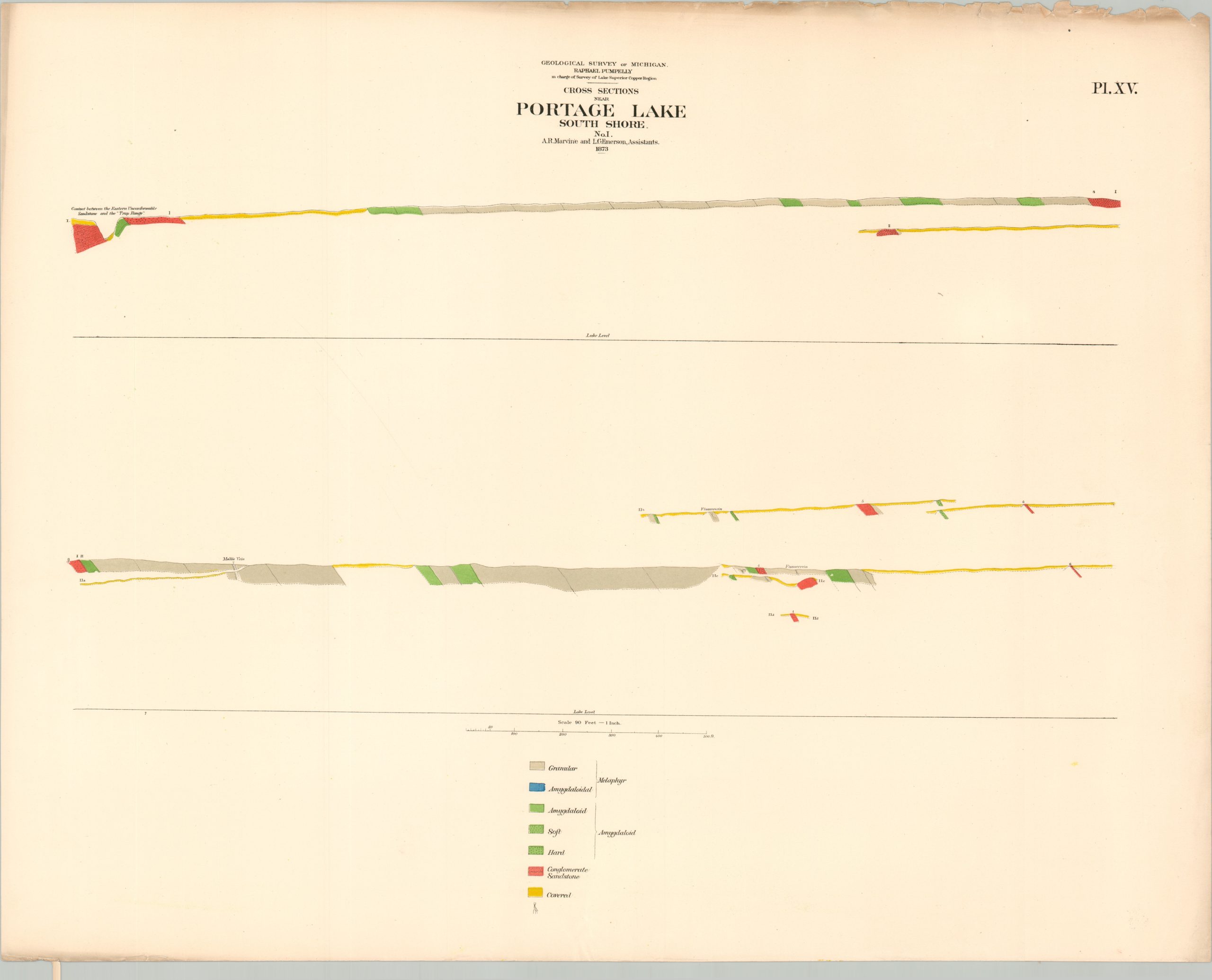
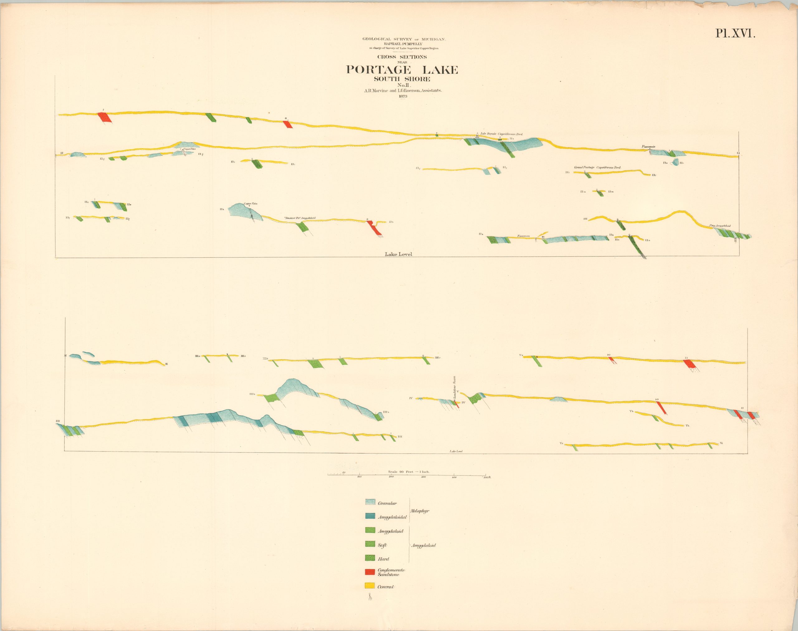
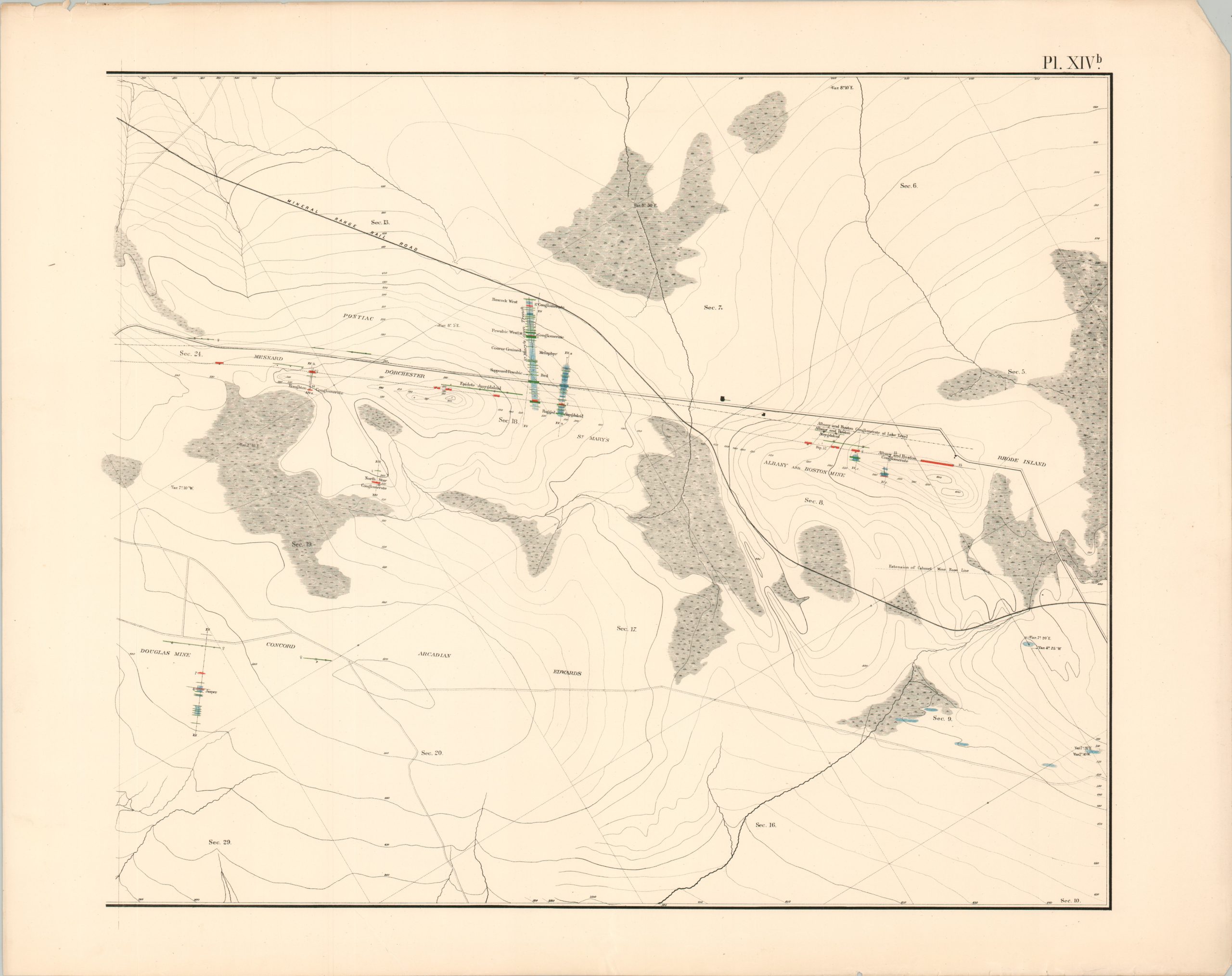
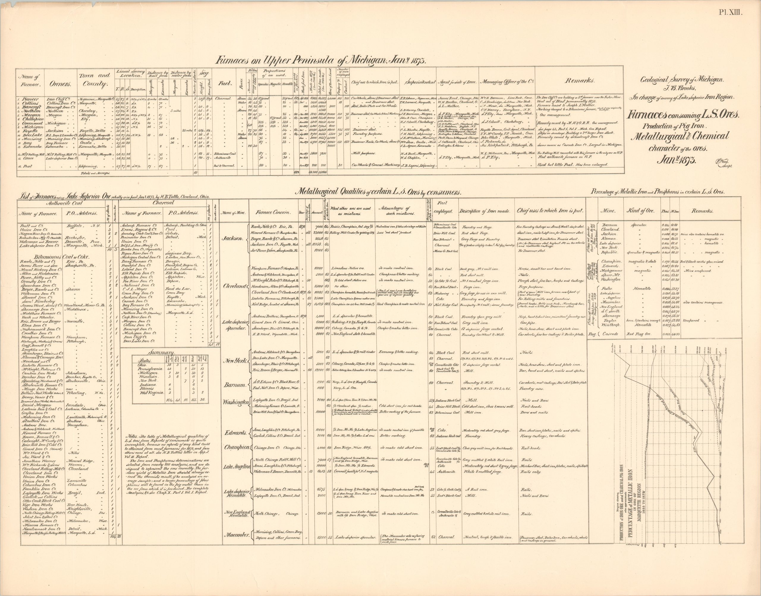
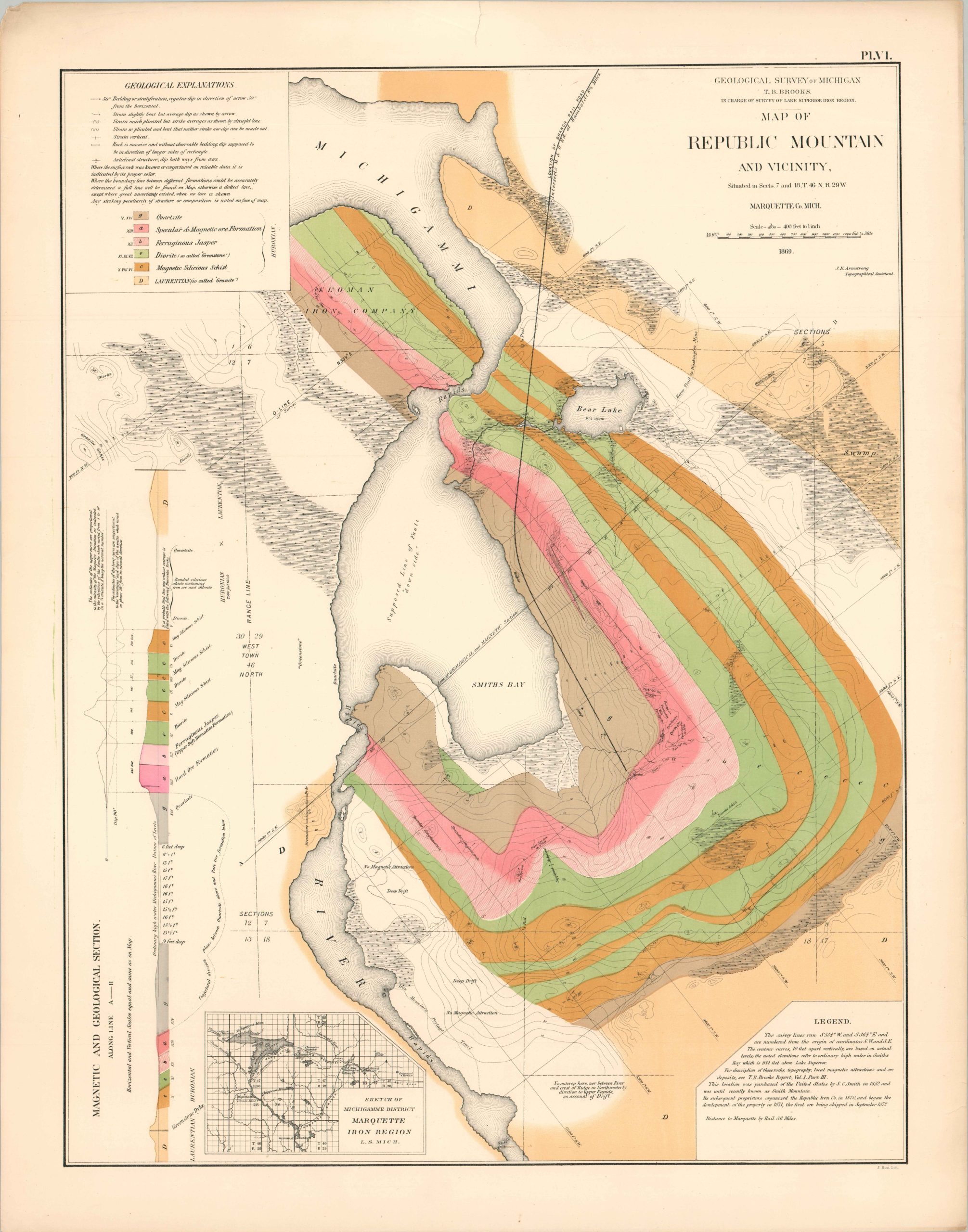
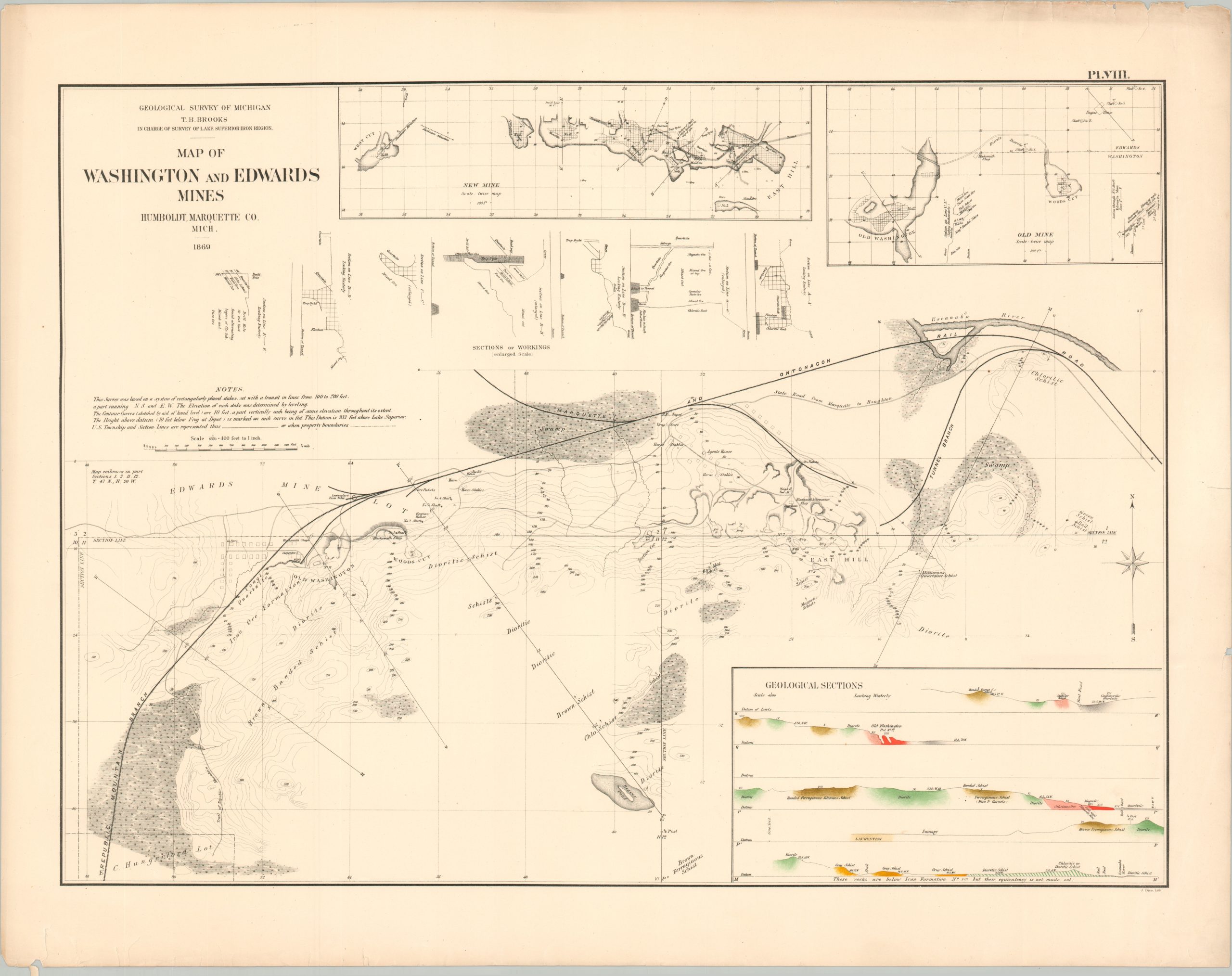
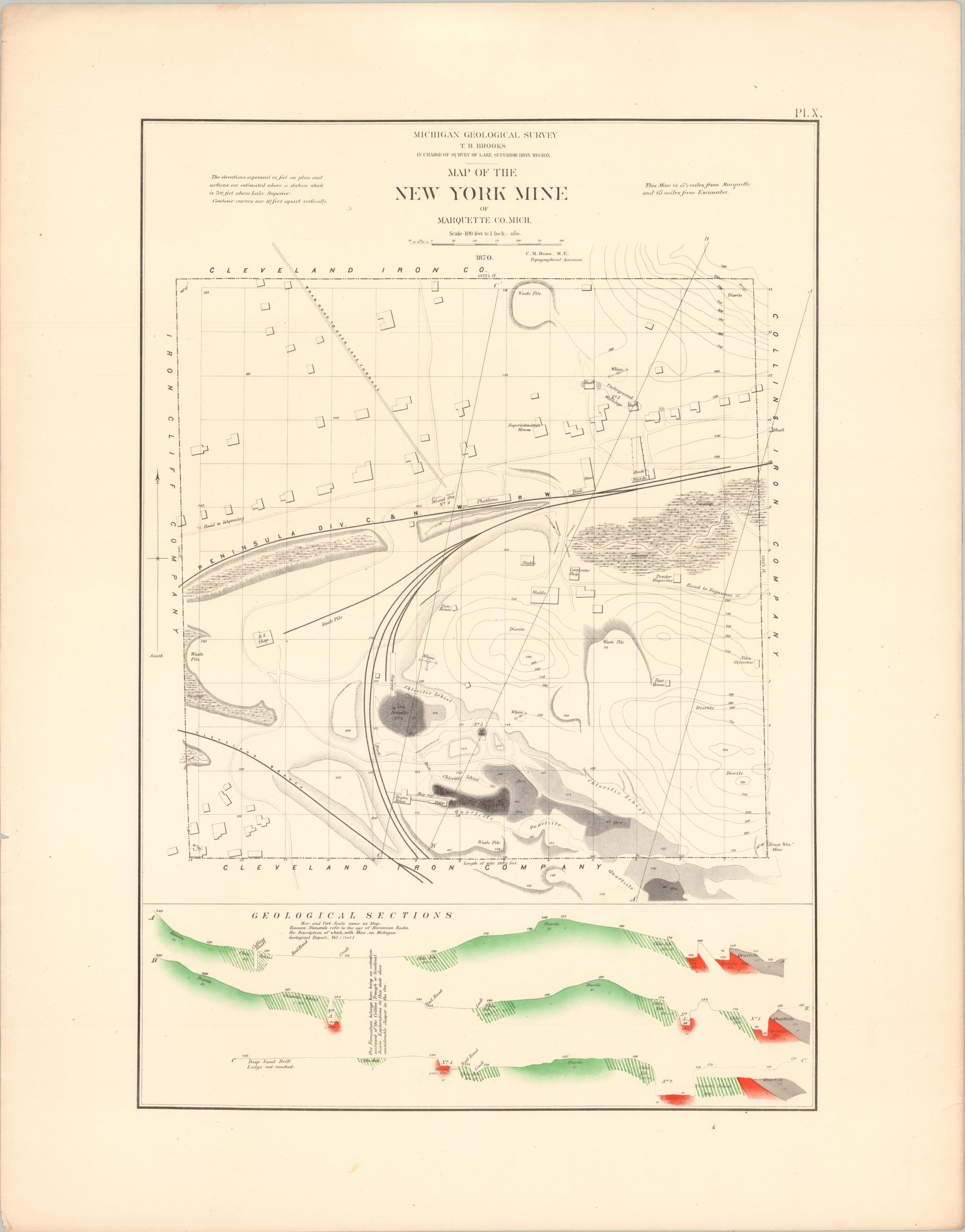
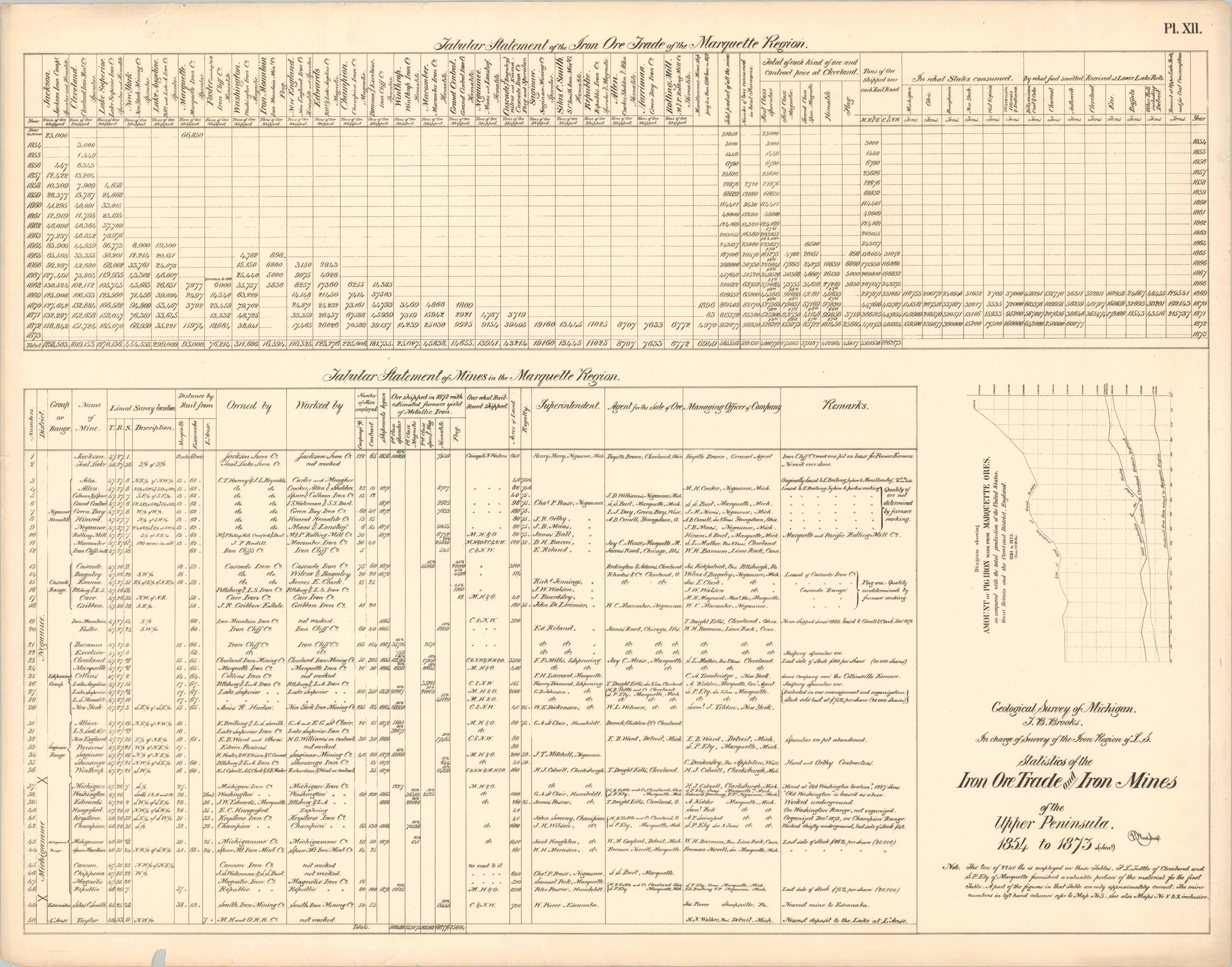
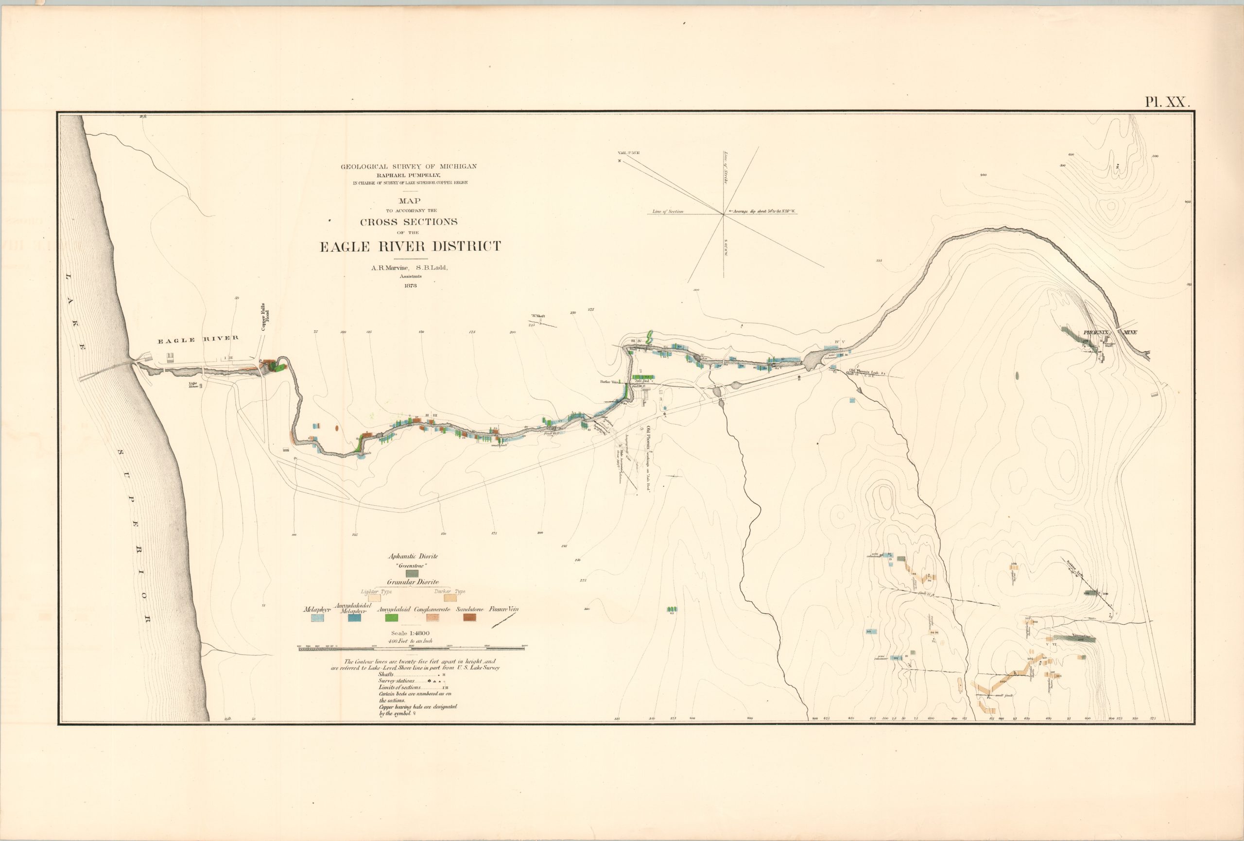
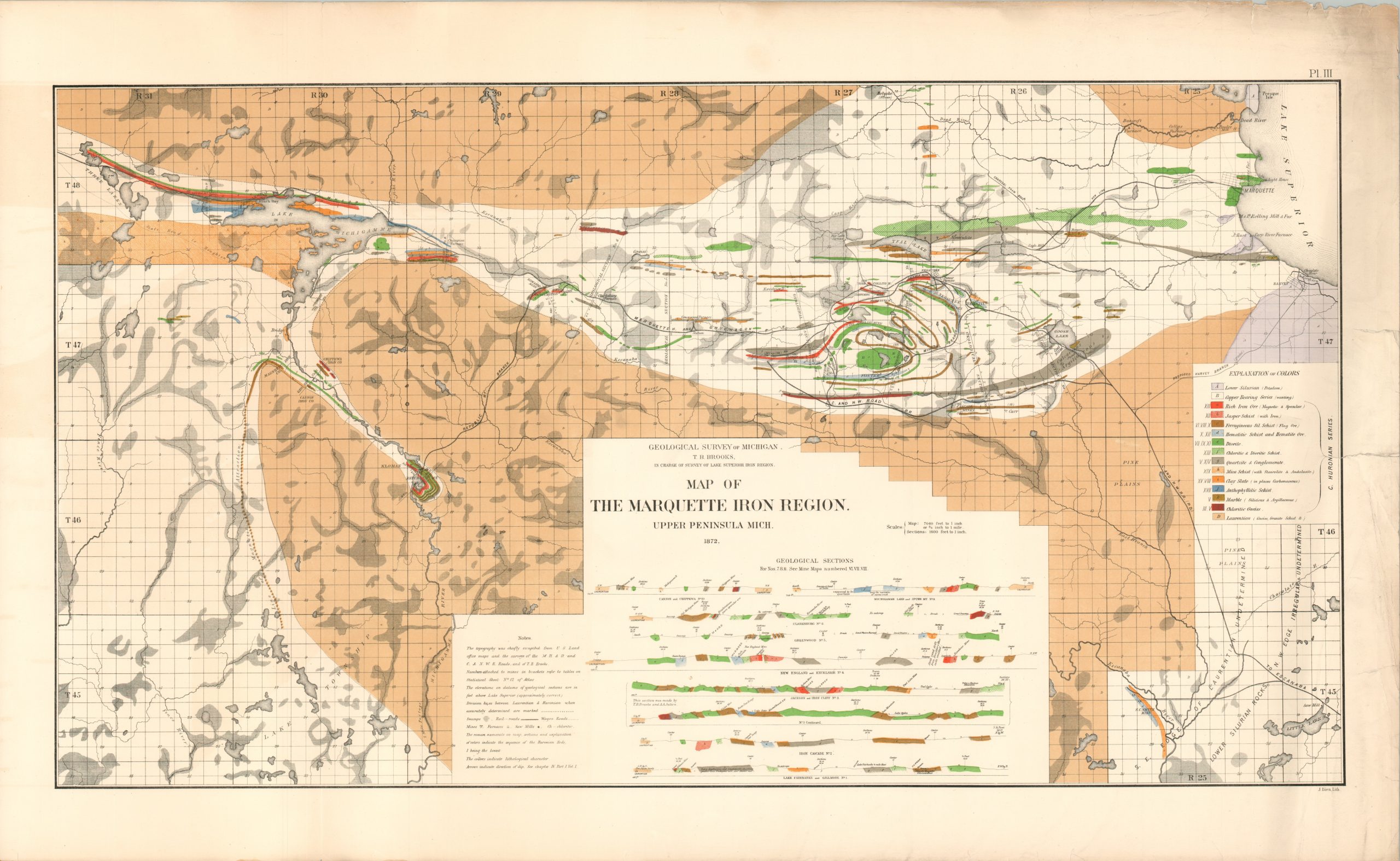
This uncommon collection of maps, diagrams, and tables of statistics was compiled under the authority of the Geological Survey of Michigan between 1869 – 1873. Legislation was passed shortly after the Civil War to resume earlier geological mapping efforts, resulting in the state’s third survey that continues to be ongoing today.
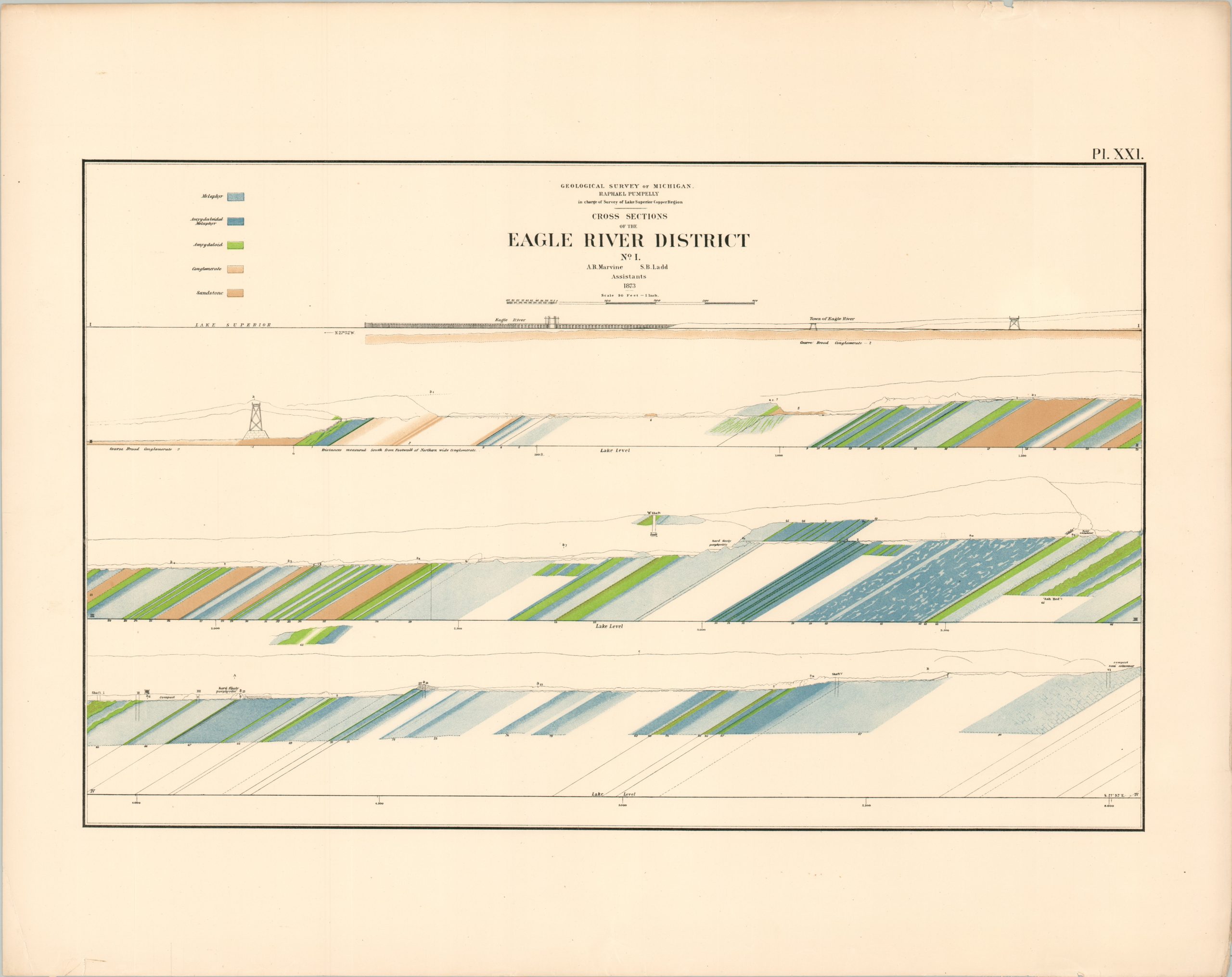
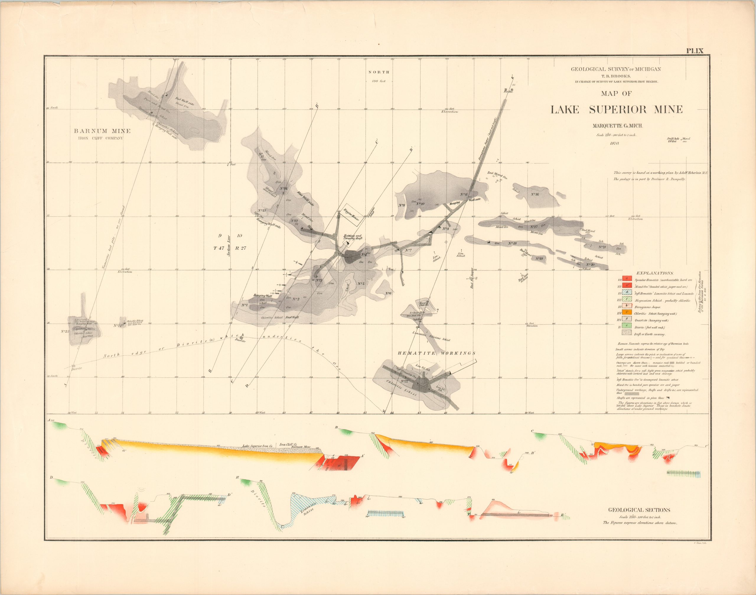
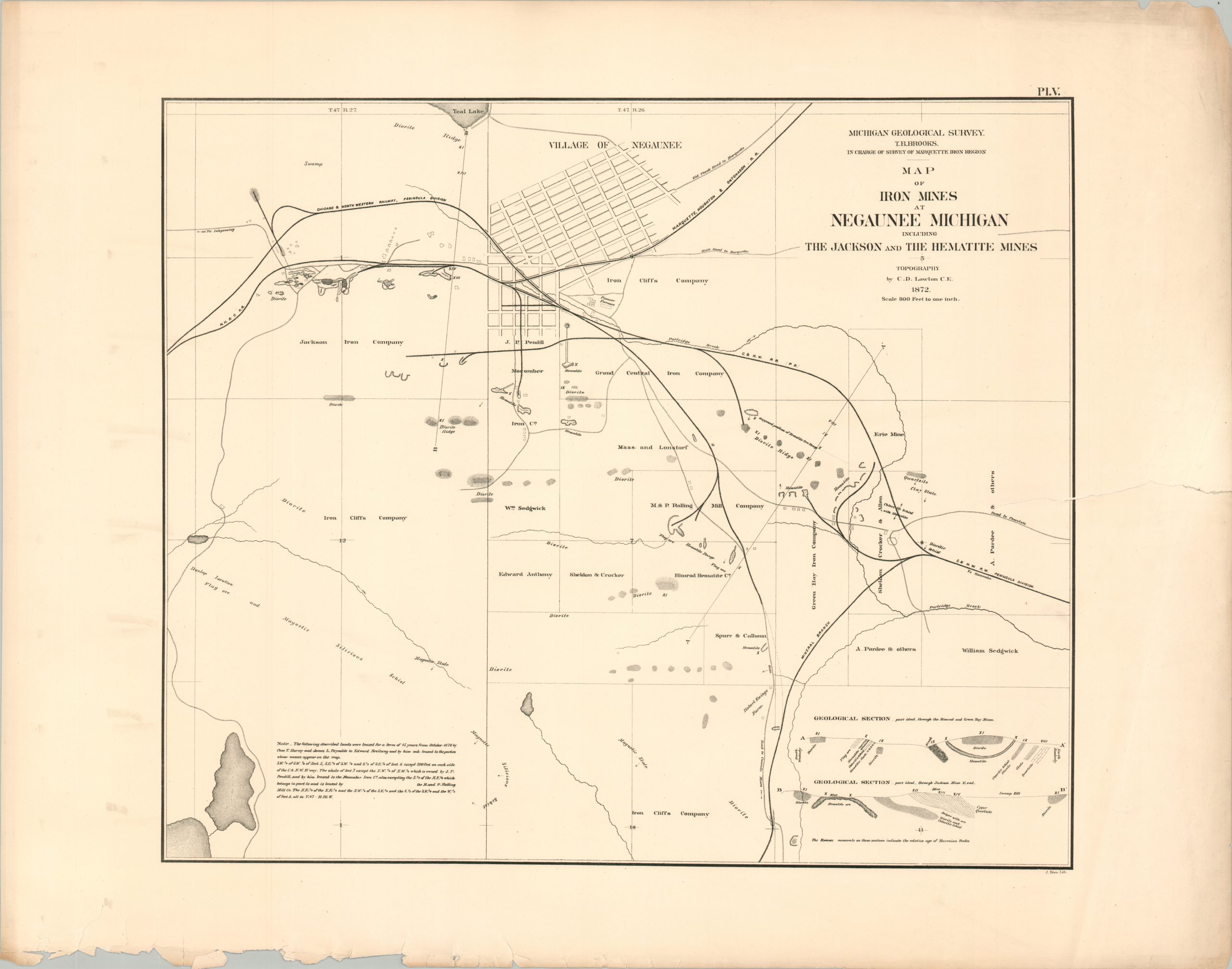
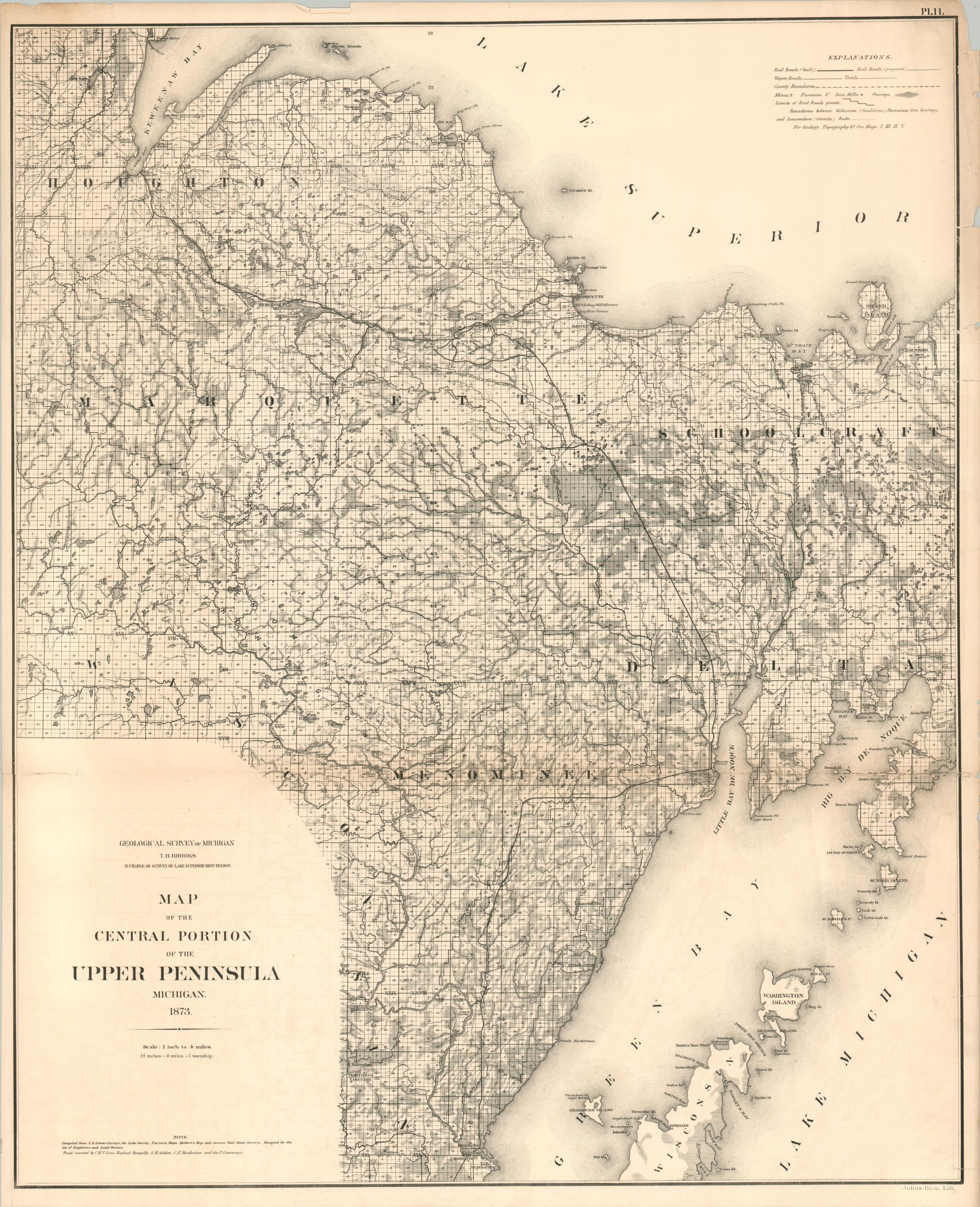
The contents focus on the economic potential of Michigan’s Upper Peninsula. At the time, the remote area was producing the vast majority (nearly 90%) of the nation’s copper and enjoyed large deposits of iron and nickel. The results of geological surveys such as this were instrumental in encouraging further financial investment, developing railroad infrastructure, and tempting additional settlement.
Map Details
Publication Date: c. 1874
Author: Geological Survey of Michigan
Sheet Width (in): 28
Sheet Height (in): 22
Condition: B
Condition Description: Lacking Plate I, the geologic overview of the Upper Peninsula. Collection of 24 color printed sheets (Plates II - XXIII, including XIVa and XIVb) and a tattered title page. Each sheet shows some variation of wear along the outer edges, ranging from light to moderate. Closed tears, scattered spotting, marginal loss (without affecting the image), and a handful of dirty fingerprints and surface soiling are the worst of the damage, apart from the title sheet.
Out of stock