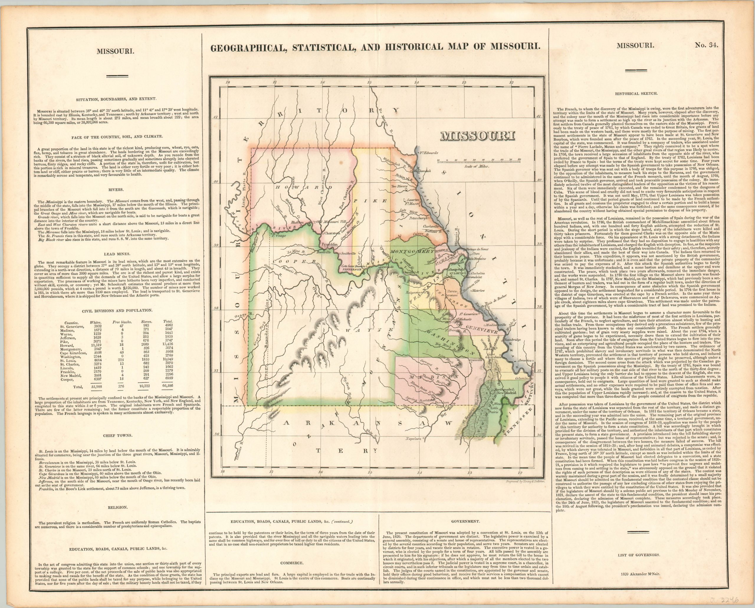
Geographical, Statistical, and Historical Map of Missouri
Original price was: $595.00.$495.00Current price is: $495.00.
The first separately printed map of Missouri.
1 in stock
Description
This fascinating early map of Missouri vividly displays how settlement in the American west generally followed patterns of navigable waterways and their adjacent riparian zones. Large county configurations in the interior reflect sparse populations, while most urban centers sit on either the Mississippi or Missouri Rivers. Numerous forts are scattered throughout the state, and large “great swamps” can be seen in the southeast.
Topography is depicted in hachure, and a large area in the south (including portions of the adjacent Arkansas Territory) is labeled as Ozark Mountains. Surrounding the map are tables and paragraphs of text outlining the climate, geography, economy, and history of the new state, which had been admitted to the Union the year prior to publication; making this the first separately printed map of Missouri as a state.
The map was engraved by Young & Delleker and included as plate number 34 in the 1822 (first) edition of Carey & Lea’s Complete Historical, Chronological, and Geographical American Atlas.
Map Details
Publication Date: 1822
Author: Carey & Lea
Sheet Width (in): 22.00
Sheet Height (in): 17.50
Condition: A-
Condition Description: Faint scattered soiling and a bit of toning around the outer edges. Two pieces of archival tape on the verso where the map was previously matted. Very good overall, with original hand color.
Original price was: $595.00.$495.00Current price is: $495.00.
1 in stock

