Geographical, Statistical, and Historical Map of Kentucky
Original price was: $195.00.$145.00Current price is: $145.00.
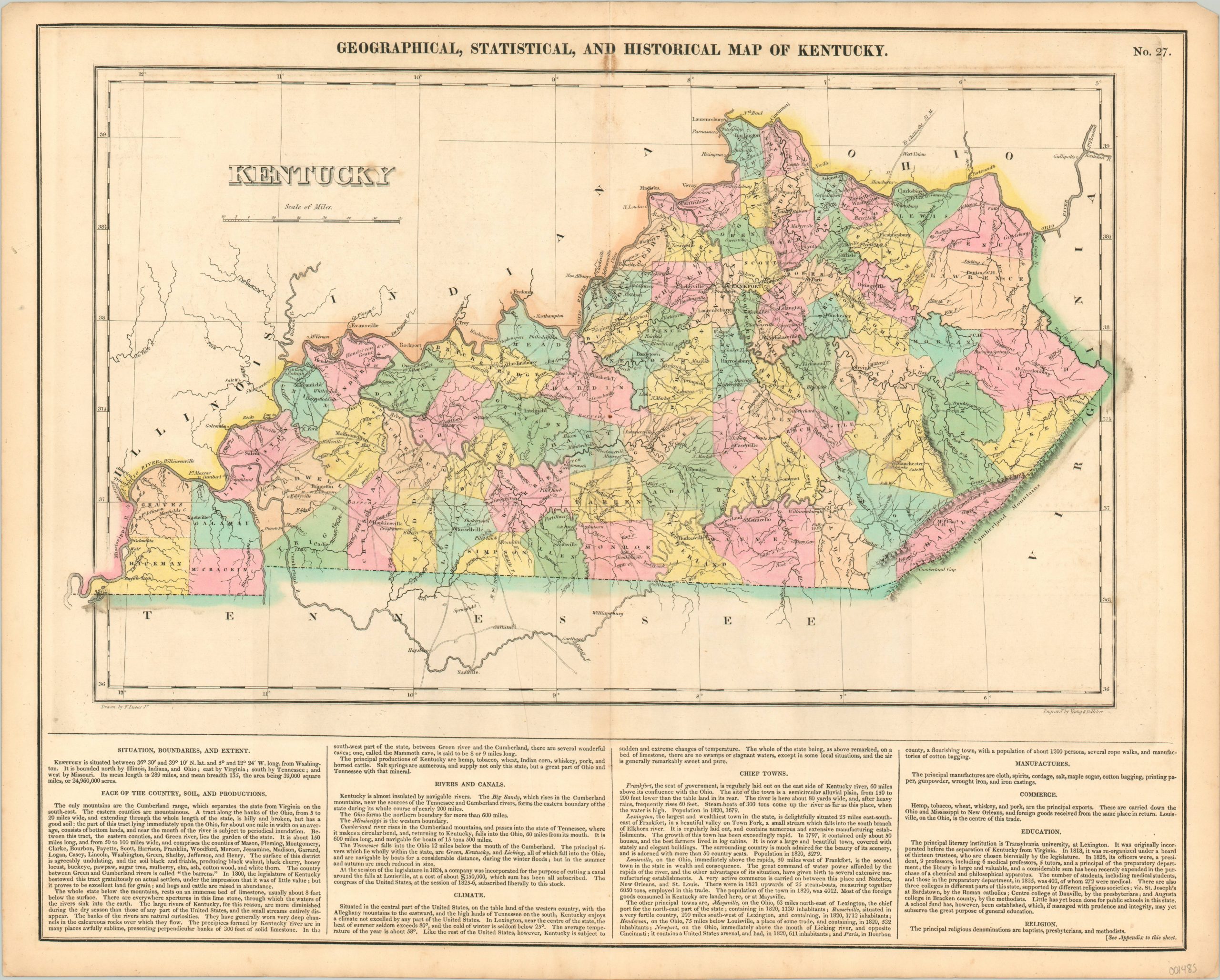
Interesting and early map of Kentucky published in Carey & Lea’s influential American atlas.
1 in stock
Description
This detailed map of Kentucky presents the Bluegrass State after the first quarter of the 19th century. It’s insulated by rivers and the Cumberland Mountains to the southeast, and has broadly dispersed settlements connected by a number of roads and at least one proposed canal. An incomplete county configuration is delineated by bright color, applied by hand. Topography is depicted pictorially, while geographic features (note Mammoth Cave), forts, and Indian towns are individually labeled.
The bottom of the sheet contains a number of paragraphs outlining the climate, geography, and infrastructure of the state. The map was designed by Fielding Lucas, Jr. and engraved by Young & Delleker. It was included as plate number 27 in the 1826 edition of Carey & Lea’s Complete Historical, Chronological, and Geographical American Atlas.
This important American publication was issued in six separate editions and three different languages between 1822 and 1827. It was heavily influenced by an earlier European atlas by Emmanuel Las Cases (published under the pseudonym A. Lesage.), which inspired the format of a base map surrounded by blocks of informative text and tables of statistics.
Henry Carey, a political economist and the son of prominent publisher Matthew Carey, and his brother-in-law Isaac Lea incorporated this novel theme into their atlas, which focused entirely on the countries of the Western Hemisphere. It was issued at a time of tremendous political change in both North and South America, and the detailed maps accompanied by extensive text provide a unique, often insightful, perspective on the problems and possibilities of the Americas in the first quarter of the 19th century.
Wheat, C. I. (2004). Mapping the Transmississippi West: 1540-1861. Mansfield Centre (CT): Martino Publishing. #348
Egli, L. G., & Phillips, P. L. (1974). A list of geographical atlases in the Library of Congress. Washington: Library of Congress. #1373
Map Details
Publication Date: 1826
Author: Carey & Lea
Sheet Width (in): 22.00
Sheet Height (in): 17.50
Condition: B+
Condition Description: Moderate discoloration and wear along the centerfold, including a few inches of separation that has been repaired on the verso. One spot of soiling along the centerfold near the top of the sheet, and a second smudge on the right side of the image and neatline. One spot also visible in the title block. Remains in good to very good condition overall, with nice original hand color.
Original price was: $195.00.$145.00Current price is: $145.00.
1 in stock