Flood Map of Louisville, Kentucky
Spectacular cartographic record of the damage done to Louisville during the 1937 Ohio River flood.
Out of stock

Description
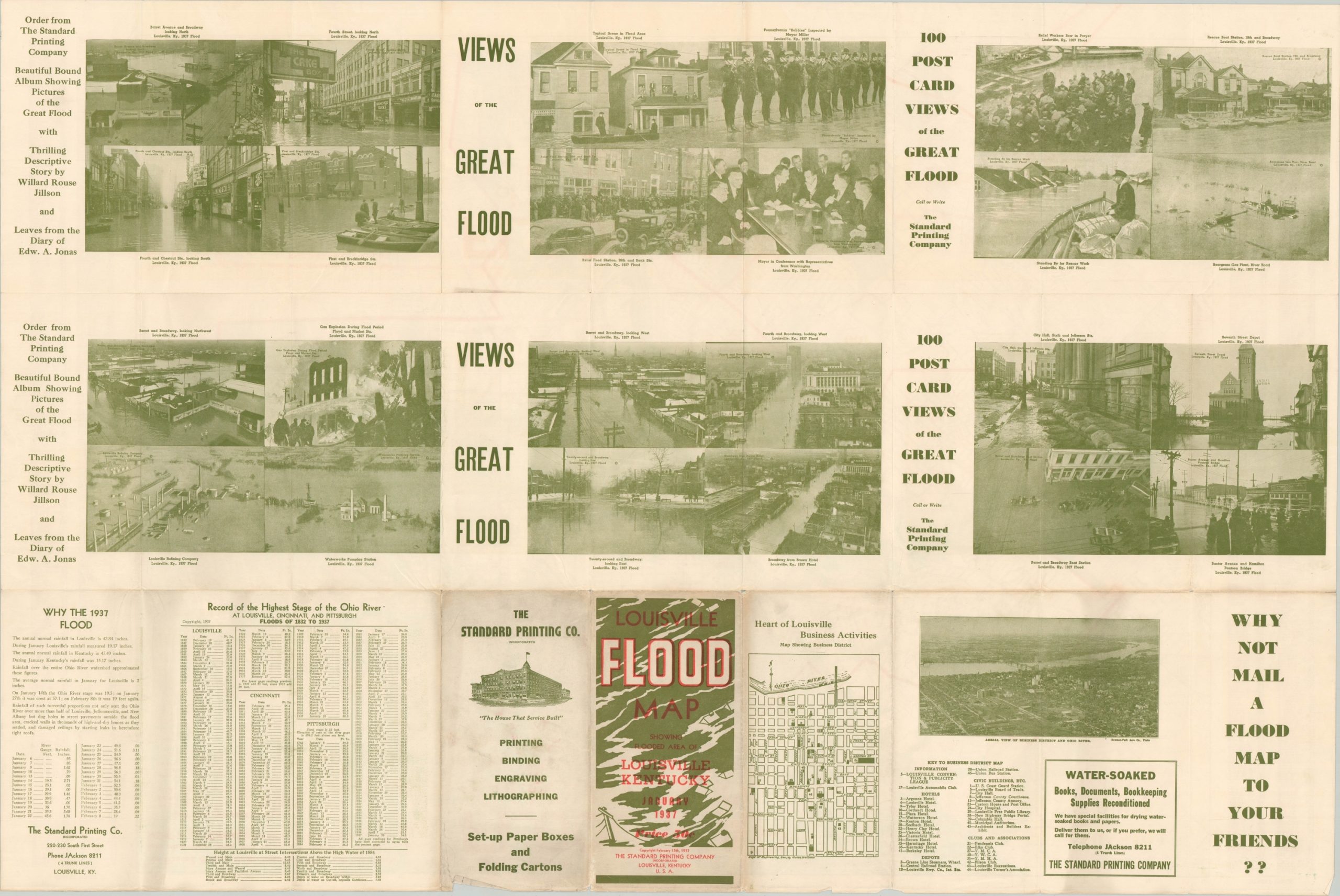
The 1937 Ohio River Flood left over 1 million people homeless and caused nearly half a billion dollars in property damage ($9 billion when adjusted to 2020) between Pittsburgh, PA, and Cairo, IL. Cities along the banks of the Ohio were inundated with icy waters for nearly a month in some places, as the federal government struggled to respond in the waning years of the Great Depression.
As evidenced by this map of Louisville, The Gateway to the South was not spared such destruction. Water covers nearly half the total area of the city limits (outlined in red) and reaches inland over 5 miles, submerging even the famous Churchill Downs. Red numbers throughout the sea of blue indicate the depth, while statistics on river elevation attempt to give some context to the extreme height.
The verso provides photographic views of the Great Flood, a brief summary and statistics of the catastrophe, and a street plan of downtown Louisville. Fortunately, the headquarters of the publishers (Standard Publishing Company) was near the corner of Market and 1st Streets in the small dry area near the center of the map. This allowed them to continue operation and produce this map less than 3 weeks after the river had crested.
Designed by J.S. Caldwell and F.S Danforth and published in Louisville, Kentucky by the Standard Printing Company in 1937.
Map Details
Publication Date: 1937
Author: J.G. Caldwell and F.S. Danforth
Sheet Width (in): 41.5
Sheet Height (in): 27.75
Condition: A-
Condition Description: Lightly creased along originally issued fold lines. A few tiny edge tears, confined to the margins, and light extraneous wrinkling. Very good overall.
Out of stock