Federal Map of Detroit and Environs
$75.00
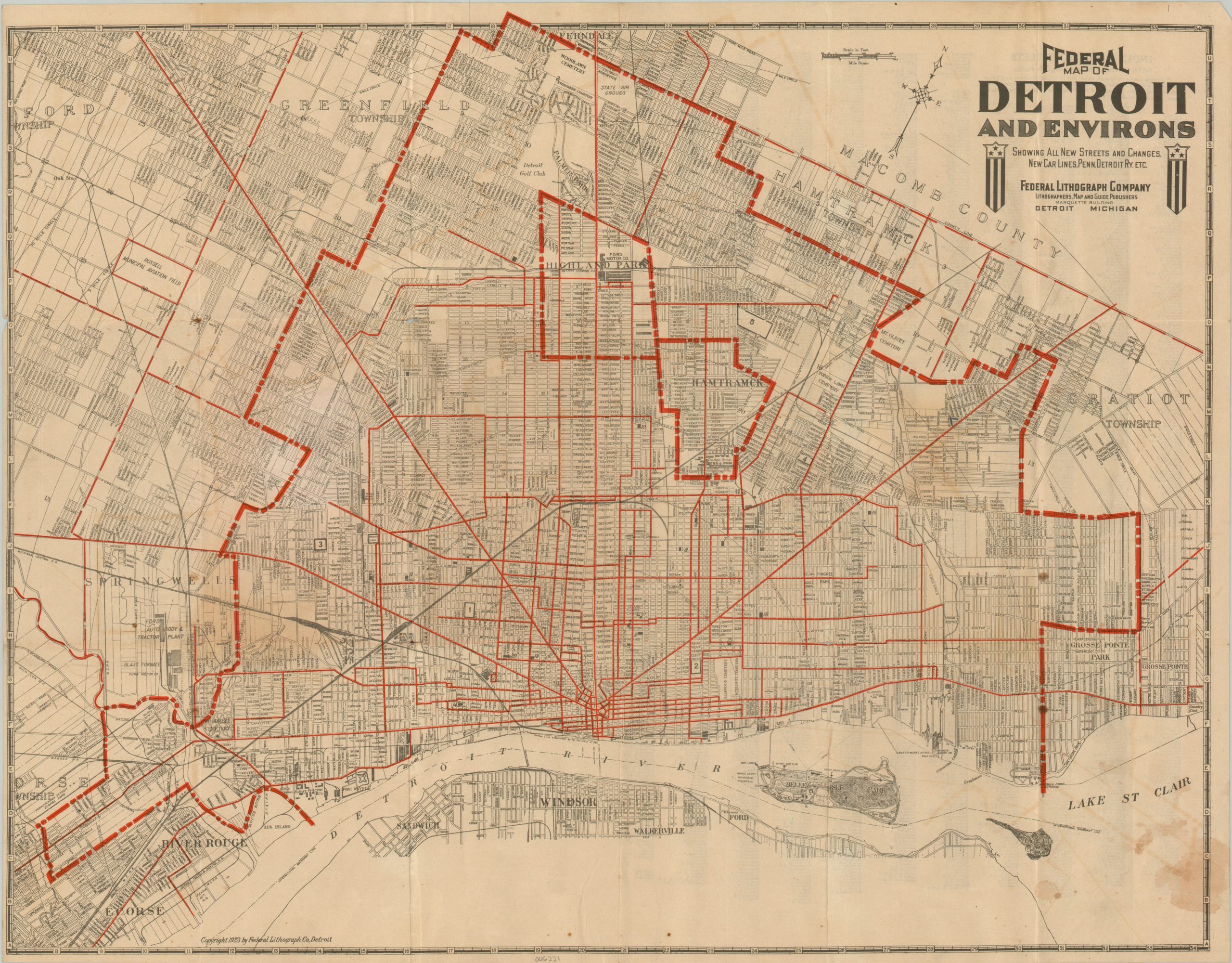
Detroit during the Roaring 20s.
1 in stock
Description
This interesting 1923 map of Detroit, Michigan was published locally by the Federal Lithograph Company. The city was well on its way to earning the nickname ‘The Motor City’, with several automotive firms bringing in large quantities of employees. Massive Ford plants can be seen in Highland Park and Springwells, with smaller factories in operation by Cadillac, Maxwell, Lincoln, and the Dodge Brothers.
Between 1900 and 1930, the city’s population skyrocketed from 265,000 to 1.5 million, necessitating suburban expansion. This was aided by the robust network of streetcars, highlighted in red. Various points of interest and important buildings are labeled throughout the image, including Fort Wayne, Russell Aviation Field, and numerous recreational facilities on Belle Isle.
Map Details
Publication Date: 1923
Author: Federal Lithograph Company
Sheet Width (in): 21.75
Sheet Height (in): 17
Condition: B-
Condition Description: Pocket map folded into 18 segments and affixed to the back of the original paper wraps (front missing). Dampstaining in the lower right corner and moderate toning visible throughout the center as a result of being previously folded. Scattered spotting along the bottom and some offsetting from the red ink. Between fair and good condition.
$75.00
1 in stock