East Texas – Oklahoma with New Mexico – West Texas
$60.00
PAPER IS PRECIOUS! Please do not throw this map away
1 in stock
Description
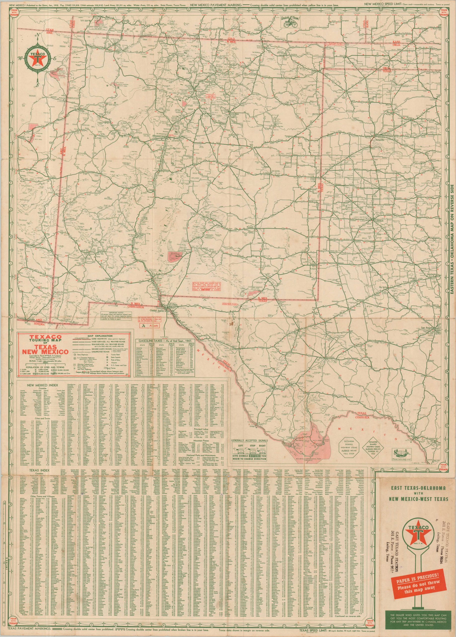
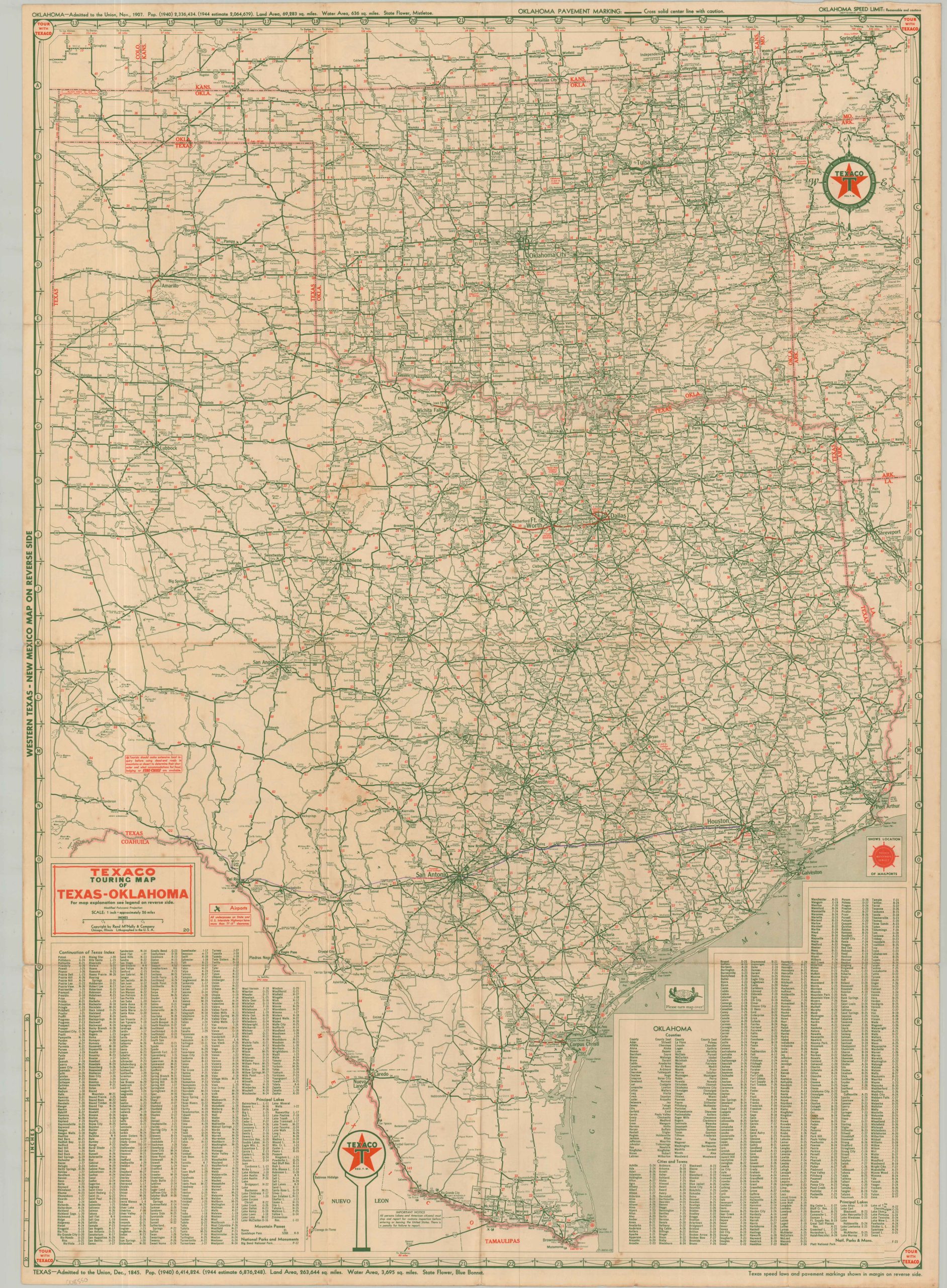
This double-sided touring map of Texas, Oklahoma, and New Mexico was published in 1947 by the Chicago-based Rand McNally & Company on behalf of Texaco Oil. Super Highways are highlighted in bright red, though they’re quite sparse and found only around Dallas/Fort Worth and Amarillo. Other solid, hashed, and cased lines show hard-surfaced, semi-surfaced, and unimproved roads, respectively.
Airports, U.S. Camps/Forts, and ports of entry are also noted. Curious little insets and charming illustrations showcase the Rules of the Road, a table of gasoline taxes, general accepted turn signals (by hand, out the window), reminders of sign shapes, etc. A neat artifact from the heady days of postwar automobile tourism.
Map Details
Publication Date: 1947
Author: Rand McNally & Company
Sheet Width (in): 22.90
Sheet Height (in): 32.90
Condition: B
Condition Description: Double-sided road map with moderate wear along original folds and heavy toning on the front cover (see scan). A few small spots of light foxing and surface soiling. About good condition overall.
$60.00
1 in stock