Durango Picture Map
Sweeping pictorial panorama of Durango, Colorado from the 1980’s.
Out of stock

Description
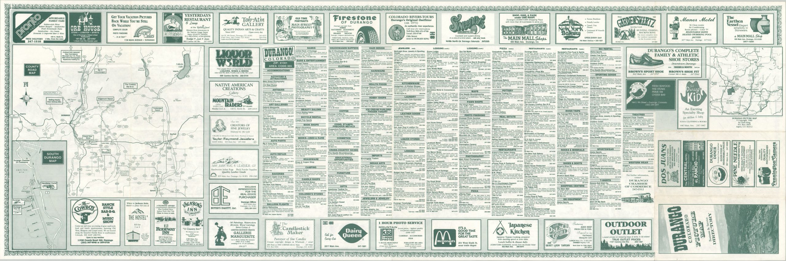
With a keen eye for detail, cartographer Chris King designed and published this map of Durango, Colorado locally in 1986. Perin’s Peak can be seen rising sharply in the background, as transportation routes and local businesses are featured prominently in the foreground.
A business directory, numerous advertisements, and county road map can all be found on the verso. An interesting synthesis of natural landscapes and modern economics.
Map Details
Publication Date: 1986
Author: Chris King
Sheet Width (in): 47.60
Sheet Height (in): 15.50
Condition: A
Condition Description: Light creasing and faint wear along originally issued fold lines. Near fine.
Out of stock