Detroit United Lines and Interurban Connections
Michigan’s largest interurban railway near its height.
Out of stock
Description
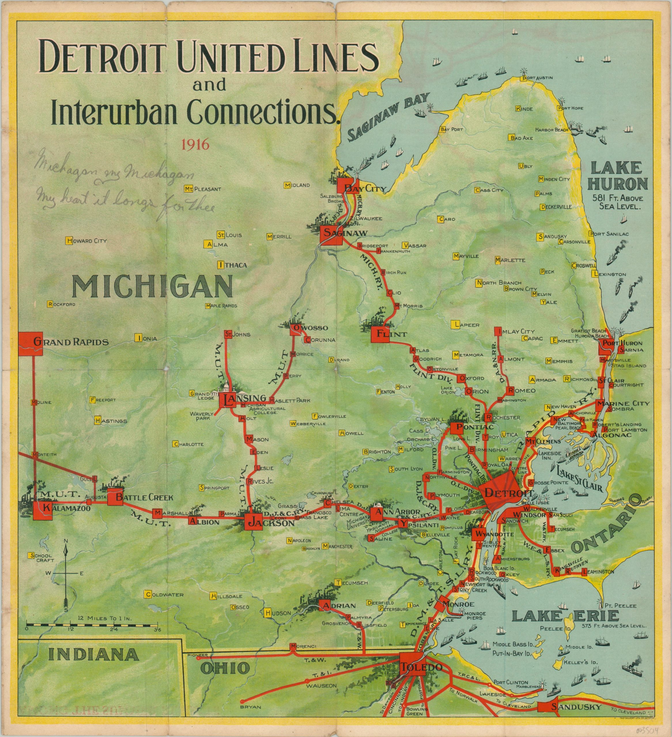
The lines of the Detroit United Railway can be seen stretching from Kalamazoo to Port Huron and Bay City to Toledo on this map, published in 1916. Through its primary routes and connecting lines the company operated the largest interurban network in the state, though financial mismanagement and political pressure would cause it to become largely abandoned about a decade later.
Labeled lines are shown emanating from Detroit and reach numerous cities across southeastern Michigan and northern Ohio. Major urban areas are represented with an industrial skyline unappealing to the modern senses, though Lansing and Ann Arbor are differentiated with their respective universities.
An interesting typographic strategy is employed to name stops along each line, as well as other towns. Ships of all shapes and sizes are shown across the Great Lakes, while a soft color palette adds to the overall pleasing aesthetic. This particular example has been accentuated with a manuscript note in the upper left – “Michagan my Michagan my heart it longs for thee.”
Map Details
Publication Date: 1916
Author: Calvert Lithograph Company
Sheet Width (in): 15.00
Sheet Height (in): 16.50
Condition: B
Condition Description: Folding brochure that's heavily soiled on the verso. Moderate wear along fold lines, including small edge tears, creasing, and some light discoloration. About 5" of separation has been repaired on the verso with archival tape.
Out of stock