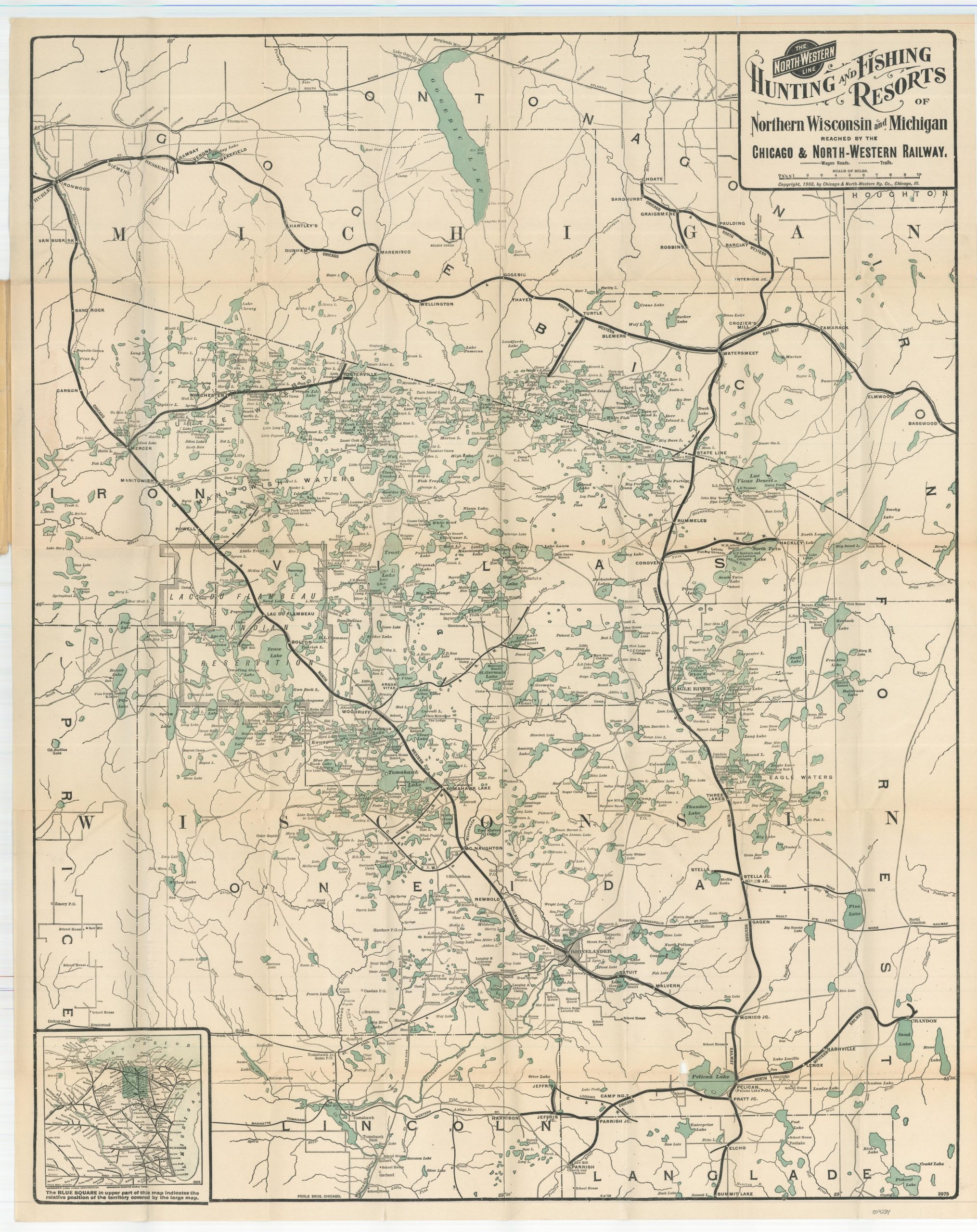
Detailed Map of the Lake Region of Northern Wisconsin and Michigan [Title on Front Cover]
$219.00
“The Hunting and Fishing Resorts of Northern Wisconsin and Michigan reached by the Chicago & North-Western Railway” [Alternate Title]
1 in stock
Description
This detailed railroad map covers the popular North Woods region along the border of northern Wisconsin and Michigan’s Upper Peninsula. Scores of bodies of water are dotted throughout the image, reflecting the area’s renown for fishing, hunting, and other means of outdoor recreation.
Tourists from Chicago, Milwaukee, St. Paul, and other Midwestern cities would flock to the region along the lines of the Chicago & Northwestern Railway, boldly shown in black. Wagon roads and hiking trails are also represented according to the legend below the title block. Numerous camp sites, hunting lodges, cottages, resorts, and cabins are labeled throughout the image, while an inset in the lower right shows the represented area in blue amid a large map of Wisconsin’s railroad network. Blank on verso.
According to the upper right, the map was designed in Chicago in 1903 by the Poole Brothers and copywritten by the Chicago & Northwestern Railway Company in 1903. The covers indicate that it was issued by the company’s Passenger Department slightly later, in 1910, during a period of increasing tourism in the North Woods area. According to historian Aaron Shapiro;
“From the turn of the century until World War I, access to Wisconsin’s North Woods had been limited and costly, with sportsmen from the upper class constituting the majority of recreational travelers.”
But the development and promotion of accommodations (such as those shown on the map) and recreation opportunities for all classes of travelers, plus the development of automobile routes, led to an explosion in regional tourism after the First World War.
Map Details
Publication Date: 1910
Author: Chicago and Northwestern Railway Co.
Sheet Width (in): 22.5
Sheet Height (in): 28.25
Condition: A-
Condition Description: Pocket map folded into 40 segments and affixed to original stiff paper wraps. Covers show some moderate toning and a few small chips, and the map is moderately creased along fold lines. Some light discoloration and wear along the outer edges also present. One small hole, lower right, has been repaired on the verso with archival tape. Very good overall.
$219.00
1 in stock

