County Map of the States of New York, New Hampshire, Vermont, Massachusetts, Rhode Id, and Connecticut
$60.00
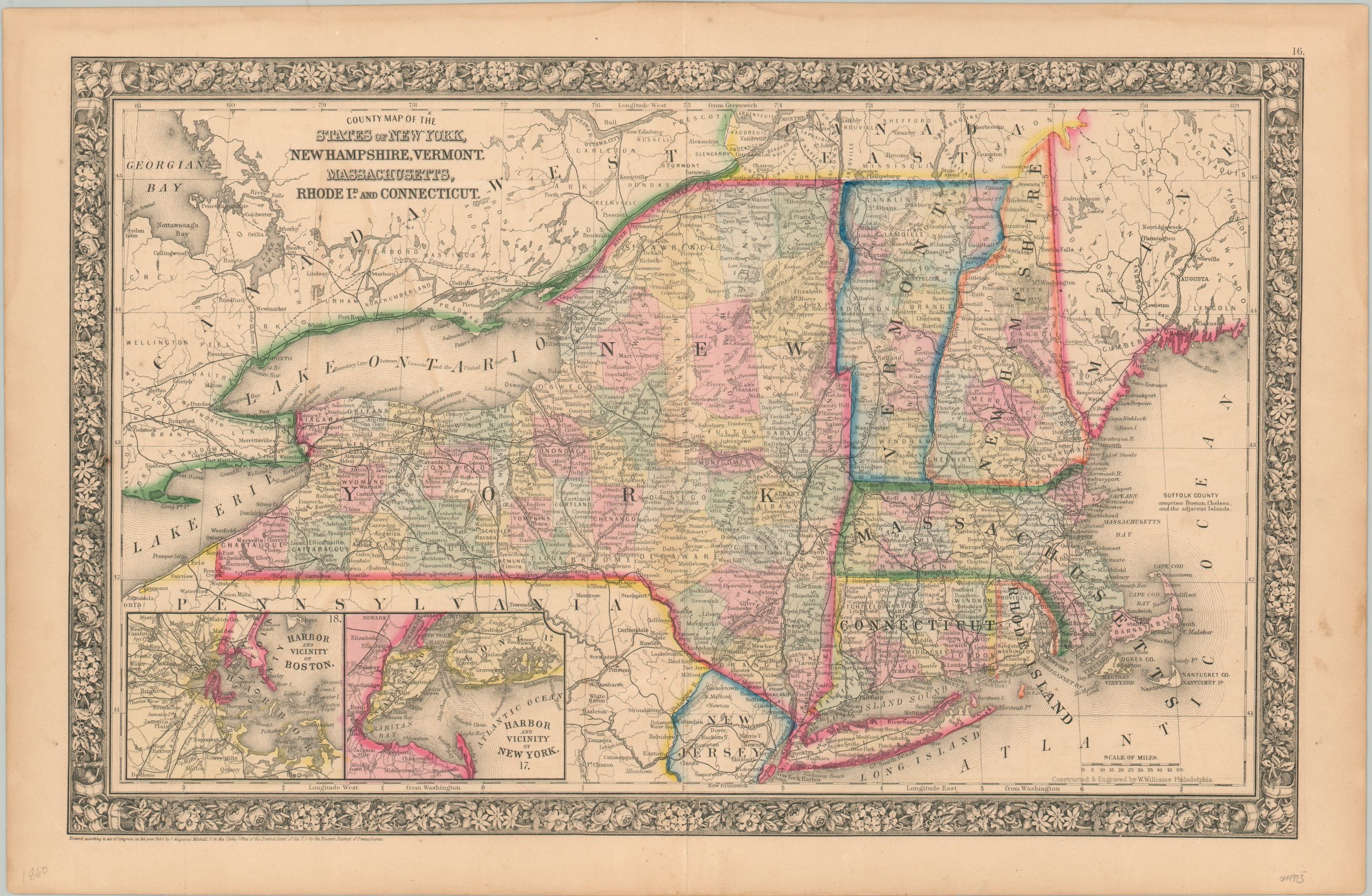
New England on the eve of the American Civil War.
1 in stock
Description
This interesting map of New England was published in Philadelphia by Samuel Augustus Mitchell in 1860. Mitchell was one of the most prominent American mapmakers of the 19th century, and initially got involved with cartography as a school teacher who was frustrated with the quality of available maps. He collaborated with skilled engravers and produced high-quality maps and atlases that contained the most up-to-date information available. Mitchell’s son (of the same name) would take over the business after his death in 1860 and continue the tremendous output.
His attention to detail is evident within the image, which provides an engaging snapshot of New York, New Hampshire, Vermont, Massachusetts, Rhode Island, and Connecticut shortly before the outbreak of the Civil War. Original hand color distinguishes state borders and county configurations, while finely engraved toponyms label a variety of settlements, geographic features, and other locations of interest.
Railroads are shown with thick black lines (proposed routes are dotted) and a number of canals are noted across New York. Inset maps in the lower left show the harbors of Boston and New York – two critical points for immigrants (i.e. new recruits) and supplies for the impending conflict.
Map Details
Publication Date: 1860
Author: Samuel Augustus Mitchell
Sheet Width (in): 23.4
Sheet Height (in): 15.2
Condition: B
Condition Description: Large damp stain visible in the upper left, around Lake Ontario and the title block. Some other scattered soiling and toning visible in the margins. About good overall, with nice original color.
$60.00
1 in stock