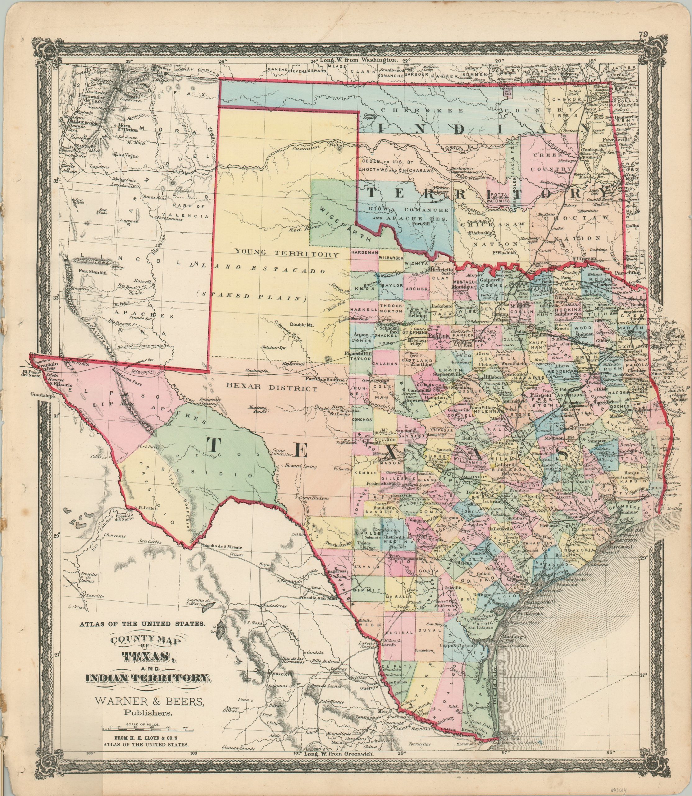
County Map of Texas, and Indian Territory
Texas and the Indian Territory in the last quarter of the 19th century.
Out of stock
Description
This steel-engraved map of Texas and Indian Territory (modern-day Oklahoma) was published in Chicago in 1875 by Warner & Beers as part of H.H. Lloyd & Co.’s Atlas of the United States. Original hand color outlines each region, along with the counties and districts organized therein.
Of particular interest is the Young Territory in Texas. This large district suffered greatly from Native American attacks during the Civil War and the county government was largely abandoned. It was reorganized the year prior to publication around the new county seat of Graham (not shown). Also of note is the large area in western Indian Territory ‘ceded to U.S. by Choctaws and Chickasaws’. These land concessions were part of the broader Reconstruction Treaties signed with Native American tribes that supported the Confederacy (due in part to Union troop withdrawal).
Railroads, both completed and proposed, and wagon roads are noted throughout the image and a fascinating variety of forts, geographic features, settlements, and other locations of interest are labeled. An interesting overview of the large southwestern region in the midst of the Reconstruction Era.
Source: Oklahoma History;
Map Details
Publication Date: 1875
Author: Warner & Beers
Sheet Width (in): 15.8
Sheet Height (in): 18.1
Condition: A-
Condition Description: The sheet has a ragged left edge, where previously bound, and shows moderate soiling and wear along the margins. A few faint spots in the image, but overall in very good condition, with original hand color.
Out of stock