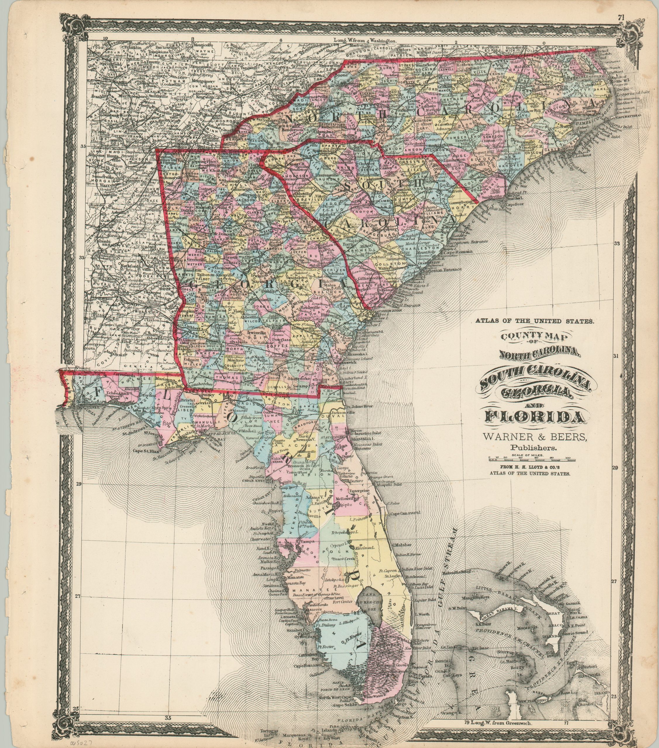
County Map of North Carolina, South Carolina, Georgia, and Florida
$140.00
The South Atlantic states near the end of the Reconstruction Era.
1 in stock
Description
This attractive, but somewhat cluttered, map presents the states of North Carolina, South Carolina, Georgia, and Florida during the mid-1870s. Vibrant original color, applied by hand shortly after printing, outlines state borders and county configurations, the latter of which also contains their date of organization (except Florida).
Topography is depicted in simple hachure, emphasizing the mountainous region in western North Carolina and northern Georgia. Lowlands are also shown, notably the gigantic Everglades Swamp in southern Florida. This area is also inaccessible from the otherwise robust network of railroads that crisscross the map. Toponyms identify a fascinating variety of forts, local industries, natural resources, geographic features, and more.
The map was published in 1875 by Warner & Beers for inclusion in H.H. Lloyd & Co’s Atlas of the United States.
Map Details
Publication Date: 1875
Author: Warner & Beers
Sheet Width (in): 15.75
Sheet Height (in): 18.2
Condition: A-
Condition Description: Moderate wear and soiling visible in the margins, including a ragged left edge where previously bound, softly creased corners, and soiling on the right side (away from the image). A handful of scattered spots within the neatline, consistent with age. Very good overall, with nice original hand color.
$140.00
1 in stock