
Colton’s Lake Superior and the Northern Part of Michigan
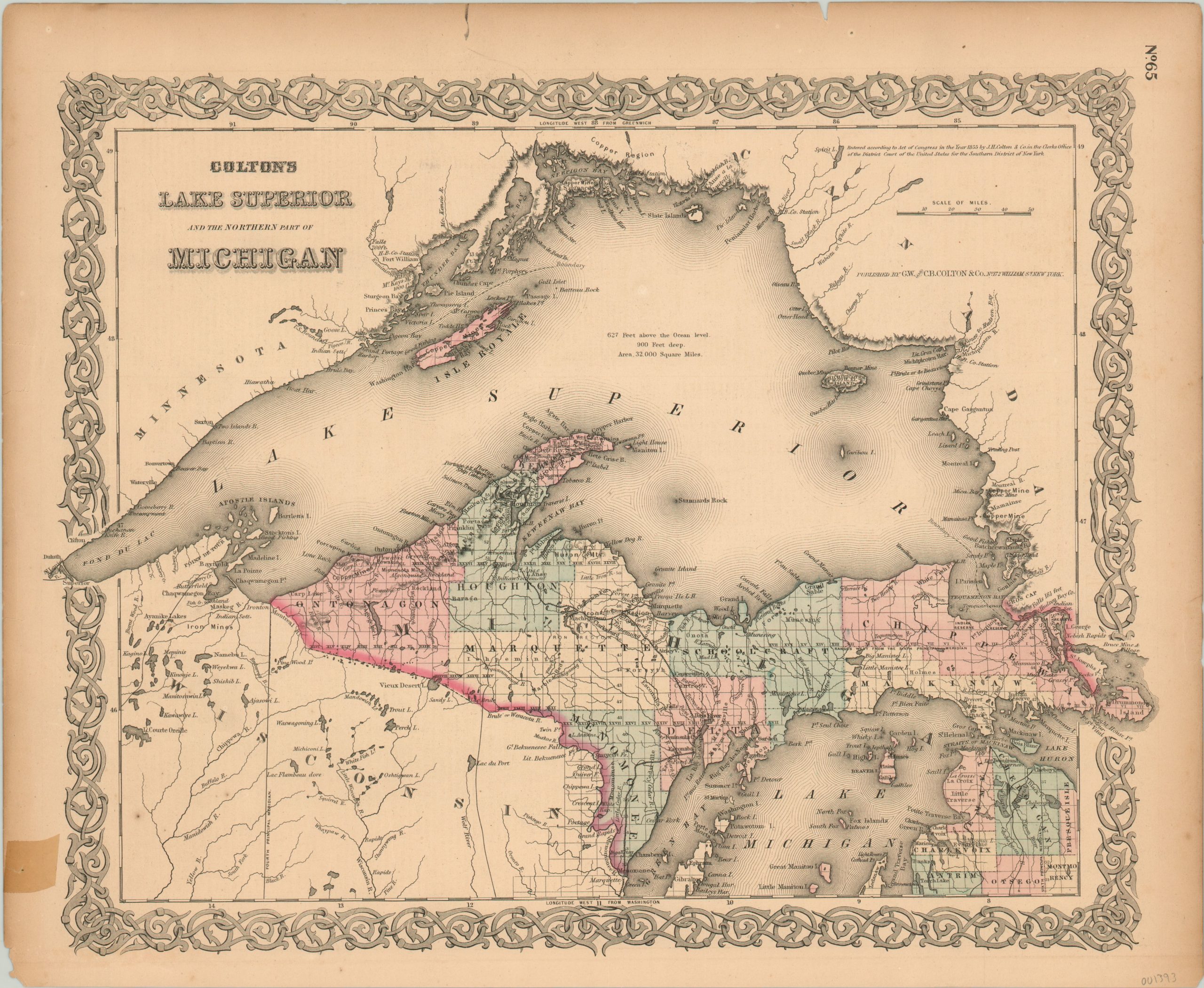
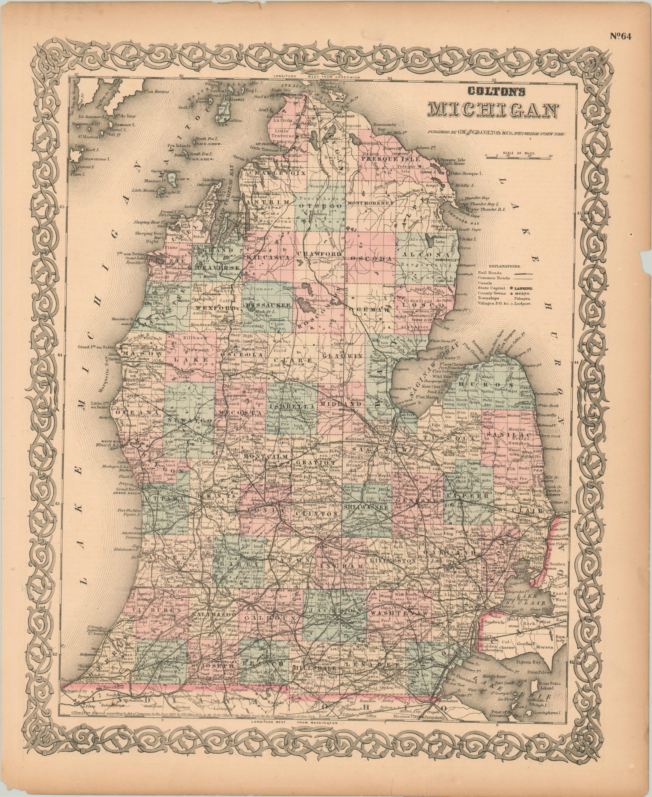
Colton’s double sided atlas map featuring the upper and lower peninsulas of Michigan.
Out of stock
Description
This detailed map was originally issued by Joseph Hutchins Colton in 1855 and has been updated to the late 1860’s in a later publication by his successors, G.W. & C.B. Colton. It shows the surveyed status of Michigan’s upper peninsula, organized into eight large counties, plus Isle Royale in Lake Superior.
The few railroad lines serving the region are shown, as are a number of prominent geographic features, settlements, townships, forts and boundary lines. Prominent local industries, such as copper, fur, and iron are also labeled accordingly. The verso features a similar map of Michigan’s lower peninsula.
Map Details
Publication Date: c. 1868
Author: J.H. Colton
Sheet Width (in): 17.40
Sheet Height (in): 14.25
Condition: B
Condition Description: Several edge tears and one small tape repair in the margins. The sheet is slightly toned from age, but the image is complete and features fine original hand color.
Out of stock