
Coast to Coast U.S. 6 Roosevelt Highway
$110.00
“The Scenic Way from the Atlantic to the Pacific.”
1 in stock
Description
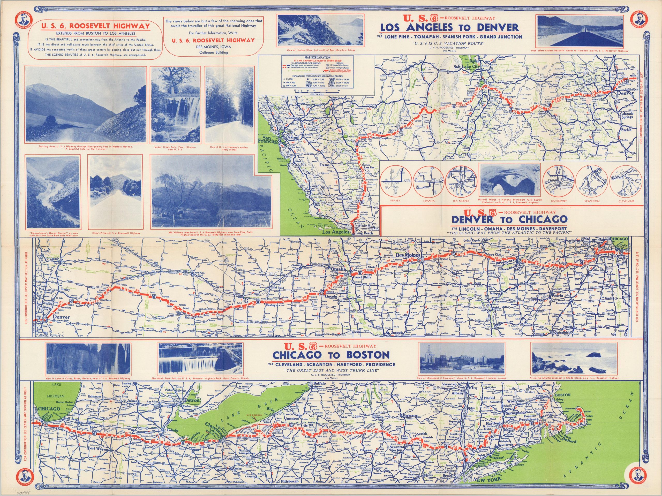
This eminently useful map was issued around 1938 by the U.S. 6, Roosevelt Highway association in Des Moines, Iowa. The city was situated approximately in the middle of the transcontinental route that connected Boston to Los Angeles through the center of the nation. The direct nature of the route, its beautiful scenery, and the sparse traffic are some of the benefits extolled by the persuasive text and accompanying photographs.
The highway map is divided into three sections, from Los Angeles to Denver, Denver to Chicago, and Chicago to Boston. Each notes towns, distances between points, connecting roads, and nearby attractions like state parks. Small insets in the upper left offer sparse overviews of the major urban centers. A map of the United States on the verso highlights the overall route in green, noting only a short stretch of gravel between Eureka, Utah and Ely, Nevada.
Map Details
Publication Date: c. 1938
Author: U.S. 6, Roosevelt Highway
Sheet Width (in): 23.50
Sheet Height (in): 17.75
Condition: A-
Condition Description: Double-sided brochure with creasing and minor wear along folds, including a 1" split repaired on verso, and a bit of light toning. Good to very good condition overall.
$110.00
1 in stock