City map of Grand Rapids, Michigan
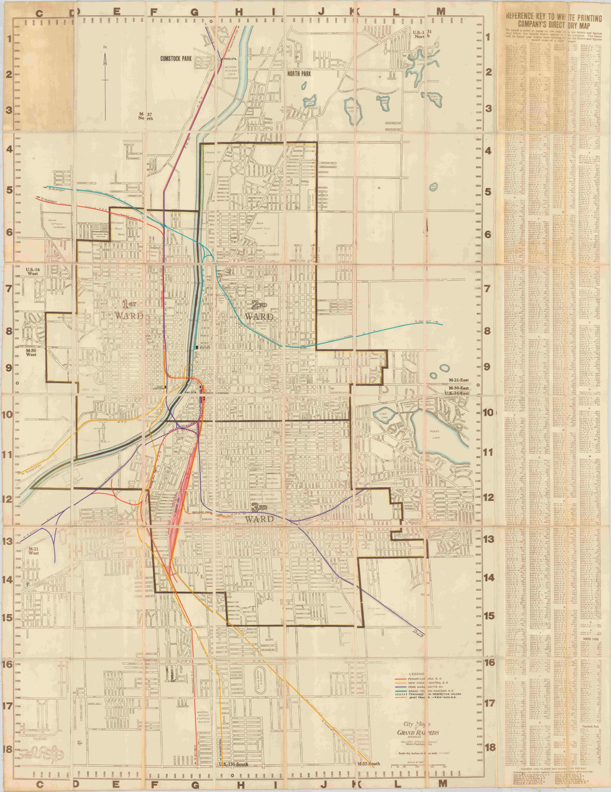
Large scale city map of Grand Rapids used in the engineering department of the Pennsylvania Railroad.
Out of stock
Description
This linen backed folding map is based on a city map of Grand Rapids published by the White Printing Company. Although it was originally designed as a street map and index, this version was used in the central engineering department (C.E. Office on the front cover) of the Pennsylvania Railroad archives and updated (by hand) with track ownership information into the early 1950’s. A custom legend identifies the tracks of five separate companies, each of which has the connecting line and destination information labeled. Manuscript annotations also highlight particular locations of interest, such as passenger stations and rail yards.
In addition, the map shows an interesting mid-century transportation configuration a few decades prior to Penn R.R.’s merger with the New York Central in 1968. The resulting company, the Penn Central, declared bankruptcy in 1970 (the largest filing at the time) and many of its lines were eventually taken over by Amtrak. A hundred years earlier, the Pennsylvania Railroad was the largest corporation in the world and paid out annual shareholder dividends for over 100 consecutive years, showing just how rapidly and completely railroading fortunes could change.
Map Details
Publication Date: c. 1939
Author: White Printing Company
Sheet Width (in): 38.00
Sheet Height (in): 49.00
Condition: A-
Condition Description: There is moderate discoloration on two panels in the upper row, but otherwise the map is in excellent condition. Mounted on linen with original covers.
Out of stock