Chain of Rocks Bridge Map of St. Louis and Vicinity
$90.00
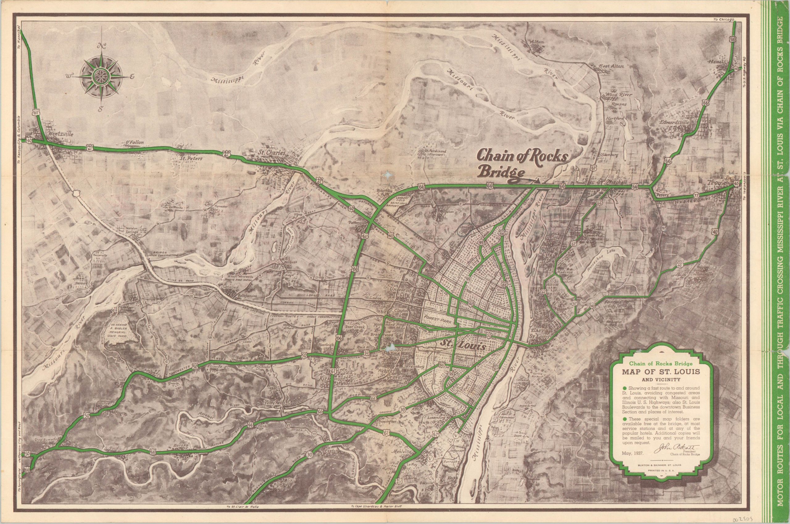
One of two ways for a motorist to cross the mighty Mississippi in the late 1930’s.
1 in stock
Description
Completed in 1929, the Chain of Rocks Bridge functioned as a bypass for Route 66 so that motorists traveling west could avoid the congested traffic of downtown St. Louis. It’s notable for a 20 degree angle in the middle of the river, though its not depicted on this map. Primary transportation routes are highlighted in green, emphasizing the limited points of access for motorists looking to cross the Mississippi River.
Otherwise the agrarian surroundings and urban density are illustrated in a highly stylized fashion. A handful of places of interest (like the ball park) and highway markers are labeled within the image.
The verso includes a table of distances between the Chain of Rocks Bridge and various places in Missouri and Illinois, as well as a list of popular hotels and attractions in St. Louis. Published in St. Louis by Buxton & Skinner in May of 1937.
Map Details
Publication Date: 1937
Author: Buxton & Skinner
Sheet Width (in): 17.75
Sheet Height (in):
Condition: B
Condition Description: Moderate creasing along originally issued fold lines and two small bits of image loss at the fold intersections in the center of the page. War along the outer edges, including two chips on the far right side of the page.
$90.00
1 in stock