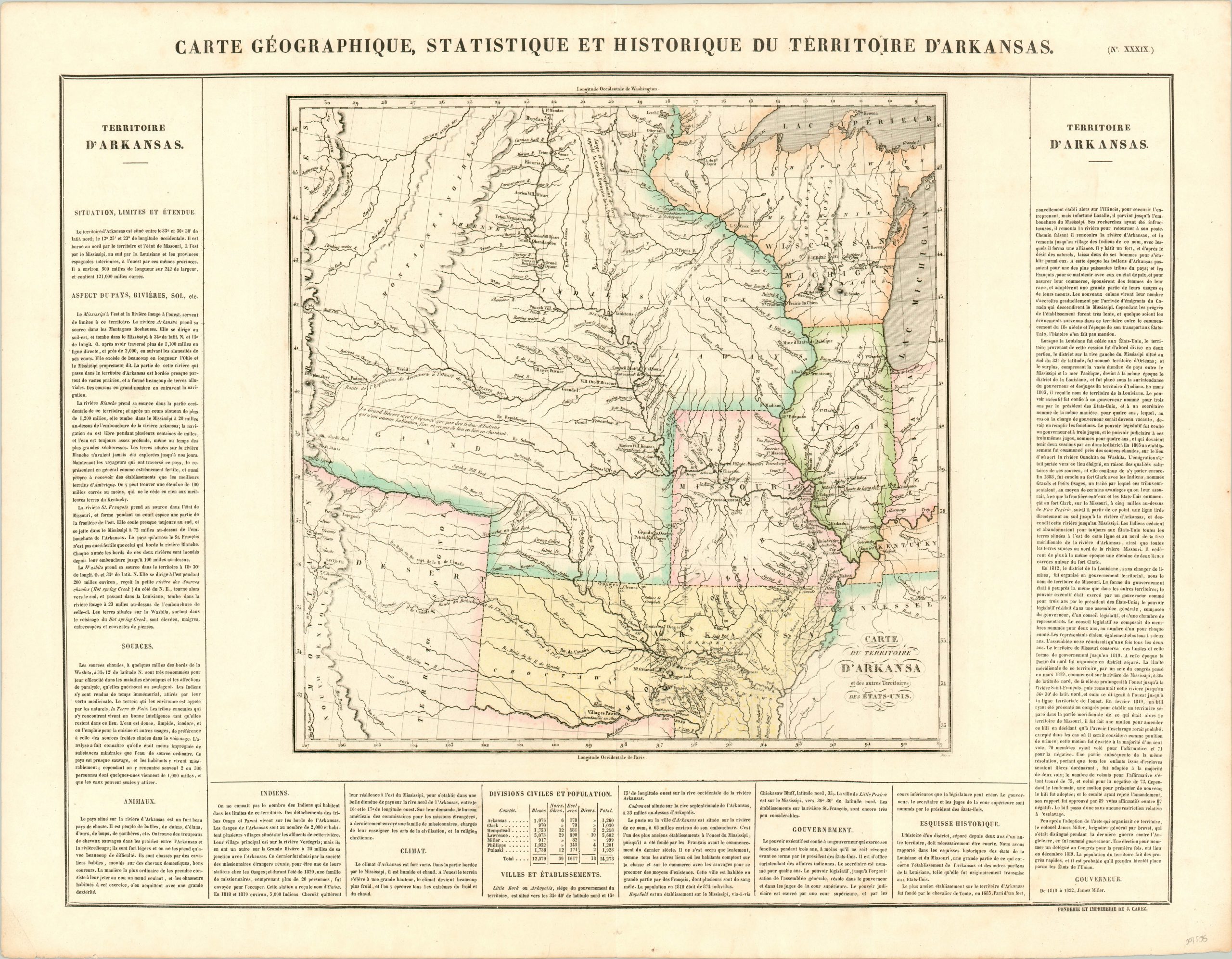
Carte Geographique, Statistique, et Historique du Territoire D’Arkansas
$725.00
The French edition of Carey & Lea’s important map of the American West.
1 in stock
Description
Following (partially, at least) in the footsteps of Lewis & Clark, Major Stephen H. Long led a number of expeditions to the American West in the early parts of the 19th century. One such journey led him along the Platte River to the Rocky Mountains, where his travels across the grassy ocean of the Great Plains led him to refer to it as “The Great Desert.”
Such a label can be found in an annotation on the left side of this map, first published just two years after Long’s report was issued and covering the area from the Mississippi River to the Rockies. It shows his route, among those of other early explorers, as well as the few available “reliable” westbound transportation routes; buffalo traces, Spanish roads, and Indian trails. Numerous Native American villages are dotted throughout the image, several of which are noted as “ancient.”
The map is a critical step in the development of the cartographic record of the United States, providing new and exciting information on the huge territory acquired by the Louisiana Purchase in 1803. In addition, the image presents a stark snapshot of the steady progress of westward expansion in the first half of the 19th century, highlighting how early settlements generally followed the course of navigable waterways and were protected by strings of frontier fortifications. It was issued in the French edition of Carey & Lea’s Complete Historical, Chronological, and Geographical American Atlas, published in Paris by Jean Alexandre Buchon in 1825.
This important American publication was issued in six separate editions and three different languages between 1822 and 1827. It was heavily influenced by an earlier European atlas by Emmanuel Las Cases (published under the pseudonym A. Lesage.), which inspired the format of a base map surrounded by blocks of informative text and tables of statistics.
Henry Carey, a political economist and the son of prominent publisher Matthew Carey, and his brother-in-law Isaac Lea incorporated this novel theme into their atlas, which focused entirely on the countries of the Western Hemisphere. It was issued at a time of tremendous political change in both North and South America, and the detailed maps accompanied by extensive text provide a unique, often insightful, perspective on the problems and possibilities of the Americas in the first quarter of the 19th century.
Wheat, C. I. (2004). Mapping the Transmississippi West: 1540-1861. Mansfield Centre (CT): Martino Publishing. #348
Egli, L. G., & Phillips, P. L. (1974). A list of geographical atlases in the Library of Congress. Washington: Library of Congress. #1373
Map Details
Publication Date: 1825
Author: Jean Alexandre Buchon
Sheet Width (in): 26.5
Sheet Height (in): 20.4
Condition: A-
Condition Description: Some very faint spotting visible along the top portion of the sheet, confined largely to the margins but with one area where the neatline is affected. Otherwise in near fine condition, with faint original color.
$725.00
1 in stock

