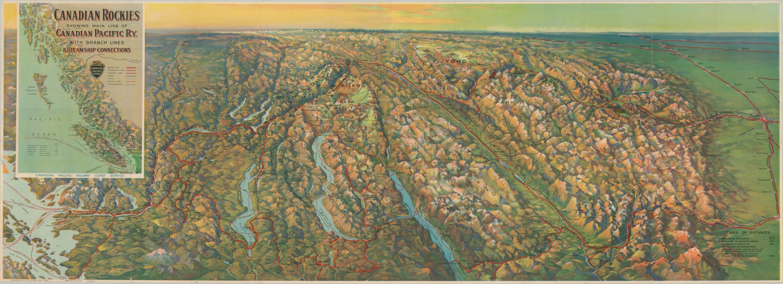
Canadian Rockies Showing Main Line of Canadian Pacific Ry. with Branch Lines & Steamship Connections
$200.00
Developing the ‘Canadian Alps’ during the early 1920s.
1 in stock
Description
This gorgeously illustrated pictorial relief map highlights the majesty of Canada’s Rocky Mountains between Calgary in the east and Vancouver in the West. The lines of the Canadian Pacific Railway, brightly highlighted in red, meander through the mountain passes, along fertile valleys, and around pristine alpine lakes. Labeled attractions include a variety of small towns, hotels/resorts, national parks, geographic features, and more. Steamship routes are also noted; both service along the Pacific Coast (see inset) and several large lakes.
Map Details
Publication Date: 1922
Author: Canadian Pacific Railway
Sheet Width (in): 46.50
Sheet Height (in): 17.00
Condition: B+
Condition Description: Single sided chromolithographed sheet with moderate wear along old folds, including creasing, a few clean splits (repaired on verso), and tiny holes at the joints. Moderate marginal wear also present, including minor paper loss that does not affect the image. Good condition overall.
$200.00
1 in stock