Canada par M. Bonne, ingenieur-hydrographe de la Marine
$150.00
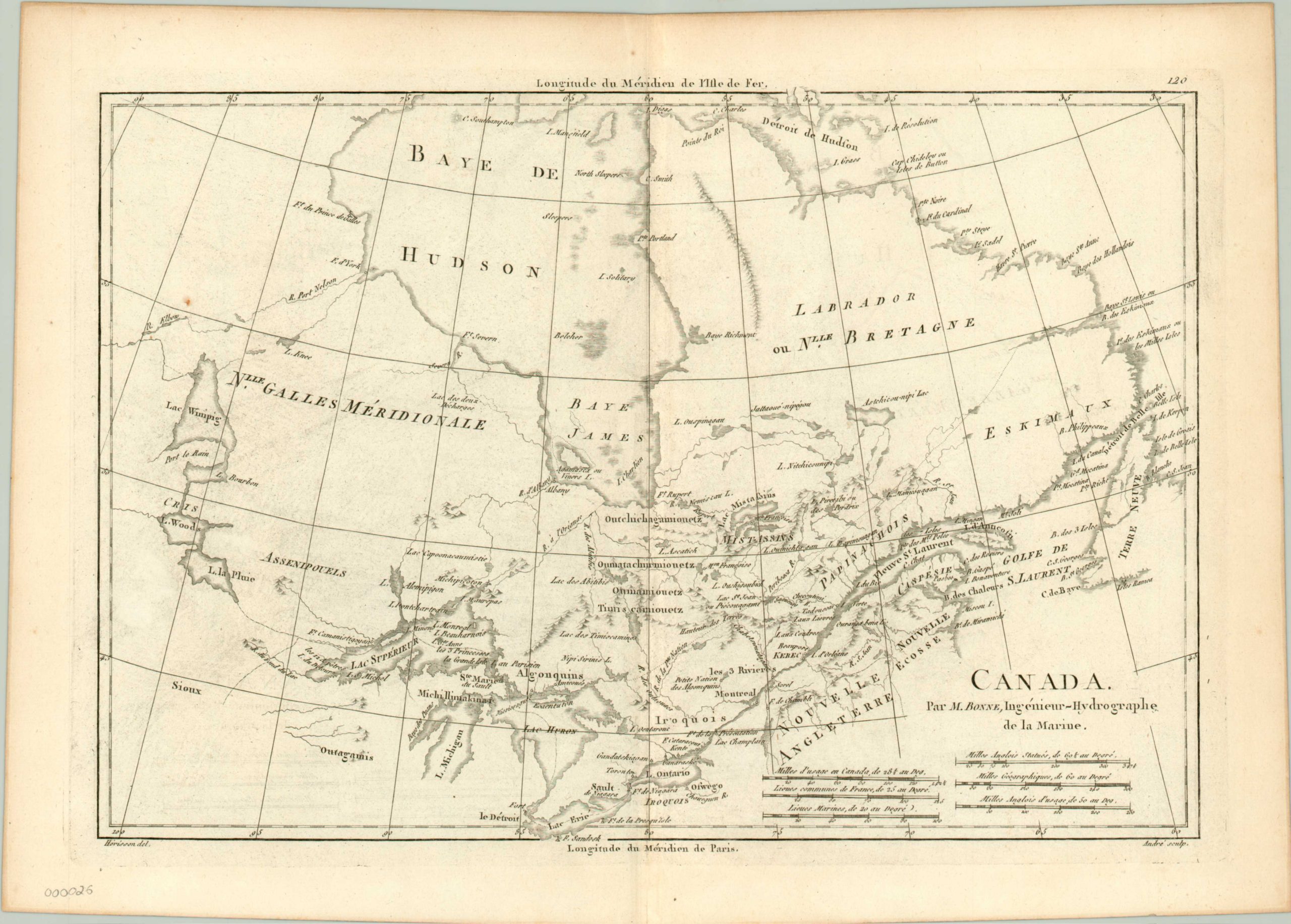
Early map of eastern Canada by the French Royal Hydrographer, Rigobert Bonne.
Description
This copperplate engraving of Canada depicts the area from Lake Winnipeg to the Gulf of St. Lawrence and Labrador, including Lake Erie and most of Hudson Bay. Native populations such as the Iroquois and Algonquins are prominently noted throughout the region, as are European forts and cities (of which there were few at this time). A water route from the St. Lawrence River through the Great Lakes is also provided, as this was the primary waterway through which men and supplies would enter the Canadian hinterland. At the time of original publication, Canada was a region within the colony of New France, but the Seven Years war led France to cede the area to Great Britain, and it then became the Province of Quebec.
Map Details
Publication Date: c. 1785
Author: Rigobert Bonne
Sheet Width (in): 15.75
Sheet Height (in): 11.2
Condition: A
Condition Description: The map is in excellent condition, with a strong image and no visible defects
$150.00