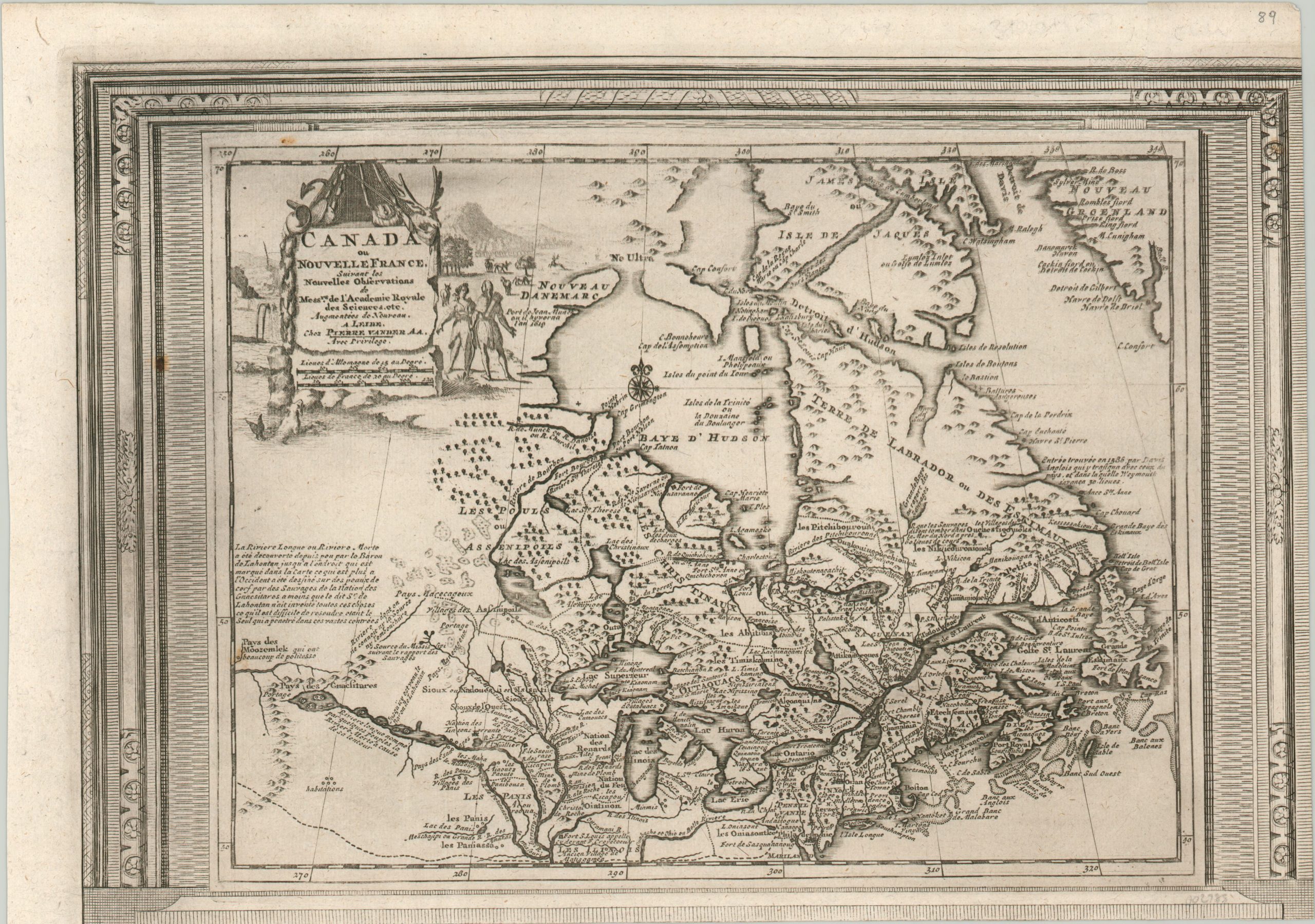
Canada ou Nouvelle France
$525.00
French map of the Great Lakes and St. Lawrence featuring a wealth of speculative cartography.
1 in stock
Description
This tremendous map of eastern Canada and the Great Lakes region of the United States (New France, at the time) was issued at a period of intense colonial rivalry between the French and British. Relations with Native American tribes, frontier fortifications, missions, and company trading posts were some of the primary mechanisms by which European power was extended into the New World.
Each can be seen scattered throughout this map, which provides a wealth of contemporary detail on the situation in North America near the beginning of the 18th century. The image presents a broad territory from Greenland in the North Atlantic to the relatively unknown Great Plains, which include a note regarding the mythical ‘River of the West’ seen running off the left side of the page. Numerous other annotations reference indigenous peoples, historical discoveries, and geographic features.
The map has several decorative features, including a small compass rose, elaborate picture-frame border, and a title cartouche that includes imagery representative of the New World. This is the third state, published in Paris around 1730 by Pieter van der Aa.
Map Details
Publication Date: c. 1730
Author: Pieter Van der Aa
Sheet Width (in): 15.5
Sheet Height (in): 10.9
Condition: B+
Condition Description: Narrowed lower and right margins from where the sheet was previously trimmed to be bound into an atlas (two maps were printed on one sheet). A few light spots and bits of faint ink residue scattered in the corners. Very good overall.
$525.00
1 in stock